
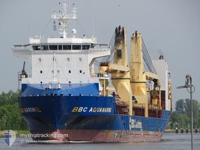
BBC AQUAMARINE
General Cargo
Current Trip
| Time Travelled | 15 days |
|---|---|
| Remaining Time | 15 days |
| Distance Travelled | 5386.24 nm |
| Remaining Distance | 5962.76 nm |
| AVG Speed | 14.8 Knots |
| MAX Speed | 17.5 Knots |
| AVG Wind | 12.2 knots |
| MAX Wind | 33.3 knots |
| MIN Temp | 15.5°C / 59.9°F |
| MAX Temp | 30.8°C / 87.44°F |
| Dybgang | 7.4 m |
| Position Modtaget | 2 d siden |
Current Position
| Longitude | 18.03197° |
|---|---|
| Latitude | -34.30763° |
| Status | Under way using engine |
| Fart | 15.8 Knots |
| Kurs | 298.8° |
| Område | South Atlantic Ocean |
| Station | T-AIS |
| Position Modtaget | 2 d siden |
Info
Information
The current position of BBC AQUAMARINE is in South Atlantic Ocean with coordinates -34.30763° / 18.03197° as reported on 2024-05-18 16:52 by AIS to our vessel tracker app. The vessel's current speed is 15.8 Knots and is heading at the port of MOREHEAD CITY. The estimated time of arrival as calculated by MyShipTracking vessel tracking app is 2024-06-05 12:55 LT
The vessel BBC AQUAMARINE (IMO: 9504736, MMSI: 305719000) is a General Cargo that was built in 2012 ( 12 år gamle ). It's sailing under the flag of [AG] Antigua Barbuda.
In this page you can find informations about the vessels current position, last detected port calls, and current voyage information. If the vessels is not in coverage by AIS you will find the latest position.
The current position of BBC AQUAMARINE is detected by our AIS receivers and we are not responsible for the reliability of the data. The last position was recorded while the vessel was in Coverage by the Ais receivers of our vessel tracking app.
The current draught of BBC AQUAMARINE as reported by AIS is 7.4 meters
Weather
| Temperature | 19.6°C / 67.28°F |
|---|---|
| Wind Speed | 14 knots |
| Direction | 173° S |
| Pressure | 1019.3 hPa |
| Humidity | 83 % |
| Cloud Coverage | --- |
Featured Company
Most Visited Ports (Last year)
| Port | Arrivals | |
|---|---|---|
| 2 | ||
| 2 | ||
| 2 | ||
| 1 | ||
| 1 | ||
| 1 |
Events
| Tid | Hændelsen | Detaljer | Position / Dest | Info |
|---|---|---|---|---|
| 2024-05-18 16:59 | Status er ændret | Default Under way using engine |
-34.29285 / 17.99988
US MRH
|
Fart: 15.8 kn Kurs: 298.8° |
| 2024-05-18 16:52 | Udenfor Dækning |
-34.30763 / 18.03197
South Atlantic Ocean
US MRH
|
Fart: 15.8 kn Kurs: 298.8° |
|
| 2024-05-18 16:50 | Status er ændret | Under way using engine Default |
-34.31101 / 18.03931
US MRH
|
Fart: 15.4 kn Kurs: 298° |
| 2024-05-18 16:38 | Status er ændret | Default Under way using engine |
-34.33524 / 18.09242
US MRH
|
Fart: 15.7 kn Kurs: 298.9° |
| 2024-05-18 16:33 | Status er ændret | Under way using engine Default |
-34.34631 / 18.11686
US MRH
|
Fart: 16 kn Kurs: 299° |
| 2024-05-18 16:10 | Status er ændret | Default Under way using engine |
-34.39390 / 18.22260
US MRH
|
Fart: 15.8 kn Kurs: 298.7° |
| 2024-05-18 15:36 | Dybgangen er ændret | 7.4 7.1 |
-34.46481 / 18.38894
US MRH
|
Fart: 15.4 kn Kurs: 297.6° |
| 2024-05-18 15:36 | Destination er ændret | US MRH AE FJR |
-34.46481 / 18.38894
US MRH
|
Fart: 15.4 kn Kurs: 297.6° |
| 2024-05-18 15:36 | ETA er ændret | 2024/06/06 12:00 2024/03/09 09:20 |
-34.46481 / 18.38894
US MRH
|
Fart: 15.4 kn Kurs: 297.6° |
| 2024-05-18 15:10 | Status er ændret | Under way using engine Default |
-34.51387 / 18.50236
AE FJR
|
Fart: 14.8 kn Kurs: 298° |