
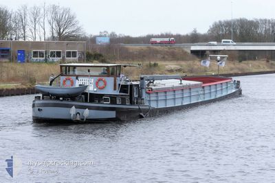
BARACAS
Other Type
Current Trip
PANHEEL BRUG OVER BE
| Time Travelled | 38 days |
|---|---|
| Remaining Time | --- |
| Distance Travelled | 212.94 nm |
| Remaining Distance | --- |
| AVG Speed | 5.6 Knots |
| MAX Speed | 8.6 Knots |
| AVG Wind | 12.5 knots |
| MAX Wind | 21.6 knots |
| MIN Temp | 4.2°C / 39.56°F |
| MAX Temp | 17.8°C / 64.04°F |
| Dybgang | 0.3 m |
| Position Modtaget | Nu |
Current Position
| Longitude | 5.75559° |
|---|---|
| Latitude | 51.27986° |
| Status | Under way using engine |
| Fart | 2.9 Knots |
| Kurs | --- |
| Område | North Sea |
| Station | T-AIS |
| Position Modtaget | Nu |
Info
Information
The current position of BARACAS is in North Sea with coordinates 51.27986° / 5.75559° as reported on 2024-05-05 17:57 by AIS to our vessel tracker app. The vessel's current speed is 2.9 Knots
The vessel BARACAS (MMSI: 244710026) is a Other Type It's sailing under the flag of [NL] Netherlands.
In this page you can find informations about the vessels current position, last detected port calls, and current voyage information. If the vessels is not in coverage by AIS you will find the latest position.
The current position of BARACAS is detected by our AIS receivers and we are not responsible for the reliability of the data. The last position was recorded while the vessel was in Coverage by the Ais receivers of our vessel tracking app.
The current draught of BARACAS as reported by AIS is 0.3 meters
Weather
| Temperature | 16.2°C / 61.16°F |
|---|---|
| Wind Speed | 2 knots |
| Direction | 270° W |
| Pressure | 1008.3 hPa |
| Humidity | 62.4 % |
| Cloud Coverage | 83 % |
Featured Company
Last Port Calls
| Port | Arrival | Departure | Time In Port |
|---|---|---|---|
| 2024-03-28 11:38 | 2024-03-28 15:39 | 4 h | |
| 2024-03-25 17:45 | 2024-03-26 08:14 | 14 h | |
| 2024-03-15 05:02 | 2024-03-15 05:34 | 32 m | |
| 2024-03-13 19:32 | 2024-03-14 05:07 | 9 h | |
| 2024-03-07 15:27 | 2024-03-07 16:17 | 49 m | |
| 2024-03-06 12:45 | 2024-03-06 13:22 | 37 m |
Most Visited Ports (Last year)
| Port | Arrivals | |
|---|---|---|
| 27 | ||
| 5 | ||
| 5 | ||
| 3 | ||
| 3 | ||
| 1 |
Last Trips
| Origin | Departure | Destination | Arrival | Distance | |
|---|---|---|---|---|---|
| 2024-03-26 09:14 | 2024-03-28 12:38 | 79.60 nm | |||
| 2024-03-15 06:34 | 2024-03-25 18:45 | 133.42 nm | |||
| 2024-03-14 06:07 | 2024-03-15 06:02 | 42.22 nm | |||
| 2024-03-07 17:17 | 2024-03-13 20:32 | 200.30 nm | |||
| 2024-03-06 14:22 | 2024-03-07 16:27 | 53.49 nm |
Events
| Tid | Hændelsen | Detaljer | Position / Dest | Info |
|---|---|---|---|---|
| 2024-05-05 17:26 | Indenfor Dækning |
51.25453 / 5.77930
North Sea
|
Fart: 3.4 kn Kurs: 328.4° |
|
| 2024-05-03 13:31 | Udenfor Dækning |
51.10585 / 5.84858
North Sea
PANHEEL BRUG OVER BE
|
Fart: 6 kn Kurs: 28° |
|
| 2024-05-03 13:17 | Destination er ændret | PANHEEL BRUG OVER BE BERGHAVEN BORN |
51.08501 / 5.83037
PANHEEL BRUG OVER BE
|
Fart: 5.9 kn Kurs: 28.4° |
| 2024-05-03 13:17 | ETA er ændret | 2024/05/03 12:54 2024/05/01 12:18 |
51.08501 / 5.83037
PANHEEL BRUG OVER BE
|
Fart: 5.9 kn Kurs: 28.4° |
| 2024-05-03 12:49 | Indenfor Dækning |
51.04680 / 5.80236
North Sea
|
Fart: 4.3 kn Kurs: 100.3° |
|
| 2024-05-03 08:58 | Udenfor Dækning |
51.04711 / 5.80152
North Sea
|
Fart: 4.5 kn Kurs: 330° |
|
| 2024-05-03 08:23 | Destination er ændret | BERGHAVEN BORN NIEUWE HAVEN TE VEGH |
51.09512 / 5.83889
BERGHAVEN BORN
|
Fart: 5.5 kn Kurs: 211° |
| 2024-05-03 08:23 | ETA er ændret | 2024/05/01 12:18 2024/04/25 09:32 |
51.09512 / 5.83889
BERGHAVEN BORN
|
Fart: 5.5 kn Kurs: 211° |
| 2024-05-03 08:15 | Indenfor Dækning |
51.10417 / 5.84686
North Sea
|
Fart: 5.6 kn Kurs: 206.2° |
|
| 2024-04-26 06:40 | Udenfor Dækning |
51.25232 / 5.78144
North Sea
|
Fart: 5.9 kn Kurs: 150° |