
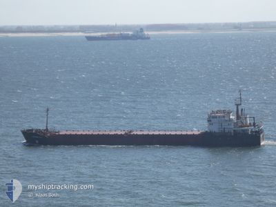
BALTIYSKIY-202
General Cargo
Current Trip
| Time Travelled | 17 days |
|---|---|
| Remaining Time | --- |
| Distance Travelled | 838.87 nm |
| Remaining Distance | --- |
| AVG Speed | 7.8 Knots |
| MAX Speed | 7.8 Knots |
| AVG Wind | 20 knots |
| MAX Wind | 38.3 knots |
| MIN Temp | -2.3°C / 27.86°F |
| MAX Temp | 8.7°C / 47.66°F |
| Dybgang | 3.5 m |
| Position Modtaget | 3 m siden |
Current Position
| Longitude | --- |
|---|---|
| Latitude | --- |
| Status | At anchor |
| Fart | |
| Kurs | 340° |
| Område | Kattegat |
| Station | T-AIS |
| Position Modtaget | 3 m siden |
Info
Information
The current position of BALTIYSKIY-202 is in Kattegat with coordinates 57.57861° / 11.06166° as reported on 2024-12-31 09:43 by AIS to our vessel tracker app. The vessel's current speed is 0 Knots
The vessel BALTIYSKIY-202 (IMO: 9057252, MMSI: 372837000) is a General Cargo that was built in 1994 ( 30 år gamle ). It's sailing under the flag of [PA] Panama.
In this page you can find informations about the vessels current position, last detected port calls, and current voyage information. If the vessels is not in coverage by AIS you will find the latest position.
The current position of BALTIYSKIY-202 is detected by our AIS receivers and we are not responsible for the reliability of the data. The last position was recorded while the vessel was in Coverage by the Ais receivers of our vessel tracking app.
The current draught of BALTIYSKIY-202 as reported by AIS is 3.5 meters
Weather
| Temperature | 2.4°C / 36.32°F |
|---|---|
| Wind Speed | 9 knots |
| Direction | 239° WSW |
| Pressure | 1013.4 hPa |
| Humidity | 79.8 % |
| Cloud Coverage | 100 % |
Featured Company
Last Port Calls
| Port | Arrival | Departure | Time In Port |
|---|---|---|---|
| 2024-12-13 21:27 | |||
| 2024-12-07 05:20 | 2024-12-13 20:53 | 6 d | |
| 2024-11-27 05:32 | 2024-11-27 18:28 | 12 h | |
| 2024-11-17 10:56 | 2024-11-18 19:40 | 1 d | |
| 2024-11-04 04:50 | 2024-11-06 22:11 | 2 d | |
| 2024-10-20 05:02 | 2024-10-21 19:37 | 1 d | |
| 2024-10-19 01:30 | 2024-10-19 17:27 | 15 h | |
| 2024-10-08 22:18 | 2024-10-09 19:13 | 20 h | |
| 2024-10-06 19:56 | 2024-10-07 07:51 | 11 h |
Most Visited Ports (Last year)
| Port | Arrivals | |
|---|---|---|
| 12 | ||
| 9 | ||
| 7 | ||
| 1 | ||
| 1 | ||
| 1 |
Last Trips
| Origin | Departure | Destination | Arrival | Distance | |
|---|---|---|---|---|---|
| 2024-11-27 19:28 | 2024-12-07 08:20 | 1403.47 nm | |||
| 2024-11-18 22:40 | 2024-11-27 06:32 | 1424.93 nm | |||
| 2024-11-06 23:11 | 2024-11-17 13:56 | 1413.76 nm | |||
| 2024-10-21 22:37 | 2024-11-04 05:50 | 1426.47 nm | |||
| 2024-10-19 20:27 | 2024-10-20 08:02 | 58.65 nm | |||
| 2024-10-09 21:13 | 2024-10-19 04:30 | 1393.65 nm | |||
| 2024-10-07 09:51 | 2024-10-09 00:18 | 148.83 nm | |||
| 2024-09-27 23:05 | 2024-10-06 21:56 | 1326.41 nm |
Events
| Tid | Hændelsen | Detaljer | Position / Dest | Info |
|---|---|---|---|---|
| 2024-12-30 08:47 | ETA er ændret | 2025/01/08 03:00 2025/01/03 03:00 |
57.57880 / 11.06176
FRDKK
|
Fart: Kurs: 356° |
| 2024-12-26 13:34 | Status er ændret | At anchor Default |
57.58012 / 11.06267
FRDKK
|
Fart: Kurs: 271° |
| 2024-12-26 13:28 | Status er ændret | Default At anchor |
57.58013 / 11.06265
FRDKK
|
Fart: Kurs: 271° |
| 2024-12-26 13:22 | Status er ændret | At anchor Default |
57.58021 / 11.06269
FRDKK
|
Fart: Kurs: 263° |
| 2024-12-26 13:16 | Status er ændret | Default At anchor |
57.58027 / 11.06265
FRDKK
|
Fart: Kurs: 263° |
| 2024-12-23 18:26 | Status er ændret | At anchor Default |
57.57849 / 11.05950
FRDKK
|
Fart: Kurs: 10° |
| 2024-12-23 18:23 | Status er ændret | Default At anchor |
57.57839 / 11.05986
FRDKK
|
Fart: Kurs: 10° |
| 2024-12-22 12:18 | Status er ændret | At anchor Default |
57.58113 / 11.06198
FRDKK
|
Fart: Kurs: 225° |
| 2024-12-22 12:15 | Status er ændret | Default At anchor |
57.58112 / 11.06197
FRDKK
|
Fart: Kurs: 228° |