
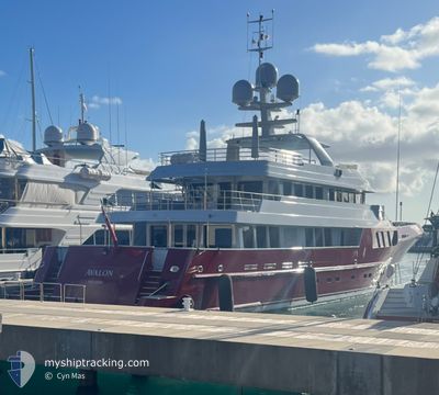
AVALON
Pleasure Craft
Current Trip
| Time Travelled | 10 days |
|---|---|
| Remaining Time | --- |
| Distance Travelled | 1633.92 nm |
| Remaining Distance | --- |
| AVG Speed | 9.6 Knots |
| MAX Speed | 12.9 Knots |
| AVG Wind | 14.5 knots |
| MAX Wind | 22 knots |
| MIN Temp | 7.5°C / 45.5°F |
| MAX Temp | 16.9°C / 62.42°F |
| Dybgang | 3 m |
| Position Modtaget | 3 d siden |
Current Position
| Longitude | -131.28050° |
|---|---|
| Latitude | 55.19305° |
| Status | Under way using engine |
| Fart | 12.9 Knots |
| Kurs | 301° |
| Område | The Coastal Waters of Southeast Alaska and British Columbia |
| Station | T-AIS |
| Position Modtaget | 3 d siden |
Info
Information
The current position of AVALON is in The Coastal Waters of Southeast Alaska and British Columbia with coordinates 55.19305° / -131.28050° as reported on 2024-05-31 16:39 by AIS to our vessel tracker app. The vessel's current speed is 12.9 Knots
The vessel AVALON (IMO: 1010521, MMSI: 319059200) is a Pleasure Craft It's sailing under the flag of [KY] Cayman Is.
In this page you can find informations about the vessels current position, last detected port calls, and current voyage information. If the vessels is not in coverage by AIS you will find the latest position.
The current position of AVALON is detected by our AIS receivers and we are not responsible for the reliability of the data. The last position was recorded while the vessel was in Coverage by the Ais receivers of our vessel tracking app.
The current draught of AVALON as reported by AIS is 3 meters
Weather
| Temperature | 7.5°C / 45.5°F |
|---|---|
| Wind Speed | 5 knots |
| Direction | 49° NE |
| Pressure | 1016.5 hPa |
| Humidity | 95.1 % |
| Cloud Coverage | 100 % |
Featured Company
Most Visited Ports (Last year)
| Port | Arrivals | |
|---|---|---|
| 3 | ||
| 2 | ||
| 1 | ||
| 1 | ||
| 1 | ||
| 1 |
Last Trips
| Origin | Departure | Destination | Arrival | Distance |
|---|
Events
| Tid | Hændelsen | Detaljer | Position / Dest | Info |
|---|---|---|---|---|
| 2024-05-31 16:39 | Udenfor Dækning |
55.19305 / -131.28050
The Coastal Waters of Southeast Alaska and British Columbia
KETCHIKAN ALASKA
|
Fart: 12.9 kn Kurs: 301° |
|
| 2024-05-31 16:39 | Indenfor Dækning |
55.19305 / -131.28050
The Coastal Waters of Southeast Alaska and British Columbia
KETCHIKAN ALASKA
|
Fart: 12.9 kn Kurs: 301° |
|
| 2024-05-31 15:05 | Udenfor Dækning |
54.99732 / -131.13263
The Coastal Waters of Southeast Alaska and British Columbia
KETCHIKAN ALASKA
|
Fart: 9.5 kn Kurs: 0° |
|
| 2024-05-31 12:49 | Ændre havområde | United States (Alaska) part of the The Coastal Waters of Southeast Alaska and British Columbia Canadian part of the The Coastal Waters of Southeast Alaska and British Columbia |
54.64702 / -131.28193
The Coastal Waters of Southeast Alaska and British Columbia
KETCHIKAN ALASKA
|
Fart: 9.8 kn Kurs: 23° |
| 2024-05-31 05:13 | Fundet i havområde | Canadian part of the The Coastal Waters of Southeast Alaska and British Columbia |
53.55948 / -130.90703
The Coastal Waters of Southeast Alaska and British Columbia
KETCHIKAN ALASKA
|
Fart: 9 kn Kurs: 354° |
| 2024-05-31 05:13 | Indenfor Dækning |
53.55948 / -130.90703
The Coastal Waters of Southeast Alaska and British Columbia
KETCHIKAN ALASKA
|
Fart: 9 kn Kurs: 354° |
|
| 2024-05-26 11:43 | Udenfor Dækning |
35.09675 / -124.03500
North Pacific Ocean
KETCHIKAN ALASKA
|
Fart: 10.2 kn Kurs: 335° |
|
| 2024-05-26 11:37 | Indenfor Dækning |
35.08495 / -124.02823
North Pacific Ocean
KETCHIKAN ALASKA
|
Fart: 10 kn Kurs: 333° |
|
| 2024-05-26 06:27 | Udenfor Dækning |
34.82980 / -122.98515
North Pacific Ocean
KETCHIKAN ALASKA
|
Fart: 10.2 kn Kurs: 282° |
|
| 2024-05-26 01:16 | Indenfor Dækning |
34.64273 / -121.96363
North Pacific Ocean
KETCHIKAN ALASKA
|
Fart: 9.8 kn Kurs: 283° |