

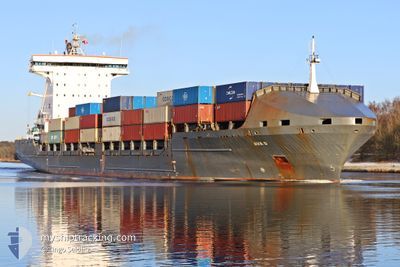
AVA D
Container Ship

Current Trip
| Time Travelled | 7 days |
|---|---|
| Remaining Time | 3 days |
| Distance Travelled | 1754.78 nm |
| Remaining Distance | 1208.84 nm |
| AVG Speed | 12.5 Knots |
| MAX Speed | 17.1 Knots |
| AVG Wind | 8.9 knots |
| MAX Wind | 28.2 knots |
| MIN Temp | -9°C / 15.8°F |
| MAX Temp | 4.9°C / 40.82°F |
| Dybgang | 9.5 m |
| Position Modtaget | 3 h, 36 m siden |
Current Position
| Longitude | --- |
|---|---|
| Latitude | --- |
| Status | Under way using engine |
| Fart | 14.1 Knots |
| Kurs | 230.6° |
| Område | Baltic Sea |
| Station | T-AIS |
| Position Modtaget | 3 h, 36 m siden |
Information
The current position of AVA D is in Baltic Sea with coordinates 59.39117° / 22.23812° as reported on 2025-02-20 05:30 by AIS to our vessel tracker app. The vessel's current speed is 14.1 Knots and is heading at the port of ROTTERDAM. The estimated time of arrival as calculated by MyShipTracking vessel tracking app is 2025-02-23 17:17 LT
The vessel AVA D (IMO: 9306225, MMSI: 255705000) is a Container Ship that was built in 2007 ( 18 år gamle ). It's sailing under the flag of [PT] Portugal.
In this page you can find informations about the vessels current position, last detected port calls, and current voyage information. If the vessels is not in coverage by AIS you will find the latest position.
The current position of AVA D is detected by our AIS receivers and we are not responsible for the reliability of the data. The last position was recorded while the vessel was in Coverage by the Ais receivers of our vessel tracking app.
The current draught of AVA D as reported by AIS is 9.5 meters
Weather
| Temperature | 1.8°C / 35.24°F |
|---|---|
| Wind Speed | 9 knots |
| Direction | 236° SW |
| Pressure | 1030.6 hPa |
| Humidity | 70 % |
| Cloud Coverage | 15 % |


Featured Company
Last Port Calls
| Port | Arrival | Departure | Time In Port |
|---|---|---|---|
| 2025-02-11 23:43 | 2025-02-12 14:17 | 14 h | |
| 2025-02-07 18:33 | 2025-02-11 23:37 | 4 d | |
| 2025-02-07 10:56 | 2025-02-07 16:54 | 5 h | |
| 2025-01-29 01:25 | 2025-01-29 01:28 | 2 m | |
| 2025-01-24 11:08 | 2025-01-27 12:24 | 3 d | |
| 2025-01-23 18:01 | 2025-01-24 10:56 | 16 h | |
| 2025-01-23 16:10 | 2025-01-23 16:23 | 12 m | |
| 2025-01-22 17:19 | |||
| 2025-01-20 20:26 | 2025-01-22 14:43 | 1 d | |
| 2025-01-20 00:41 | 2025-01-20 02:29 | 1 h |
Most Visited Ports (Last year)
| Port | Arrivals | |
|---|---|---|
| 26 | ||
| 11 | ||
| 11 | ||
| 11 | ||
| 8 | ||
| 7 |
Last Trips
| Origin | Departure | Destination | Arrival | Distance | |
|---|---|---|---|---|---|
| 2025-02-12 00:37 | 2025-02-12 00:43 | 0.44 nm | |||
| 2025-02-07 17:54 | 2025-02-07 19:33 | 16.32 nm | |||
| 2025-01-29 02:28 | 2025-02-07 11:56 | 1974.50 nm | |||
| 2025-01-27 13:24 | 2025-01-29 02:25 | 319.47 nm | |||
| 2025-01-24 11:56 | 2025-01-24 12:08 | 0.96 nm | |||
| 2025-01-23 17:23 | 2025-01-23 19:01 | 16.01 nm | |||
| 2025-01-22 15:43 | 2025-01-23 17:10 | 17.81 nm | |||
| 2025-01-22 15:43 | 2025-01-22 18:19 | 17.47 nm | |||
| 2025-01-20 03:29 | 2025-01-20 21:26 | 363.33 nm | |||
| 2025-01-10 06:07 | 2025-01-20 01:41 | 2011.89 nm |
Events
| Tid | Hændelsen | Detaljer | Position / Dest | Info |
|---|---|---|---|---|
| 2025-02-20 05:33 | Status er ændret | Default Under way using engine |
59.38316 / 22.21905
NLRTM VIA NOK
|
Fart: 14.1 kn Kurs: 230.6° |
| 2025-02-20 05:30 | Udenfor Dækning |
59.39117 / 22.23812
Baltic Sea
NLRTM VIA NOK
|
Fart: 14.1 kn Kurs: 230.6° |
|
| 2025-02-20 03:29 | Ændre havområde | Finnish part of the Baltic Sea Finnish part of the Gulf of Finland |
59.58884 / 23.09796
Baltic Sea
NLRTM VIA NOK
|
Fart: 14.7 kn Kurs: 256° |
| 2025-02-20 00:04 | Ændre havområde | Finnish part of the Gulf of Finland Estonian part of the Gulf of Finland |
59.80913 / 24.68816
Gulf of Finland
NLRTM VIA NOK
|
Fart: 15 kn Kurs: 259.4° |
| 2025-02-19 22:52 | Status er ændret | Under way using engine Default |
59.86873 / 25.26808
NLRTM VIA NOK
|
Fart: 14.8 kn Kurs: 258° |
| 2025-02-19 22:49 | Status er ændret | Default Under way using engine |
59.87115 / 25.28945
NLRTM VIA NOK
|
Fart: 14.8 kn Kurs: 258.1° |
| 2025-02-19 22:40 | Ændre havområde | Estonian part of the Gulf of Finland Finnish part of the Gulf of Finland |
59.87919 / 25.36313
Gulf of Finland
NLRTM VIA NOK
|
Fart: 14.8 kn Kurs: 257.3° |
| 2025-02-19 21:56 | Status er ændret | Under way using engine Default |
59.91627 / 25.71846
NLRTM VIA NOK
|
Fart: 14.8 kn Kurs: 258° |
| 2025-02-19 21:25 | Status er ændret | Default Under way using engine |
59.97769 / 25.93034
NLRTM VIA NOK
|
Fart: 14.9 kn Kurs: 229.6° |
| 2025-02-19 21:19 | Status er ændret | Under way using engine Default |
59.99558 / 25.97139
NLRTM VIA NOK
|
Fart: 14.9 kn Kurs: 229° |