
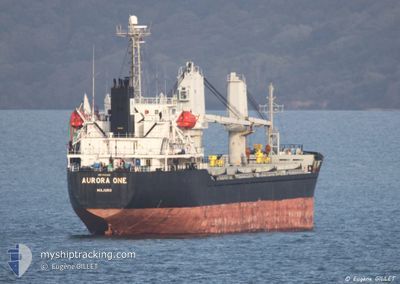
AURORA ONE
Bulk Carrier
Current Trip
| Time Travelled | 9 days |
|---|---|
| Remaining Time | --- |
| Distance Travelled | 2237.00 nm |
| Remaining Distance | --- |
| AVG Speed | 10.6 Knots |
| MAX Speed | 13.2 Knots |
| AVG Wind | 14.3 knots |
| MAX Wind | 26 knots |
| MIN Temp | 6.6°C / 43.88°F |
| MAX Temp | 17.2°C / 62.96°F |
| Dybgang | 9.1 m |
| Position Modtaget | Nu |
Current Position
| Longitude | -9.79988° |
|---|---|
| Latitude | 37.68972° |
| Status | Under way using engine |
| Fart | 11.1 Knots |
| Kurs | 162.9° |
| Område | North Atlantic Ocean |
| Station | T-AIS |
| Position Modtaget | Nu |
Info
Information
The current position of AURORA ONE is in North Atlantic Ocean with coordinates 37.68972° / -9.79988° as reported on 2024-05-07 16:32 by AIS to our vessel tracker app. The vessel's current speed is 11.1 Knots and is heading at the port of BARI. The estimated time of arrival as calculated by MyShipTracking vessel tracking app is 2024-05-14 17:00 LT
The vessel AURORA ONE (IMO: 9343819, MMSI: 538005792) is a Bulk Carrier that was built in 2007 ( 17 år gamle ). It's sailing under the flag of [MH] Marshall Is.
In this page you can find informations about the vessels current position, last detected port calls, and current voyage information. If the vessels is not in coverage by AIS you will find the latest position.
The current position of AURORA ONE is detected by our AIS receivers and we are not responsible for the reliability of the data. The last position was recorded while the vessel was in Coverage by the Ais receivers of our vessel tracking app.
The current draught of AURORA ONE as reported by AIS is 9.1 meters
Weather
| Temperature | 17.2°C / 62.96°F |
|---|---|
| Wind Speed | 15 knots |
| Direction | 352° N |
| Pressure | 1018.3 hPa |
| Humidity | 80.4 % |
| Cloud Coverage | 99 % |
Featured Company
Last Port Calls
| Port | Arrival | Departure | Time In Port |
|---|---|---|---|
| 2024-04-25 21:56 | 2024-04-28 03:40 | 2 d | |
| 2024-04-20 13:21 | 2024-04-23 16:32 | 3 d | |
| 2024-03-24 15:49 | 2024-04-01 00:26 | 7 d | |
| 2024-03-04 07:09 |
Last Trips
| Origin | Departure | Destination | Arrival | Distance | |
|---|---|---|---|---|---|
| 2024-04-23 19:32 | 2024-04-26 00:56 | 77.95 nm | |||
| 2024-04-01 02:26 | 2024-04-20 16:21 | 4260.59 nm | |||
| 2024-03-04 09:09 | 2024-03-24 17:49 | 592.21 nm |
Events
| Tid | Hændelsen | Detaljer | Position / Dest | Info |
|---|---|---|---|---|
| 2024-05-07 14:06 | Destination er ændret | BARI RAVENNA |
38.12980 / -9.92911
BARI
|
Fart: 10.9 kn Kurs: 165.1° |
| 2024-05-07 14:06 | ETA er ændret | 2024/05/14 17:00 2024/05/16 08:00 |
38.12980 / -9.92911
BARI
|
Fart: 10.9 kn Kurs: 165.1° |
| 2024-05-07 05:17 | Status er ændret | Under way using engine Default |
39.69251 / -10.09726
RAVENNA
|
Fart: 10.6 kn Kurs: 186° |
| 2024-05-07 05:14 | Status er ændret | Default Under way using engine |
39.70107 / -10.09723
RAVENNA
|
Fart: 10.4 kn Kurs: 181° |
| 2024-05-06 23:35 | Status er ændret | Under way using engine Default |
40.71153 / -10.10490
RAVENNA
|
Fart: 10.5 kn Kurs: 175° |
| 2024-05-06 23:34 | Status er ændret | Default Under way using engine |
40.71400 / -10.10489
RAVENNA
|
Fart: 10.5 kn Kurs: 178.2° |
| 2024-05-06 23:13 | Status er ændret | Under way using engine Default |
40.78311 / -10.10597
RAVENNA
|
Fart: 10.5 kn Kurs: 183° |
| 2024-05-06 23:10 | Status er ændret | Default Under way using engine |
40.78507 / -10.10603
RAVENNA
|
Fart: 10.6 kn Kurs: 184.1° |
| 2024-05-06 22:27 | Status er ændret | Under way using engine Default |
40.91303 / -10.10211
RAVENNA
|
Fart: 10.6 kn Kurs: 180° |
| 2024-05-06 22:26 | Status er ændret | Default Under way using engine |
40.91600 / -10.10227
RAVENNA
|
Fart: 10.6 kn Kurs: 176° |