
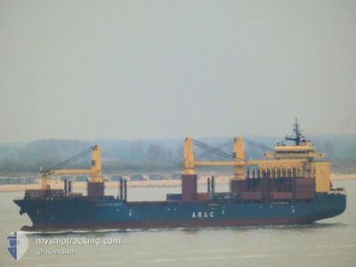
ATLANTIC PROJECT II
General Cargo
Current Trip
| Time Travelled | 6 days |
|---|---|
| Remaining Time | --- |
| Distance Travelled | 1915.54 nm |
| Remaining Distance | --- |
| AVG Speed | 14.4 Knots |
| MAX Speed | 18.3 Knots |
| AVG Wind | 7.4 knots |
| MAX Wind | 17.9 knots |
| MIN Temp | 21.7°C / 71.06°F |
| MAX Temp | 29.1°C / 84.38°F |
| Dybgang | 8.5 m |
| Position Modtaget | 3 d siden |
Current Position
| Longitude | -76.57825° |
|---|---|
| Latitude | 28.23111° |
| Status | Under way using engine |
| Fart | 14.1 Knots |
| Kurs | 71.5° |
| Område | North Atlantic Ocean |
| Station | T-AIS |
| Position Modtaget | 3 d siden |
Info
Information
The current position of ATLANTIC PROJECT II is in North Atlantic Ocean with coordinates 28.23111° / -76.57825° as reported on 2024-05-21 23:57 by AIS to our vessel tracker app. The vessel's current speed is 14.1 Knots and is heading at the port of ST PETERSBURG. The estimated time of arrival as calculated by MyShipTracking vessel tracking app is 2024-06-07 15:00 LT
The vessel ATLANTIC PROJECT II (IMO: 9235983, MMSI: 538010307) is a General Cargo that was built in 2002 ( 22 år gamle ). It's sailing under the flag of [MH] Marshall Is.
In this page you can find informations about the vessels current position, last detected port calls, and current voyage information. If the vessels is not in coverage by AIS you will find the latest position.
The current position of ATLANTIC PROJECT II is detected by our AIS receivers and we are not responsible for the reliability of the data. The last position was recorded while the vessel was in Coverage by the Ais receivers of our vessel tracking app.
The current draught of ATLANTIC PROJECT II as reported by AIS is 8.5 meters
Weather
| Temperature | 22.4°C / 72.32°F |
|---|---|
| Wind Speed | 6 knots |
| Direction | 252° WSW |
| Pressure | 1016.1 hPa |
| Humidity | 78.1 % |
| Cloud Coverage | 7 % |
Featured Company
Last Port Calls
| Port | Arrival | Departure | Time In Port |
|---|---|---|---|
| 2024-05-16 01:02 | 2024-05-18 04:30 | 2 d | |
| 2024-05-06 01:13 | 2024-05-07 20:06 | 1 d | |
| 2024-05-06 00:02 | 2024-05-06 00:17 | 15 m | |
| 2024-04-11 13:37 | 2024-04-16 03:34 | 4 d | |
| 2024-03-14 21:39 | 2024-03-16 04:03 | 1 d | |
| 2024-03-10 14:36 | 2024-03-13 00:21 | 2 d | |
| 2024-03-01 22:20 | 2024-03-02 21:39 | 23 h |
Most Visited Ports (Last year)
| Port | Arrivals | |
|---|---|---|
| 5 | ||
| 4 | ||
| 2 | ||
| 2 | ||
| 2 | ||
| 1 |
Last Trips
| Origin | Departure | Destination | Arrival | Distance | |
|---|---|---|---|---|---|
| 2024-05-07 20:06 | 2024-05-16 01:02 | 2231.31 nm | |||
| 2024-05-06 00:17 | 2024-05-06 01:13 | 3.43 nm | |||
| 2024-04-16 03:34 | 2024-05-06 00:02 | 5524.28 nm | |||
| 2024-03-16 04:03 | 2024-04-11 13:37 | 6542.74 nm | |||
| 2024-03-13 00:21 | 2024-03-14 21:39 | 55.03 nm | |||
| 2024-03-02 21:39 | 2024-03-10 14:36 | 1797.74 nm | |||
| 2024-02-05 10:50 | 2024-03-01 22:20 | 5543.12 nm |
Events
| Tid | Hændelsen | Detaljer | Position / Dest | Info |
|---|---|---|---|---|
| 2024-05-21 23:57 | Udenfor Dækning |
28.23111 / -76.57825
North Atlantic Ocean
RU LED
|
Fart: 14.1 kn Kurs: 71.5° |
|
| 2024-05-21 22:22 | Indenfor Dækning |
28.11774 / -76.96303
North Atlantic Ocean
RU LED
|
Fart: 13.7 kn Kurs: 72.4° |
|
| 2024-05-21 11:17 | Status er ændret | Default Under way using engine |
26.90821 / -79.34643
RU LED
|
Fart: 16 kn Kurs: 6.5° |
| 2024-05-21 11:05 | Udenfor Dækning |
26.85526 / -79.35322
North Atlantic Ocean
RU LED
|
Fart: 16 kn Kurs: 6.5° |
|
| 2024-05-21 10:51 | Status er ændret | Under way using engine Default |
26.79278 / -79.36063
RU LED
|
Fart: 15.8 kn Kurs: 5° |
| 2024-05-21 10:51 | Indenfor Dækning |
26.79979 / -79.35980
North Atlantic Ocean
RU LED
|
Fart: 15.7 kn Kurs: 5.8° |
|
| 2024-05-21 08:44 | Status er ændret | Default Under way using engine |
26.23190 / -79.41956
RU LED
|
Fart: 16.2 kn Kurs: 6.2° |
| 2024-05-21 08:43 | Udenfor Dækning |
26.22831 / -79.41996
North Atlantic Ocean
RU LED
|
Fart: 16.2 kn Kurs: 6.2° |
|
| 2024-05-21 08:22 | ETA er ændret | 2024/06/07 12:00 2024/06/05 12:00 |
26.13238 / -79.42956
RU LED
|
Fart: 16.7 kn Kurs: 3.6° |
| 2024-05-21 06:43 | Fundet i havområde | Bahamas part of the North Atlantic Ocean |
25.67490 / -79.47331
North Atlantic Ocean
RU LED
|
Fart: 16.8 kn Kurs: 4.9° |