

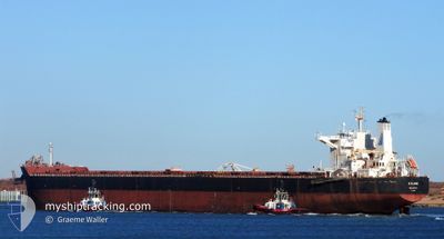
ATALANDI
Cargo

Current Trip
| Time Travelled | 23 days |
|---|---|
| Remaining Time | 10 days |
| Distance Travelled | 6668.17 nm |
| Remaining Distance | 3212.32 nm |
| AVG Speed | 12 Knots |
| MAX Speed | 15.7 Knots |
| AVG Wind | 11.5 knots |
| MAX Wind | 28 knots |
| MIN Temp | 20°C / 68°F |
| MAX Temp | 29.7°C / 85.46°F |
| Dybgang | 7.7 m |
| Position Modtaget | 15 h, 37 m siden |
Current Position
| Longitude | --- |
|---|---|
| Latitude | --- |
| Status | Under way using engine |
| Fart | 13.5 Knots |
| Kurs | 285° |
| Område | South Atlantic Ocean |
| Station | T-AIS |
| Position Modtaget | 15 h, 37 m siden |
Information
The current position of ATALANDI is in South Atlantic Ocean with coordinates -34.48171° / 17.76493° as reported on 2025-02-21 05:40 by AIS to our vessel tracker app. The vessel's current speed is 13.5 Knots and is heading at the port of SANTOS. The estimated time of arrival as calculated by MyShipTracking vessel tracking app is 2025-03-03 20:23 LT
The vessel ATALANDI (IMO: 9658886, MMSI: 241317000) is a Cargo It's sailing under the flag of [GR] Greece.
In this page you can find informations about the vessels current position, last detected port calls, and current voyage information. If the vessels is not in coverage by AIS you will find the latest position.
The current position of ATALANDI is detected by our AIS receivers and we are not responsible for the reliability of the data. The last position was recorded while the vessel was in Coverage by the Ais receivers of our vessel tracking app.
The current draught of ATALANDI as reported by AIS is 7.7 meters
Weather
| Temperature | 20.1°C / 68.18°F |
|---|---|
| Wind Speed | 11 knots |
| Direction | 176° S |
| Pressure | 1012.6 hPa |
| Humidity | 90 % |
| Cloud Coverage | 66 % |


Featured Company
Last Port Calls
| Port | Arrival | Departure | Time In Port |
|---|---|---|---|
| 2025-01-24 19:09 | 2025-01-30 02:59 | 5 d | |
| 2025-01-16 16:52 | 2025-01-22 00:04 | 5 d | |
| 2024-12-08 19:33 | 2024-12-10 08:38 | 1 d | |
| 2024-12-03 19:13 |
Last Trips
| Origin | Departure | Destination | Arrival | Distance | |
|---|---|---|---|---|---|
| 2025-01-22 00:04 | 2025-01-24 19:09 | 427.63 nm | |||
| 2024-12-10 08:38 | 2025-01-16 16:52 | 8946.89 nm | |||
| 2024-12-03 19:13 | 2024-12-08 19:33 | 864.96 nm |
Events
| Tid | Hændelsen | Detaljer | Position / Dest | Info |
|---|---|---|---|---|
| 2025-02-21 05:45 | Status er ændret | Default Under way using engine |
-34.47686 / 17.74209
SANTOS
|
Fart: 13.5 kn Kurs: 285° |
| 2025-02-21 05:40 | Status er ændret | Under way using engine Default |
-34.48171 / 17.76493
SANTOS
|
Fart: 13.6 kn Kurs: 284° |
| 2025-02-21 05:40 | Udenfor Dækning |
-34.48171 / 17.76493
South Atlantic Ocean
SANTOS
|
Fart: 13.5 kn Kurs: 285° |
|
| 2025-02-21 05:23 | Status er ændret | Default Under way using engine |
-34.49770 / 17.83988
SANTOS
|
Fart: 13.5 kn Kurs: 285.5° |
| 2025-02-21 05:14 | Status er ændret | Under way using engine Default |
-34.50683 / 17.87959
SANTOS
|
Fart: 13.8 kn Kurs: 286° |
| 2025-02-21 05:00 | Status er ændret | Default Under way using engine |
-34.52254 / 17.94225
SANTOS
|
Fart: 13.8 kn Kurs: 289° |
| 2025-02-21 04:48 | Status er ændret | Under way using engine Default |
-34.53971 / 17.99411
SANTOS
|
Fart: 14 kn Kurs: 289° |
| 2025-02-21 04:09 | Status er ændret | Default Under way using engine |
-34.58893 / 18.17053
SANTOS
|
Fart: 14.3 kn Kurs: 286.9° |
| 2025-02-21 03:48 | Status er ændret | Under way using engine Default |
-34.61483 / 18.26698
SANTOS
|
Fart: 14.3 kn Kurs: 289° |
| 2025-02-21 03:31 | Status er ændret | Default Under way using engine |
-34.63705 / 18.34399
SANTOS
|
Fart: 14.1 kn Kurs: 289° |