

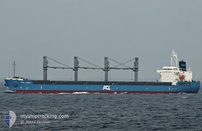
ASL LEBAN
Bulk Carrier

Current Trip
PH MNL
| Time Travelled | 12 h, 39 mins |
|---|---|
| Remaining Time | --- |
| Distance Travelled | 86.00 nm |
| Remaining Distance | --- |
| AVG Speed | 12.9 Knots |
| MAX Speed | 14.9 Knots |
| AVG Wind | 7.7 knots |
| MAX Wind | 13.8 knots |
| MIN Temp | 27.6°C / 81.68°F |
| MAX Temp | 30.7°C / 87.26°F |
| Dybgang | 11.1 m |
| Position Modtaget | 9 d siden |
Current Position
| Longitude | --- |
|---|---|
| Latitude | --- |
| Status | Under way using engine |
| Fart | 9.1 Knots |
| Kurs | 91.2° |
| Område | South China Sea |
| Station | T-AIS |
| Position Modtaget | 9 d siden |
Information
The current position of ASL LEBAN is in South China Sea with coordinates 14.50662° / 120.81323° as reported on 2025-03-08 22:20 by AIS to our vessel tracker app. The vessel's current speed is 9.1 Knots
The vessel ASL LEBAN (IMO: 9547178, MMSI: 538005604) is a Bulk Carrier that was built in 2014 ( 11 år gamle ). It's sailing under the flag of [MH] Marshall Is.
In this page you can find informations about the vessels current position, last detected port calls, and current voyage information. If the vessels is not in coverage by AIS you will find the latest position.
The current position of ASL LEBAN is detected by our AIS receivers and we are not responsible for the reliability of the data. The last position was recorded while the vessel was in Coverage by the Ais receivers of our vessel tracking app.
The current draught of ASL LEBAN as reported by AIS is 11.1 meters
Weather
| Temperature | 26.3°C / 79.34°F |
|---|---|
| Wind Speed | 10 knots |
| Direction | 7° N |
| Pressure | 1013.7 hPa |
| Humidity | 79.2 % |
| Cloud Coverage | 64 % |


Featured Company
Last Port Calls
| Port | Arrival | Departure | Time In Port |
|---|---|---|---|
| 2025-03-14 17:49 | 2025-03-18 14:34 | 3 d | |
| 2025-02-18 16:46 | 2025-02-22 13:50 | 3 d | |
| 2025-02-08 07:10 | 2025-02-12 02:10 | 3 d | |
| 2025-02-02 16:48 | 2025-02-03 20:48 | 1 d | |
| 2025-01-30 09:03 | 2025-02-01 22:26 | 2 d | |
| 2025-01-20 03:00 | 2025-01-23 10:20 | 3 d | |
| 2025-01-06 11:37 | 2025-01-07 12:54 | 1 d | |
| 2025-01-01 14:26 | 2025-01-02 08:29 | 18 h |
Most Visited Ports (Last year)
| Port | Arrivals | |
|---|---|---|
| 3 | ||
| 1 | ||
| 1 | ||
| 1 | ||
| 1 | ||
| 1 |
Last Trips
| Origin | Departure | Destination | Arrival | Distance | |
|---|---|---|---|---|---|
| 2025-02-22 13:50 | 2025-03-14 17:49 | 3936.38 nm | |||
| 2025-02-12 02:10 | 2025-02-18 16:46 | 1400.60 nm | |||
| 2025-02-03 20:48 | 2025-02-08 07:10 | 421.63 nm | |||
| 2025-02-01 22:26 | 2025-02-02 16:48 | 211.04 nm | |||
| 2025-01-23 10:20 | 2025-01-30 09:03 | 1710.64 nm | |||
| 2025-01-07 12:54 | 2025-01-20 03:00 | 3793.72 nm | |||
| 2025-01-02 08:29 | 2025-01-06 11:37 | 804.19 nm | |||
| 2024-12-29 18:57 | 2025-01-01 14:26 | 524.29 nm |
Events
| Tid | Hændelsen | Detaljer | Position / Dest | Info |
|---|---|---|---|---|
| 2025-03-18 06:34 | Afsejlet fra sidste havn |
|
14.60492 / 120.92522
PH MNL
|
Fart: 5.5 kn Kurs: 275° |
| 2025-03-18 06:26 | START Sejllads |
14.60387 / 120.93773
[PH] MANILA
|
Fart: 4.5 kn Kurs: 282° |
|
| 2025-03-14 10:22 | STOP Sejllads |
14.60292 / 120.94276
[PH] MANILA
|
Fart: 0.2 kn Kurs: 257° |
|
| 2025-03-14 09:49 | Skibe i havn |
|
14.60419 / 120.93627
[PH] MANILA
|
Fart: 2.7 kn Kurs: 98° |
| 2025-03-14 09:06 | START Sejllads | 3.34 nm, South West of MANILA |
14.59596 / 120.89374
PH MNL
|
Fart: 4.3 kn Kurs: 342° |
| 2025-03-09 05:26 | STOP Sejllads | 2.87 nm, South West of MANILA |
14.59061 / 120.90665
PH MNL
|
Fart: 0.2 kn Kurs: 105° |
| 2025-03-09 03:58 | START Sejllads | 5.63 nm, West of MANILA SOUTH HARBOR |
14.54125 / 120.88169
PH MNL
|
Fart: 4.5 kn Kurs: 295° |
| 2025-03-08 23:14 | STOP Sejllads | 5.84 nm, West of MANILA SOUTH HARBOR |
14.53744 / 120.87911
PH MNL
|
Fart: 0.3 kn Kurs: 115° |
| 2025-03-08 22:26 | Status er ændret | Default Under way using engine |
14.50765 / 120.82822
PH MNL
|
Fart: 9.1 kn Kurs: 91.2° |
| 2025-03-08 22:20 | Udenfor Dækning |
14.50662 / 120.81323
South China Sea
PH MNL
|
Fart: 9.1 kn Kurs: 91.2° |