
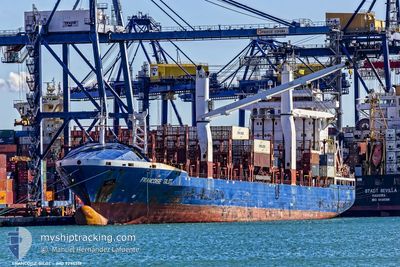
AS FRANZISKA
Container Ship
Current Trip
| Time Travelled | 11 days |
|---|---|
| Remaining Time | 3 days |
| Distance Travelled | 2513.53 nm |
| Remaining Distance | 1430.67 nm |
| AVG Speed | 9.9 Knots |
| MAX Speed | 15.4 Knots |
| AVG Wind | 17.7 knots |
| MAX Wind | 27.5 knots |
| MIN Temp | 5.9°C / 42.62°F |
| MAX Temp | 19.8°C / 67.64°F |
| Dybgang | 9.2 m |
| Position Modtaget | 2 d siden |
Current Position
| Longitude | -6.43598° |
|---|---|
| Latitude | 35.82758° |
| Status | Under way using engine |
| Fart | 12.6 Knots |
| Kurs | 238.9° |
| Område | North Atlantic Ocean |
| Station | T-AIS |
| Position Modtaget | 2 d siden |
Info
Information
The current position of AS FRANZISKA is in North Atlantic Ocean with coordinates 35.82758° / -6.43598° as reported on 2024-04-28 22:19 by AIS to our vessel tracker app. The vessel's current speed is 12.6 Knots and is heading at the port of BANJUL. The estimated time of arrival as calculated by MyShipTracking vessel tracking app is 2024-05-05 00:43 LT
The vessel AS FRANZISKA (IMO: 9295517, MMSI: 305213000) is a Container Ship that was built in 2005 ( 19 år gamle ). It's sailing under the flag of [AG] Antigua Barbuda.
In this page you can find informations about the vessels current position, last detected port calls, and current voyage information. If the vessels is not in coverage by AIS you will find the latest position.
The current position of AS FRANZISKA is detected by our AIS receivers and we are not responsible for the reliability of the data. The last position was recorded while the vessel was in Coverage by the Ais receivers of our vessel tracking app.
The current draught of AS FRANZISKA as reported by AIS is 9.2 meters
Weather
| Temperature | 19.3°C / 66.74°F |
|---|---|
| Wind Speed | 17 knots |
| Direction | 46° NE |
| Pressure | 1020.2 hPa |
| Humidity | 73.7 % |
| Cloud Coverage | 100 % |
Featured Company
Last Port Calls
| Port | Arrival | Departure | Time In Port |
|---|---|---|---|
| 2024-04-18 14:06 | 2024-04-19 20:16 | 1 d | |
| 2024-04-12 05:19 | 2024-04-12 20:24 | 15 h | |
| 2024-04-03 20:23 | 2024-04-04 03:34 | 7 h | |
| 2024-03-28 00:26 | 2024-03-28 10:03 | 9 h | |
| 2024-03-19 11:29 | |||
| 2024-03-07 16:17 |
Most Visited Ports (Last year)
| Port | Arrivals | |
|---|---|---|
| 12 | ||
| 6 | ||
| 6 | ||
| 3 | ||
| 2 | ||
| 1 |
Last Trips
| Origin | Departure | Destination | Arrival | Distance | |
|---|---|---|---|---|---|
| 2024-04-12 22:24 | 2024-04-18 16:06 | 1655.59 nm | |||
| 2024-04-04 03:34 | 2024-04-12 07:19 | 663.15 nm | |||
| 2024-03-28 11:03 | 2024-04-03 20:23 | 454.68 nm | |||
| 2024-03-19 11:29 | 2024-03-28 01:26 | 1555.75 nm |
Events
| Tid | Hændelsen | Detaljer | Position / Dest | Info |
|---|---|---|---|---|
| 2024-04-28 22:47 | Status er ændret | Default Under way using engine |
35.74972 / -6.54345
GMBJL
|
Fart: 12.6 kn Kurs: 238.9° |
| 2024-04-28 22:19 | Fundet i havområde | Moroccan part of the North Atlantic Ocean |
35.82758 / -6.43598
North Atlantic Ocean
GMBJL
|
Fart: 12.6 kn Kurs: 238.9° |
| 2024-04-28 22:19 | Udenfor Dækning |
35.82758 / -6.43598
North Atlantic Ocean
GMBJL
|
Fart: 12.6 kn Kurs: 238.9° |
|
| 2024-04-28 21:17 | Fundet i havområde | Spanish part of the North Atlantic Ocean |
35.94631 / -6.23144
North Atlantic Ocean
GMBJL
|
Fart: 11.4 kn Kurs: 264.7° |
| 2024-04-28 20:16 | Fundet i havområde | Moroccan part of the North Atlantic Ocean |
35.94920 / -5.99749
North Atlantic Ocean
GMBJL
|
Fart: 10.9 kn Kurs: 271.4° |
| 2024-04-28 20:16 | Status er ændret | Under way using engine Default |
35.94920 / -5.99749
GMBJL
|
Fart: 10.9 kn Kurs: 273° |
| 2024-04-28 20:02 | Status er ændret | Default Under way using engine |
35.94865 / -5.97832
GMBJL
|
Fart: 10.6 kn Kurs: 271.3° |
| 2024-04-28 19:29 | Status er ændret | Under way using engine Default |
35.94552 / -5.84188
GMBJL
|
Fart: 10.3 kn Kurs: 272° |
| 2024-04-28 19:13 | Status er ændret | Default Under way using engine |
35.94457 / -5.80012
GMBJL
|
Fart: 9.5 kn Kurs: 273.3° |
| 2024-04-28 19:08 | Ændre havområde | Moroccan part of the Strait of Gibraltar Spanish part of the Strait of Gibraltar |
35.94388 / -5.77700
Strait of Gibraltar
GMBJL
|
Fart: 9.5 kn Kurs: 273.3° |