

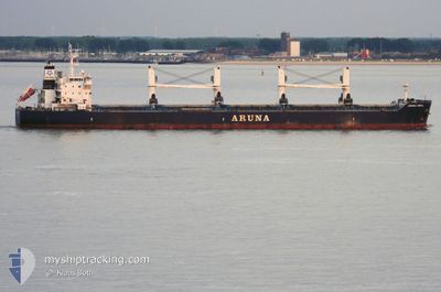
ARUNA ISMAIL
Bulk Carrier

Current Trip
| Trip Time | 1 h, 35 mins |
|---|---|
| Trip Distance | 5.72 nm |
| AVG Speed | 5.4 Knots |
| MAX Speed | 10.3 Knots |
| Dybgang | 10 m |
| AVG Wind | 10 knots |
| MAX Wind | 11 knots |
| MIN Temp | 29.4°C / 84.92°F |
| MAX Temp | 29.6°C / 85.28°F |
| Position Modtaget | 27 d siden |
Current Position
| Longitude | --- |
|---|---|
| Latitude | --- |
| Status | Under way using engine |
| Fart | 12.1 Knots |
| Kurs | 215.4° |
| Område | North Atlantic Ocean |
| Station | T-AIS |
| Position Modtaget | 27 d siden |
Information
The current position of ARUNA ISMAIL is in North Atlantic Ocean with coordinates 28.07529° / -13.68148° as reported on 2025-02-03 05:45 by AIS to our vessel tracker app. The vessel's current speed is 12.1 Knots and is currently inside the port of BUCHANAN.
The vessel ARUNA ISMAIL (IMO: 9637296, MMSI: 538004999) is a Bulk Carrier that was built in 2013 ( 12 år gamle ). It's sailing under the flag of [MH] Marshall Is.
In this page you can find informations about the vessels current position, last detected port calls, and current voyage information. If the vessels is not in coverage by AIS you will find the latest position.
The current position of ARUNA ISMAIL is detected by our AIS receivers and we are not responsible for the reliability of the data. The last position was recorded while the vessel was in Coverage by the Ais receivers of our vessel tracking app.
The current draught of ARUNA ISMAIL as reported by AIS is 10 meters
Weather
| Temperature | 25.8°C / 78.44°F |
|---|---|
| Wind Speed | 6 knots |
| Direction | 265° W |
| Pressure | 1010.9 hPa |
| Humidity | 85.9 % |
| Cloud Coverage | 95 % |


Featured Company
Last Trips
| Origin | Departure | Destination | Arrival | Distance | |
|---|---|---|---|---|---|
| 2025-02-28 13:31 | 2025-02-28 15:06 | 5.72 nm | |||
| 2025-02-15 20:49 | 2025-02-28 12:43 | 973.66 nm | |||
| 2025-01-30 17:24 | 2025-02-11 03:53 | 3223.19 nm | |||
| 2025-01-05 15:36 | 2025-01-16 11:06 | 535.39 nm | |||
| 2024-11-28 03:32 | 2025-01-01 16:06 | 2377.95 nm |
Events
| Tid | Hændelsen | Detaljer | Position / Dest | Info |
|---|---|---|---|---|
| 2025-02-28 15:24 | STOP Sejllads |
5.85789 / -10.05020
[LR] BUCHANAN
|
Fart: Kurs: 308° |
|
| 2025-02-28 15:06 | Skibe i havn |
|
5.85843 / -10.05820
[LR] BUCHANAN
|
Fart: 4.7 kn Kurs: 99° |
| 2025-02-28 14:39 | START Sejllads | 3.23 nm, West of BUCHANAN |
5.85910 / -10.10877
GHTEM
|
Fart: 6.9 kn Kurs: 93° |
| 2025-02-28 14:14 | STOP Sejllads | 3.31 nm, West of BUCHANAN |
5.86229 / -10.10997
GHTEM
|
Fart: 0.3 kn Kurs: 255° |
| 2025-02-28 13:31 | Afsejlet fra sidste havn |
|
5.86071 / -10.07272
GHTEM
|
Fart: 5 kn Kurs: 280° |
| 2025-02-28 13:20 | START Sejllads |
5.85758 / -10.05328
[LR] BUCHANAN
|
Fart: 3.7 kn Kurs: 278° |
|
| 2025-02-28 13:02 | STOP Sejllads |
5.85782 / -10.05025
[LR] BUCHANAN
|
Fart: Kurs: 308° |
|
| 2025-02-28 12:43 | Skibe i havn |
|
5.85904 / -10.06047
[LR] BUCHANAN
|
Fart: 4.9 kn Kurs: 102° |
| 2025-02-28 12:42 | START Sejllads | 0.45 nm, West of BUCHANAN |
5.85920 / -10.06219
GHTEM
|
Fart: 4.9 kn Kurs: 102° |
| 2025-02-28 07:06 | START Sejllads | 17.66 nm, South of BUCHANAN |
5.57754 / -10.14918
GHTEM
|
Fart: 4.4 kn Kurs: 18° |