
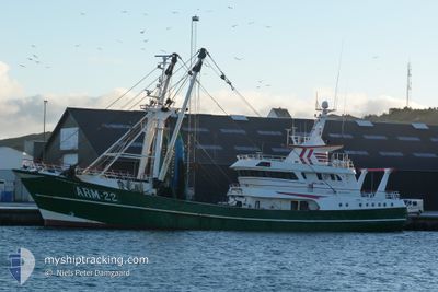
ARM22 KLAAS ADRIANA
Trawler
Current Trip
FISHINGGROUND VHF16<
| Time Travelled | 1 day |
|---|---|
| Remaining Time | --- |
| Distance Travelled | 88.66 nm |
| Remaining Distance | --- |
| AVG Speed | 11.1 Knots |
| MAX Speed | 12.3 Knots |
| AVG Wind | 14.6 knots |
| MAX Wind | 16.5 knots |
| MIN Temp | 11.8°C / 53.24°F |
| MAX Temp | 13.3°C / 55.94°F |
| Dybgang | 5 m |
| Position Modtaget | 1 d siden |
Current Position
| Longitude | 2.12983° |
|---|---|
| Latitude | 52.55674° |
| Status | Under way using engine |
| Fart | 6.7 Knots |
| Kurs | 5.2° |
| Område | North Sea |
| Station | T-AIS |
| Position Modtaget | 1 d siden |
Info
Information
The current position of ARM22 KLAAS ADRIANA is in North Sea with coordinates 52.55674° / 2.12983° as reported on 2024-05-21 01:26 by AIS to our vessel tracker app. The vessel's current speed is 6.7 Knots
The vessel ARM22 KLAAS ADRIANA (IMO: 9063940, MMSI: 244221000) is a Trawler that was built in 1994 ( 30 år gamle ). It's sailing under the flag of [NL] Netherlands.
In this page you can find informations about the vessels current position, last detected port calls, and current voyage information. If the vessels is not in coverage by AIS you will find the latest position.
The current position of ARM22 KLAAS ADRIANA is detected by our AIS receivers and we are not responsible for the reliability of the data. The last position was recorded while the vessel was in Coverage by the Ais receivers of our vessel tracking app.
The current draught of ARM22 KLAAS ADRIANA as reported by AIS is 5 meters
Weather
| Temperature | 11.8°C / 53.24°F |
|---|---|
| Wind Speed | 13 knots |
| Direction | 26° NNE |
| Pressure | 1009.9 hPa |
| Humidity | 95.3 % |
| Cloud Coverage | 12 % |
Featured Company
Last Port Calls
| Port | Arrival | Departure | Time In Port |
|---|---|---|---|
| 2024-05-17 11:18 | 2024-05-20 14:17 | 3 d | |
| 2024-05-09 05:41 | 2024-05-12 23:19 | 3 d | |
| 2024-05-03 15:42 | 2024-05-06 02:29 | 2 d | |
| 2024-04-26 11:07 | 2024-04-28 22:55 | 2 d | |
| 2024-04-19 01:23 | 2024-04-21 23:02 | 2 d | |
| 2024-04-12 05:27 | 2024-04-14 23:01 | 2 d | |
| 2024-04-09 21:28 | 2024-04-10 00:21 | 2 h | |
| 2024-04-05 13:29 | 2024-04-07 23:08 | 2 d | |
| 2024-03-29 02:31 | 2024-04-01 16:42 | 3 d | |
| 2024-03-22 10:34 | 2024-03-25 00:02 | 2 d |
Most Visited Ports (Last year)
| Port | Arrivals | |
|---|---|---|
| 47 | ||
| 3 | ||
| 1 | ||
| 1 |
Last Trips
| Origin | Departure | Destination | Arrival | Distance | |
|---|---|---|---|---|---|
| 2024-05-13 01:19 | 2024-05-17 13:18 | 444.77 nm | |||
| 2024-05-06 04:29 | 2024-05-09 07:41 | 442.13 nm | |||
| 2024-04-29 00:55 | 2024-05-03 17:42 | 563.15 nm | |||
| 2024-04-22 01:02 | 2024-04-26 13:07 | 511.27 nm | |||
| 2024-04-15 01:01 | 2024-04-19 03:23 | 481.33 nm | |||
| 2024-04-10 02:21 | 2024-04-12 07:27 | 256.78 nm | |||
| 2024-04-08 01:08 | 2024-04-09 23:28 | 164.82 nm | |||
| 2024-04-01 18:42 | 2024-04-05 15:29 | 388.55 nm | |||
| 2024-03-25 01:02 | 2024-03-29 03:31 | 451.75 nm | |||
| 2024-03-18 01:04 | 2024-03-22 11:34 | 372.07 nm |
Events
| Tid | Hændelsen | Detaljer | Position / Dest | Info |
|---|---|---|---|---|
| 2024-05-21 01:26 | Udenfor Dækning |
52.55674 / 2.12983
North Sea
|
Fart: 6.7 kn Kurs: 5.2° |
|
| 2024-05-21 00:57 | Ændre havområde | United Kingdom part of the North Sea Dutch part of the North Sea |
52.55048 / 2.16043
North Sea
|
Fart: 1.7 kn Kurs: 219.1° |
| 2024-05-21 00:57 | Indenfor Dækning |
52.55048 / 2.16043
North Sea
|
Fart: 1.7 kn Kurs: 219.1° |
|
| 2024-05-20 18:54 | Udenfor Dækning |
51.99866 / 2.71955
North Sea
|
Fart: 9.6 kn Kurs: 311° |
|
| 2024-05-20 14:17 | Afsejlet fra sidste havn |
|
51.44120 / 3.60034
FISHINGGROUND VHF16<
|
Fart: 8.6 kn Kurs: 117° |
| 2024-05-20 14:15 | START Sejllads |
51.44256 / 3.59612
[NL] VLISSINGEN STATION
|
Fart: 3.2 kn Kurs: 115° |
|
| 2024-05-17 11:18 | STOP Sejllads |
51.44457 / 3.59123
[NL] VLISSINGEN STATION
|
Fart: 0.2 kn Kurs: 14° |
|
| 2024-05-17 11:18 | Skibe i havn |
|
51.44458 / 3.59124
[NL] VLISSINGEN STATION
|
Fart: 1.4 kn Kurs: 359° |
| 2024-05-17 11:16 | START Sejllads | 0.26 nm, South of VLISSINGEN STATION |
51.44344 / 3.59299
FISHINGGROUND VHF16<
|
Fart: 4 kn Kurs: 299° |
| 2024-05-17 10:55 | STOP Sejllads | 0.36 nm, South East of VLISSINGEN STATION |
51.44261 / 3.59606
FISHINGGROUND VHF16<
|
Fart: 0.1 kn Kurs: 292° |