
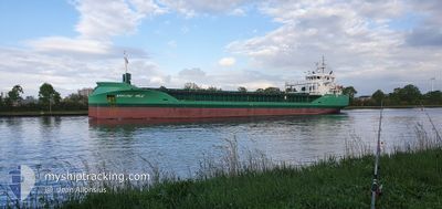
ARKLOW VALE
Cargo
Current Trip
| Time Travelled | 2 days |
|---|---|
| Remaining Time | 15 h, 24 mins |
| Distance Travelled | 341.10 nm |
| Remaining Distance | 185.67 nm |
| AVG Speed | 11.2 Knots |
| MAX Speed | 14.1 Knots |
| AVG Wind | 6.3 knots |
| MAX Wind | 10.8 knots |
| MIN Temp | 8.4°C / 47.12°F |
| MAX Temp | 17.8°C / 64.04°F |
| Dybgang | 5.3 m |
| Position Modtaget | 1 m siden |
Current Position
| Longitude | 8.52362° |
|---|---|
| Latitude | 57.21237° |
| Status | Under way using engine |
| Fart | 12.1 Knots |
| Kurs | 60.1° |
| Område | North Sea |
| Station | T-AIS |
| Position Modtaget | 1 m siden |
Info
Information
The current position of ARKLOW VALE is in North Sea with coordinates 57.21237° / 8.52362° as reported on 2024-05-11 16:19 by AIS to our vessel tracker app. The vessel's current speed is 12.1 Knots and is heading at the port of HALMSTAD. The estimated time of arrival as calculated by MyShipTracking vessel tracking app is 2024-05-12 07:44 LT
The vessel ARKLOW VALE (IMO: 9772527, MMSI: 244750645) is a Cargo It's sailing under the flag of [NL] Netherlands.
In this page you can find informations about the vessels current position, last detected port calls, and current voyage information. If the vessels is not in coverage by AIS you will find the latest position.
The current position of ARKLOW VALE is detected by our AIS receivers and we are not responsible for the reliability of the data. The last position was recorded while the vessel was in Coverage by the Ais receivers of our vessel tracking app.
The current draught of ARKLOW VALE as reported by AIS is 5.3 meters
Weather
| Temperature | 10.7°C / 51.26°F |
|---|---|
| Wind Speed | 7 knots |
| Direction | 305° NW |
| Pressure | 1025 hPa |
| Humidity | 83.3 % |
| Cloud Coverage | 72 % |
Featured Company
Last Port Calls
| Port | Arrival | Departure | Time In Port |
|---|---|---|---|
| 2024-05-09 03:22 | 2024-05-09 04:10 | 47 m | |
| 2024-05-06 17:30 | 2024-05-08 15:40 | 1 d | |
| 2024-05-03 17:27 | 2024-05-03 18:11 | 44 m | |
| 2024-05-03 16:43 | 2024-05-03 17:02 | 19 m | |
| 2024-04-27 03:08 | 2024-05-03 15:55 | 6 d | |
| 2024-04-27 01:56 | 2024-04-27 02:16 | 20 m | |
| 2024-04-27 00:59 | 2024-04-27 01:34 | 34 m | |
| 2024-04-21 19:20 | 2024-04-24 18:59 | 2 d | |
| 2024-04-19 23:54 | 2024-04-20 15:43 | 15 h | |
| 2024-04-04 01:06 | 2024-04-07 16:32 | 3 d |
Last Trips
| Origin | Departure | Destination | Arrival | Distance | |
|---|---|---|---|---|---|
| 2024-05-08 17:40 | 2024-05-09 05:22 | 131.33 nm | |||
| 2024-05-03 19:11 | 2024-05-06 19:30 | 725.38 nm | |||
| 2024-05-03 18:02 | 2024-05-03 18:27 | 1.94 nm | |||
| 2024-05-03 16:55 | 2024-05-03 17:43 | 4.56 nm | |||
| 2024-04-27 03:16 | 2024-04-27 04:08 | 4.03 nm | |||
| 2024-04-27 02:34 | 2024-04-27 02:56 | 1.96 nm | |||
| 2024-04-24 20:59 | 2024-04-27 01:59 | 615.99 nm | |||
| 2024-04-20 17:43 | 2024-04-21 21:20 | 197.43 nm | |||
| 2024-04-07 17:32 | 2024-04-20 01:54 | 1557.77 nm | |||
| 2024-04-03 23:45 | 2024-04-04 02:06 | 19.38 nm |
Events
| Tid | Hændelsen | Detaljer | Position / Dest | Info |
|---|---|---|---|---|
| 2024-05-11 16:13 | Ændre havområde | Danish part of the Skaggerak Danish part of the North Sea |
57.20250 / 8.49098
Skaggerak
HALMSTAD
|
Fart: 12.2 kn Kurs: 60.8° |
| 2024-05-11 05:16 | Fundet i havområde | Danish part of the North Sea |
55.39420 / 6.37207
North Sea
HALMSTAD
|
Fart: 12 kn Kurs: 29.5° |
| 2024-05-11 00:35 | Status er ændret | Under way using engine Default |
54.59840 / 5.55092
HALMSTAD
|
Fart: 12 kn Kurs: 30° |
| 2024-05-11 00:30 | Status er ændret | Default Under way using engine |
54.58548 / 5.53808
HALMSTAD
|
Fart: 12.2 kn Kurs: 30.4° |
| 2024-05-11 00:19 | Ændre havområde | German part of the North Sea Dutch part of the North Sea |
54.55263 / 5.50483
North Sea
HALMSTAD
|
Fart: 12.2 kn Kurs: 30.4° |
| 2024-05-11 00:19 | Status er ændret | Under way using engine Default |
54.55263 / 5.50483
HALMSTAD
|
Fart: 12.2 kn Kurs: 31° |
| 2024-05-11 00:10 | Indenfor Dækning |
54.55263 / 5.50483
North Sea
HALMSTAD
|
Fart: 12.2 kn Kurs: 30.4° |
|
| 2024-05-10 19:59 | Status er ændret | Default Under way using engine |
53.72666 / 4.92500
HALMSTAD
|
Fart: 13.1 kn Kurs: 21.5° |
| 2024-05-10 19:53 | Udenfor Dækning |
53.70953 / 4.91392
North Sea
HALMSTAD
|
Fart: 13.1 kn Kurs: 21.5° |
|
| 2024-05-10 19:41 | Status er ændret | Under way using engine Default |
53.66720 / 4.88588
HALMSTAD
|
Fart: 13 kn Kurs: 21° |