
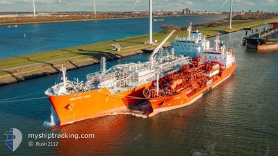
ARCTIC GAS
Tanker
Current Trip
| Time Travelled | 10 days |
|---|---|
| Remaining Time | --- |
| Distance Travelled | 3523.87 nm |
| Remaining Distance | --- |
| AVG Speed | 13.8 Knots |
| MAX Speed | 16.7 Knots |
| AVG Wind | 14.9 knots |
| MAX Wind | 23 knots |
| MIN Temp | 8.5°C / 47.3°F |
| MAX Temp | 24.5°C / 76.1°F |
| Dybgang | 9.8 m |
| Position Modtaget | 9 d siden |
Current Position
| Longitude | -6.55296° |
|---|---|
| Latitude | 49.73082° |
| Status | Under way using engine |
| Fart | 13.8 Knots |
| Kurs | 274.6° |
| Område | Celtic Sea |
| Station | T-AIS |
| Position Modtaget | 9 d siden |
Info
Information
The current position of ARCTIC GAS is in Celtic Sea with coordinates 49.73082° / -6.55296° as reported on 2024-05-29 10:13 by AIS to our vessel tracker app. The vessel's current speed is 13.8 Knots and is heading at the port of HOUSTON. The estimated time of arrival as calculated by MyShipTracking vessel tracking app is 2024-06-11 01:00 LT
The vessel ARCTIC GAS (IMO: 9745512, MMSI: 219025000) is a Tanker It's sailing under the flag of [DK] Denmark.
In this page you can find informations about the vessels current position, last detected port calls, and current voyage information. If the vessels is not in coverage by AIS you will find the latest position.
The current position of ARCTIC GAS is detected by our AIS receivers and we are not responsible for the reliability of the data. The last position was recorded while the vessel was in Coverage by the Ais receivers of our vessel tracking app.
The current draught of ARCTIC GAS as reported by AIS is 9.8 meters
Weather
| Temperature | 24.3°C / 75.74°F |
|---|---|
| Wind Speed | 13 knots |
| Direction | 213° SSW |
| Pressure | 1012.4 hPa |
| Humidity | 89.8 % |
| Cloud Coverage | 56 % |
Featured Company
Last Port Calls
| Port | Arrival | Departure | Time In Port |
|---|---|---|---|
| 2024-05-18 07:23 | 2024-05-28 05:03 | 9 d | |
| 2024-05-13 15:00 | 2024-05-16 12:34 | 2 d |
Most Visited Ports (Last year)
| Port | Arrivals | |
|---|---|---|
| 4 | ||
| 2 | ||
| 1 | ||
| 1 | ||
| 1 | ||
| 1 |
Last Trips
| Origin | Departure | Destination | Arrival | Distance | |
|---|---|---|---|---|---|
| 2024-05-16 12:34 | 2024-05-18 07:23 | 105.35 nm |
Events
| Tid | Hændelsen | Detaljer | Position / Dest | Info |
|---|---|---|---|---|
| 2024-05-29 10:20 | Status er ændret | Default Under way using engine |
49.73285 / -6.59196
US HOU
|
Fart: 13.8 kn Kurs: 274.6° |
| 2024-05-29 10:13 | Status er ændret | Under way using engine Default |
49.73082 / -6.55296
US HOU
|
Fart: 13.8 kn Kurs: 275° |
| 2024-05-29 10:13 | Udenfor Dækning |
49.73082 / -6.55296
Celtic Sea
US HOU
|
Fart: 13.8 kn Kurs: 274.6° |
|
| 2024-05-29 10:00 | Status er ændret | Default Under way using engine |
49.72682 / -6.47228
US HOU
|
Fart: 13.9 kn Kurs: 273.8° |
| 2024-05-29 09:54 | Ændre havområde | United Kingdom part of the Celtic Sea United Kingdom part of the English Channel |
49.72529 / -6.44079
Celtic Sea
US HOU
|
Fart: 13.9 kn Kurs: 273.8° |
| 2024-05-29 09:54 | Status er ændret | Under way using engine Default |
49.72529 / -6.44079
US HOU
|
Fart: 13.8 kn Kurs: 274° |
| 2024-05-29 09:44 | Status er ændret | Default Under way using engine |
49.72232 / -6.37856
US HOU
|
Fart: 13.7 kn Kurs: 274.4° |
| 2024-05-29 09:44 | Indenfor Dækning |
49.72155 / -6.36393
English Channel
US HOU
|
Fart: 13.7 kn Kurs: 274.4° |
|
| 2024-05-29 09:41 | Status er ændret | Under way using engine Default |
49.72150 / -6.36286
US HOU
|
Fart: 13.7 kn Kurs: 275° |
| 2024-05-29 06:14 | Udenfor Dækning |
49.80239 / -5.17621
English Channel
US HOU
|
Fart: 13 kn Kurs: 264.9° |