

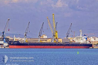
ARCADIA
Cargo

Current Trip
USHOU
| Time Travelled | 14 days |
|---|---|
| Remaining Time | --- |
| Distance Travelled | 3653.42 nm |
| Remaining Distance | --- |
| AVG Speed | 10.2 Knots |
| MAX Speed | 14.4 Knots |
| AVG Wind | 9.9 knots |
| MAX Wind | 39.8 knots |
| MIN Temp | 6.7°C / 44.06°F |
| MAX Temp | 20.5°C / 68.9°F |
| Dybgang | 7.6 m |
| Position Modtaget | 5 d siden |
Current Position
| Longitude | --- |
|---|---|
| Latitude | --- |
| Status | Under way using engine |
| Fart | 11.4 Knots |
| Kurs | 235.3° |
| Område | North Atlantic Ocean |
| Station | T-AIS |
| Position Modtaget | 5 d siden |
Information
The current position of ARCADIA is in North Atlantic Ocean with coordinates 34.40693° / -9.16743° as reported on 2025-02-15 04:36 by AIS to our vessel tracker app. The vessel's current speed is 11.4 Knots
The vessel ARCADIA (IMO: 9695640, MMSI: 256820000) is a Cargo It's sailing under the flag of [MT] Malta.
In this page you can find informations about the vessels current position, last detected port calls, and current voyage information. If the vessels is not in coverage by AIS you will find the latest position.
The current position of ARCADIA is detected by our AIS receivers and we are not responsible for the reliability of the data. The last position was recorded while the vessel was in Coverage by the Ais receivers of our vessel tracking app.
The current draught of ARCADIA as reported by AIS is 7.6 meters
Weather
| Temperature | 20.2°C / 68.36°F |
|---|---|
| Wind Speed | 5 knots |
| Direction | 204° SSW |
| Pressure | 1024.1 hPa |
| Humidity | 66.7 % |
| Cloud Coverage | 17 % |


Featured Company
Last Port Calls
| Port | Arrival | Departure | Time In Port |
|---|---|---|---|
| 2025-01-27 09:49 | 2025-02-05 16:49 | 9 d | |
| 2025-01-18 01:13 | 2025-01-22 12:24 | 4 d | |
| 2025-01-06 13:20 | 2025-01-09 15:48 | 3 d | |
| 2024-12-26 11:02 | 2024-12-30 13:05 | 4 d | |
| 2024-12-03 13:10 | 2024-12-08 13:33 | 5 d |
Last Trips
| Origin | Departure | Destination | Arrival | Distance | |
|---|---|---|---|---|---|
| 2025-01-22 14:24 | 2025-01-27 12:49 | 1098.59 nm | |||
| 2025-01-09 18:48 | 2025-01-18 03:13 | 524.14 nm | |||
| 2024-12-30 14:05 | 2025-01-06 16:20 | 1762.63 nm | |||
| 2024-12-08 07:33 | 2024-12-26 12:02 | 4781.74 nm | |||
| 2024-11-30 03:49 | 2024-12-03 07:10 | 490.48 nm |
Events
| Tid | Hændelsen | Detaljer | Position / Dest | Info |
|---|---|---|---|---|
| 2025-02-15 04:47 | Status er ændret | Default Under way using engine |
34.39105 / -9.20359
USHOU
|
Fart: 11.4 kn Kurs: 235.3° |
| 2025-02-15 04:36 | Udenfor Dækning |
34.40693 / -9.16743
North Atlantic Ocean
|
Fart: 11.4 kn Kurs: 235.3° |
|
| 2025-02-15 04:36 | Status er ændret | Under way using engine Default |
34.40741 / -9.16642
USHOU
|
Fart: 11.7 kn Kurs: 239° |
| 2025-02-15 04:22 | Status er ændret | Default Under way using engine |
34.43008 / -9.11890
USHOU
|
Fart: 11.5 kn Kurs: 239.9° |
| 2025-02-15 03:58 | Status er ændret | Under way using engine Default |
34.46837 / -9.03785
USHOU
|
Fart: 11 kn Kurs: 241° |
| 2025-02-15 03:53 | Status er ændret | Default Under way using engine |
34.47596 / -9.02113
USHOU
|
Fart: 11.2 kn Kurs: 240.1° |
| 2025-02-15 03:49 | Status er ændret | Under way using engine Default |
34.48096 / -9.00997
USHOU
|
Fart: 11.5 kn Kurs: 246° |
| 2025-02-15 03:46 | Indenfor Dækning |
34.48096 / -9.00997
North Atlantic Ocean
|
Fart: 11.4 kn Kurs: 238° |
|
| 2025-02-15 00:26 | Status er ændret | Default Under way using engine |
34.76819 / -8.31745
USHOU
|
Fart: 11.1 kn Kurs: 243.3° |
| 2025-02-15 00:23 | Udenfor Dækning |
34.77266 / -8.30685
North Atlantic Ocean
|
Fart: 11.1 kn Kurs: 243.3° |