
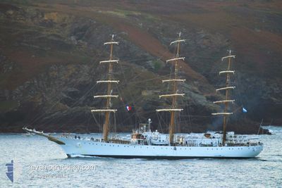
A.R.A. LIBERTAD
Not available
Current Trip
| Time Travelled | 38 days |
|---|---|
| Remaining Time | --- |
| Distance Travelled | 4208.54 nm |
| Remaining Distance | --- |
| AVG Speed | 8.7 Knots |
| MAX Speed | 12.6 Knots |
| AVG Wind | 6.6 knots |
| MAX Wind | 11.9 knots |
| MIN Temp | 17.6°C / 63.68°F |
| MAX Temp | 24.9°C / 76.82°F |
| Dybgang | 6.9 m |
| Position Modtaget | 2 m siden |
Current Position
| Longitude | --- |
|---|---|
| Latitude | --- |
| Status | At anchor |
| Fart | |
| Kurs | --- |
| Område | South Atlantic Ocean |
| Station | T-AIS |
| Position Modtaget | 2 m siden |
Info
Information
The current position of A.R.A. LIBERTAD is in South Atlantic Ocean with coordinates -22.90769° / -43.15312° as reported on 2024-10-18 07:29 by AIS to our vessel tracker app. The vessel's current speed is 0 Knots
The vessel A.R.A. LIBERTAD (IMO: 6125398, MMSI: 701000001) is a Not available It's sailing under the flag of [AR] Argentina.
In this page you can find informations about the vessels current position, last detected port calls, and current voyage information. If the vessels is not in coverage by AIS you will find the latest position.
The current position of A.R.A. LIBERTAD is detected by our AIS receivers and we are not responsible for the reliability of the data. The last position was recorded while the vessel was in Coverage by the Ais receivers of our vessel tracking app.
The current draught of A.R.A. LIBERTAD as reported by AIS is 6.9 meters
Weather
| Temperature | 21°C / 69.8°F |
|---|---|
| Wind Speed | 4 knots |
| Direction | 284° WNW |
| Pressure | 1013.8 hPa |
| Humidity | 88.4 % |
| Cloud Coverage | 100 % |
Featured Company
Most Visited Ports (Last year)
| Port | Arrivals | |
|---|---|---|
| 1 | ||
| 1 | ||
| 1 | ||
| 1 |
Events
| Tid | Hændelsen | Detaljer | Position / Dest | Info |
|---|---|---|---|---|
| 2024-10-17 10:56 | Status er ændret | At anchor Under way using engine |
-22.90906 / -43.15257
RIO DE JANEIRO
|
Fart: 0.8 kn Kurs: 511° |
| 2024-10-17 10:47 | STOP Sejllads | 0.67 nm, South East of RIO DE JANEIRO |
-22.90809 / -43.15279
RIO DE JANEIRO
|
Fart: 0.2 kn Kurs: 511° |
| 2024-10-17 09:01 | Destination er ændret | RIO DE JANEIRO BRIDGETOWN |
-23.06392 / -43.07816
RIO DE JANEIRO
|
Fart: 4 kn Kurs: 325.7° |
| 2024-10-17 09:01 | ETA er ændret | 2024/10/18 08:00 2024/09/20 09:00 |
-23.06392 / -43.07816
RIO DE JANEIRO
|
Fart: 4 kn Kurs: 325.7° |
| 2024-10-17 07:58 | Ændre havområde | Brazilian part of the South Atlantic Ocean United States part of the North Atlantic Ocean |
-23.12105 / -43.02178
South Atlantic Ocean
|
Fart: 5 kn Kurs: 307.7° |
| 2024-10-17 07:54 | Indenfor Dækning |
-23.12105 / -43.02178
South Atlantic Ocean
|
Fart: 5 kn Kurs: 307.7° |