
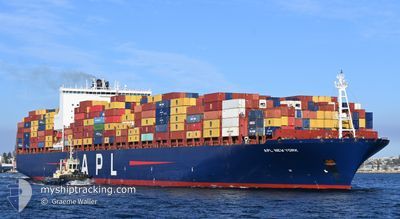
APL NEW YORK
Container Ship
Current Trip
| Time Travelled | 23 h, 36 mins |
|---|---|
| Remaining Time | 8 h, 7 mins |
| Distance Travelled | 246.54 nm |
| Remaining Distance | 109.65 nm |
| AVG Speed | 10.9 Knots |
| MAX Speed | 15.2 Knots |
| AVG Wind | 13.1 knots |
| MAX Wind | 22.7 knots |
| MIN Temp | 6.4°C / 43.52°F |
| MAX Temp | 9.4°C / 48.92°F |
| Dybgang | 10.5 m |
| Position Modtaget | 12 h, 13 m siden |
Current Position
| Longitude | --- |
|---|---|
| Latitude | --- |
| Status | Under way using engine |
| Fart | 13.7 Knots |
| Kurs | 16.9° |
| Område | North Sea |
| Station | T-AIS |
| Position Modtaget | 12 h, 13 m siden |
Info
Information
The current position of APL NEW YORK is in North Sea with coordinates 53.82898° / 4.98434° as reported on 2025-12-05 14:45 by AIS to our vessel tracker app. The vessel's current speed is 13.7 Knots and is heading at the port of HAMBURG. The estimated time of arrival as calculated by MyShipTracking vessel tracking app is 2025-12-06 12:05 LT
The vessel APL NEW YORK (IMO: 9597484, MMSI: 566879000) is a Container Ship that was built in 2013 ( 12 år gamle ). It's sailing under the flag of [SG] Singapore.
In this page you can find informations about the vessels current position, last detected port calls, and current voyage information. If the vessels is not in coverage by AIS you will find the latest position.
The current position of APL NEW YORK is detected by our AIS receivers and we are not responsible for the reliability of the data. The last position was recorded while the vessel was in Coverage by the Ais receivers of our vessel tracking app.
The current draught of APL NEW YORK as reported by AIS is 10.5 meters
Weather
| Temperature | 6.5°C / 43.7°F |
|---|---|
| Wind Speed | 22 knots |
| Direction | 165° SSE |
| Pressure | 1005.4 hPa |
| Humidity | 83.4 % |
| Cloud Coverage | 100 % |
Featured Company
Last Port Calls
| Port | Arrival | Departure | Time In Port |
|---|---|---|---|
| 2025-12-04 09:06 | 2025-12-05 04:22 | 19 h | |
| 2025-12-02 13:16 | 2025-12-03 08:36 | 19 h | |
| 2025-11-03 11:22 | 2025-11-04 11:26 | 1 d | |
| 2025-10-30 20:54 | 2025-10-31 17:10 | 20 h | |
| 2025-10-25 03:03 | 2025-10-26 06:36 | 1 d | |
| 2025-10-13 08:09 | 2025-10-14 11:31 | 1 d | |
| 2025-10-06 22:11 | 2025-10-09 02:36 | 2 d | |
| 2025-10-02 11:26 | 2025-10-05 03:36 | 2 d |
Last Trips
| Origin | Departure | Destination | Arrival | Distance | |
|---|---|---|---|---|---|
| 2025-12-03 08:36 | 2025-12-04 09:06 | 198.72 nm | |||
| 2025-11-04 11:26 | 2025-12-02 13:16 | 10923.51 nm | |||
| 2025-10-31 17:10 | 2025-11-03 11:22 | 721.02 nm | |||
| 2025-10-26 06:36 | 2025-10-30 20:54 | 1594.29 nm | |||
| 2025-10-14 11:31 | 2025-10-25 03:03 | 3680.22 nm | |||
| 2025-10-09 02:36 | 2025-10-13 08:09 | 1006.98 nm | |||
| 2025-10-05 03:36 | 2025-10-06 22:11 | 589.99 nm | |||
| 2025-09-10 03:59 | 2025-10-02 11:26 | 5871.09 nm |
Events
| Tid | Hændelsen | Detaljer | Position / Dest | Info |
|---|---|---|---|---|
| 2025-12-05 14:53 | Status er ændret | Default Under way using engine |
53.85961 / 4.99993
DEHAM
|
Fart: 13.7 kn Kurs: 16.9° |
| 2025-12-05 14:45 | Udenfor Dækning |
53.82898 / 4.98434
North Sea
DEHAM
|
Fart: 13.7 kn Kurs: 16.9° |
|
| 2025-12-05 13:39 | ETA er ændret | 2025/12/06 11:30 2025/12/06 02:30 |
53.60263 / 4.83028
DEHAM
|
Fart: 13.6 kn Kurs: 22.4° |
| 2025-12-05 06:46 | Status er ændret | Under way using engine Default |
52.49968 / 3.90826
DEHAM
|
Fart: 11.1 kn Kurs: 10° |
| 2025-12-05 06:45 | Status er ændret | Default Under way using engine |
52.49565 / 3.90705
DEHAM
|
Fart: 11.1 kn Kurs: 10.7° |
| 2025-12-05 03:55 | ETA er ændret | 2025/12/06 02:30 2025/12/05 23:30 |
52.01017 / 3.97586
DEHAM
|
Fart: 15 kn Kurs: 296.5° |
| 2025-12-05 03:52 | ETA er ændret | 2025/12/05 23:30 2025/12/04 05:30 |
52.00354 / 3.99781
DEHAM
|
Fart: 15.2 kn Kurs: 293.3° |
| 2025-12-05 03:47 | Destination er ændret | DEHAM NLRTM |
51.99576 / 4.02827
DEHAM
|
Fart: 15.2 kn Kurs: 293.6° |
| 2025-12-05 03:47 | Status er ændret | Under way using engine Moored |
51.99525 / 4.03016
NLRTM
|
Fart: 15.2 kn Kurs: 294° |
| 2025-12-05 03:46 | Status er ændret | Moored Under way using engine |
51.99474 / 4.03204
NLRTM
|
Fart: 15.2 kn Kurs: 293.6° |