

APAGEON
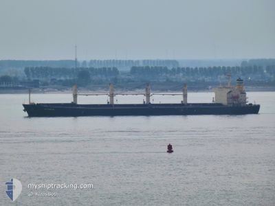
Bulk Carrier

Current Trip
| Trip Time | 12 days |
|---|---|
| Trip Distance | 722.48 nm |
| AVG Speed | 9.6 Knots |
| MAX Speed | 16.2 Knots |
| Dybgang | 6.5 m |
| AVG Wind | 8.8 knots |
| MAX Wind | 18.9 knots |
| MIN Temp | 4.6°C / 40.28°F |
| MAX Temp | 27.3°C / 81.14°F |
| Position Modtaget | 3 d siden |
Current Position
| Longitude | --- |
|---|---|
| Latitude | --- |
| Status | Under way using engine |
| Fart | 10.6 Knots |
| Kurs | 323.8° |
| Område | North Atlantic Ocean |
| Station | T-AIS |
| Position Modtaget | 3 d siden |
Information
The current position of APAGEON is in North Atlantic Ocean with coordinates 29.95245° / -90.14080° as reported on 2025-02-17 21:37 by AIS to our vessel tracker app. The vessel's current speed is 10.6 Knots and is currently inside the port of NEW ORLEANS.
The vessel APAGEON (IMO: 9278870, MMSI: 256334000) is a Bulk Carrier that was built in 2005 ( 20 år gamle ). It's sailing under the flag of [MT] Malta.
In this page you can find informations about the vessels current position, last detected port calls, and current voyage information. If the vessels is not in coverage by AIS you will find the latest position.
The current position of APAGEON is detected by our AIS receivers and we are not responsible for the reliability of the data. The last position was recorded while the vessel was in Coverage by the Ais receivers of our vessel tracking app.
The current draught of APAGEON as reported by AIS is 6.5 meters
Weather
| Temperature | 3°C / 37.4°F |
|---|---|
| Wind Speed | 15 knots |
| Direction | 39° NE |
| Pressure | 1031.8 hPa |
| Humidity | 53.3 % |
| Cloud Coverage | --- |


Featured Company
Last Port Calls
| Port | Arrival | Departure | Time In Port |
|---|---|---|---|
| 2025-02-17 16:27 | |||
| 2025-01-30 11:07 | 2025-02-04 17:07 | 5 d | |
| 2025-01-03 18:21 | 2025-01-06 12:00 | 2 d | |
| 2025-01-03 17:04 | |||
| 2025-01-03 16:58 | |||
| 2024-12-16 18:46 | 2024-12-20 07:08 | 3 d | |
| 2024-12-10 15:27 | 2024-12-11 20:27 | 1 d | |
| 2024-12-01 16:15 |
Most Visited Ports (Last year)
| Port | Arrivals | |
|---|---|---|
| 2 | ||
| 2 | ||
| 1 | ||
| 1 | ||
| 1 | ||
| 1 |
Last Trips
| Origin | Departure | Destination | Arrival | Distance | |
|---|---|---|---|---|---|
| 2025-02-04 17:07 | 2025-02-17 16:27 | 722.48 nm | |||
| 2025-01-06 12:00 | 2025-01-30 11:07 | 6924.62 nm | |||
| 2025-01-03 16:58 | 2025-01-03 18:21 | 12.35 nm | |||
| 2024-12-20 07:08 | 2025-01-03 17:04 | 2045.90 nm | |||
| 2024-12-11 20:27 | 2024-12-16 18:46 | 1408.24 nm | |||
| 2024-12-01 16:15 | 2024-12-10 15:27 | 751.35 nm |
Events
| Tid | Hændelsen | Detaljer | Position / Dest | Info |
|---|---|---|---|---|
| 2025-02-17 22:28 | STOP Sejllads |
29.93661 / -90.22040
[US] NEW ORLEANS
|
Fart: 0.3 kn Kurs: 350° |
|
| 2025-02-17 22:27 | Skibe i havn |
|
29.93661 / -90.22040
[US] NEW ORLEANS
|
Fart: 1.5 kn Kurs: 344° |
| 2025-02-17 21:43 | Status er ændret | Default Under way using engine |
29.95157 / -90.15807
US MSY
|
Fart: 10.6 kn Kurs: 323.8° |
| 2025-02-17 21:37 | Udenfor Dækning |
29.95245 / -90.14080
North Atlantic Ocean
[US] NEW ORLEANS
|
Fart: 10.6 kn Kurs: 323.8° |
|
| 2025-02-17 21:23 | Status er ændret | Under way using engine Default |
29.91120 / -90.13055
US MSY
|
Fart: 11 kn Kurs: 276° |
| 2025-02-17 21:11 | Status er ændret | Default Under way using engine |
29.91232 / -90.09261
US MSY
|
Fart: 9.8 kn Kurs: 244.4° |
| 2025-02-17 19:04 | Dybgangen er ændret | 6.5 6.3 |
29.83754 / -89.98781
US MSY
|
Fart: 11 kn Kurs: 33.4° |
| 2025-02-17 19:04 | ETA er ændret | 2025/02/12 06:00 2025/02/05 10:00 |
29.83754 / -89.98781
US MSY
|
Fart: 11 kn Kurs: 33.4° |
| 2025-02-17 18:39 | Status er ændret | Under way using engine Default |
29.77009 / -90.02191
US MSY
|
Fart: 10.1 kn Kurs: 353° |
| 2025-02-17 18:31 | Indenfor Dækning |
29.77282 / -90.02074
North Atlantic Ocean
|
Fart: 10.4 kn Kurs: 21.9° |