
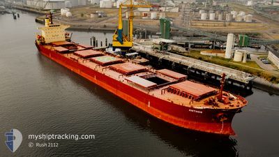
ANTHOS
Bulk Carrier
Current Trip
| Time Travelled | 4 days |
|---|---|
| Remaining Time | 17 h, 29 mins |
| Distance Travelled | 1296.32 nm |
| Remaining Distance | 312.39 nm |
| AVG Speed | 11.3 Knots |
| MAX Speed | 14.4 Knots |
| AVG Wind | 11.6 knots |
| MAX Wind | 26 knots |
| MIN Temp | 13.8°C / 56.84°F |
| MAX Temp | 26.4°C / 79.52°F |
| Dybgang | 7.1 m |
| Position Modtaget | 9 d siden |
Current Position
| Longitude | --- |
|---|---|
| Latitude | --- |
| Status | Under way using engine |
| Fart | 14.2 Knots |
| Kurs | 272.2° |
| Område | Rio de La Plata |
| Station | T-AIS |
| Position Modtaget | 9 d siden |
Info
Information
The current position of ANTHOS is in Rio de La Plata with coordinates -35.16786° / -56.77057° as reported on 2025-03-05 22:07 by AIS to our vessel tracker app. The vessel's current speed is 14.2 Knots and is heading at the port of PARANAGUA. The estimated time of arrival as calculated by MyShipTracking vessel tracking app is 2025-03-16 12:04 LT
The vessel ANTHOS (IMO: 9217656, MMSI: 538006247) is a Bulk Carrier that was built in 2001 ( 24 år gamle ). It's sailing under the flag of [MH] Marshall Is.
In this page you can find informations about the vessels current position, last detected port calls, and current voyage information. If the vessels is not in coverage by AIS you will find the latest position.
The current position of ANTHOS is detected by our AIS receivers and we are not responsible for the reliability of the data. The last position was recorded while the vessel was in Coverage by the Ais receivers of our vessel tracking app.
The current draught of ANTHOS as reported by AIS is 7.1 meters
Weather
| Temperature | 26.3°C / 79.34°F |
|---|---|
| Wind Speed | 12 knots |
| Direction | 190° S |
| Pressure | 1014.2 hPa |
| Humidity | 66.9 % |
| Cloud Coverage | 5 % |
Featured Company
Last Port Calls
| Port | Arrival | Departure | Time In Port |
|---|---|---|---|
| 2025-03-06 21:30 | 2025-03-10 22:42 | 4 d | |
| 2025-01-16 22:44 | 2025-01-26 10:24 | 9 d | |
| 2025-01-06 07:32 | 2025-01-06 16:37 | 9 h | |
| 2025-01-04 03:36 |
Most Visited Ports (Last year)
| Port | Arrivals | |
|---|---|---|
| 12 | ||
| 7 | ||
| 5 | ||
| 4 | ||
| 3 | ||
| 3 |
Last Trips
| Origin | Departure | Destination | Arrival | Distance | |
|---|---|---|---|---|---|
| 2025-01-26 10:24 | 2025-03-06 21:30 | 8595.08 nm | |||
| 2025-01-04 03:36 | 2025-01-16 22:44 | 3157.01 nm | |||
| 2025-01-04 03:36 | 2025-01-06 07:32 | 396.28 nm |
Events
| Tid | Hændelsen | Detaljer | Position / Dest | Info |
|---|---|---|---|---|
| 2025-03-12 02:46 | START Sejllads | 7.83 nm, North East of LA PLATA |
-34.74339 / -57.79413
BR PNG
|
Fart: 4.5 kn Kurs: 29° |
| 2025-03-11 23:10 | STOP Sejllads | 7.73 nm, North East of LA PLATA |
-34.74220 / -57.79993
BR PNG
|
Fart: 0.3 kn Kurs: 160° |
| 2025-03-11 01:42 | Afsejlet fra sidste havn |
|
-32.87528 / -60.68482
BR PNG
|
Fart: 9.9 kn Kurs: 172° |
| 2025-03-10 23:49 | START Sejllads |
-32.65214 / -60.73829
[AR] SAN LORENZO
|
Fart: 3.7 kn Kurs: 321° |
|
| 2025-03-07 08:33 | STOP Sejllads |
-32.65389 / -60.73650
[AR] SAN LORENZO
|
Fart: 0.2 kn Kurs: 311° |
|
| 2025-03-07 07:59 | START Sejllads |
-32.67271 / -60.71845
[AR] SAN LORENZO
|
Fart: 4.6 kn Kurs: 319° |
|
| 2025-03-07 00:42 | STOP Sejllads |
-32.67526 / -60.71273
[AR] SAN LORENZO
|
Fart: 0.1 kn Kurs: 336° |
|
| 2025-03-07 00:30 | Skibe i havn |
|
-32.67514 / -60.71455
[AR] SAN LORENZO
|
Fart: 3 kn Kurs: 341° |
| 2025-03-05 22:15 | Status er ændret | Default Under way using engine |
-35.16670 / -56.80557
BR PNG
|
Fart: 14.2 kn Kurs: 272.2° |
| 2025-03-05 22:07 | Udenfor Dækning |
-35.16786 / -56.77057
Rio de La Plata
|
Fart: 14.2 kn Kurs: 272.2° |