
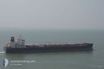
ANTARES
Tanker
Current Trip
| Time Travelled | 3 days |
|---|---|
| Remaining Time | 1 day |
| Distance Travelled | 868.72 nm |
| Remaining Distance | 496.61 nm |
| AVG Speed | 11.4 Knots |
| MAX Speed | 13.1 Knots |
| AVG Wind | 14.6 knots |
| MAX Wind | 28 knots |
| MIN Temp | 1.6°C / 34.88°F |
| MAX Temp | 17.5°C / 63.5°F |
| Dybgang | 7.5 m |
| Position Modtaget | 22 h, 54 m siden |
Current Position
| Longitude | --- |
|---|---|
| Latitude | --- |
| Status | Under way using engine |
| Fart | 11.9 Knots |
| Kurs | 114.2° |
| Område | Ionian Sea |
| Station | T-AIS |
| Position Modtaget | 22 h, 54 m siden |
Info
Information
The current position of ANTARES is in Ionian Sea with coordinates 37.05392° / 20.08861° as reported on 2026-01-03 17:22 by AIS to our vessel tracker app. The vessel's current speed is 11.9 Knots and is heading at the port of EL DEKHEILA. The estimated time of arrival as calculated by MyShipTracking vessel tracking app is 2026-01-06 04:45 LT
The vessel ANTARES (IMO: 9723019, MMSI: 311000231) is a Tanker It's sailing under the flag of [BS] Bahamas.
In this page you can find informations about the vessels current position, last detected port calls, and current voyage information. If the vessels is not in coverage by AIS you will find the latest position.
The current position of ANTARES is detected by our AIS receivers and we are not responsible for the reliability of the data. The last position was recorded while the vessel was in Coverage by the Ais receivers of our vessel tracking app.
The current draught of ANTARES as reported by AIS is 7.5 meters
Weather
| Temperature | 16.2°C / 61.16°F |
|---|---|
| Wind Speed | 17 knots |
| Direction | 159° SSE |
| Pressure | 1020 hPa |
| Humidity | 57.1 % |
| Cloud Coverage | 5 % |
Featured Company
Last Port Calls
| Port | Arrival | Departure | Time In Port |
|---|---|---|---|
| 2025-12-30 01:16 | 2026-01-01 07:39 | 2 d | |
| 2025-12-04 13:28 | 2025-12-06 10:09 | 1 d | |
| 2025-11-29 10:07 | 2025-12-01 06:45 | 1 d | |
| 2025-11-26 08:01 | 2025-11-28 07:33 | 1 d | |
| 2025-11-17 14:05 | 2025-11-21 07:37 | 3 d | |
| 2025-11-11 11:02 | 2025-11-12 19:52 | 1 d |
Most Visited Ports (Last year)
| Port | Arrivals | |
|---|---|---|
| 9 | ||
| 4 | ||
| 3 | ||
| 3 | ||
| 3 | ||
| 2 |
Last Trips
| Origin | Departure | Destination | Arrival | Distance | |
|---|---|---|---|---|---|
| 2025-12-06 10:09 | 2025-12-30 01:16 | 2251.40 nm | |||
| 2025-12-01 06:45 | 2025-12-04 13:28 | 735.57 nm | |||
| 2025-11-28 07:33 | 2025-11-29 10:07 | 341.92 nm | |||
| 2025-11-21 07:37 | 2025-11-26 08:01 | 18.26 nm | |||
| 2025-11-12 19:52 | 2025-11-17 14:05 | 818.27 nm | |||
| 2025-10-20 10:40 | 2025-11-11 11:02 | 2525.33 nm |
Events
| Tid | Hændelsen | Detaljer | Position / Dest | Info |
|---|---|---|---|---|
| 2026-01-03 17:22 | Udenfor Dækning |
37.05392 / 20.08861
Ionian Sea
EG EDK
|
Fart: 11.9 kn Kurs: 114.2° |
|
| 2026-01-03 17:19 | Indenfor Dækning |
37.05392 / 20.08861
Ionian Sea
EG EDK
|
Fart: 11.9 kn Kurs: 114.2° |
|
| 2026-01-03 15:46 | Udenfor Dækning |
37.20646 / 19.83156
Ionian Sea
EG EDK
|
Fart: 10.8 kn Kurs: 190.6° |
|
| 2026-01-03 15:46 | Status er ændret | Under way using engine Default |
37.20646 / 19.83156
EG EDK
|
Fart: 10.3 kn Kurs: 197° |
| 2026-01-03 15:43 | Indenfor Dækning |
37.20646 / 19.83156
Ionian Sea
EG EDK
|
Fart: 10.8 kn Kurs: 190.6° |
|
| 2026-01-03 13:06 | Status er ændret | Default Under way using engine |
37.57643 / 19.84749
EG EDK
|
Fart: 12.5 kn Kurs: 97.7° |
| 2026-01-03 12:54 | Status er ændret | Under way using engine Default |
37.58122 / 19.79566
EG EDK
|
Fart: 12.1 kn Kurs: 98° |
| 2026-01-03 12:54 | Udenfor Dækning |
37.58122 / 19.79566
Ionian Sea
EG EDK
|
Fart: 12.5 kn Kurs: 97.7° |
|
| 2026-01-03 12:21 | Status er ændret | Default Under way using engine |
37.59835 / 19.65335
EG EDK
|
Fart: 12.2 kn Kurs: 100.8° |
| 2026-01-03 12:10 | Status er ændret | Under way using engine Default |
37.60358 / 19.60841
EG EDK
|
Fart: 9.9 kn Kurs: 191° |