
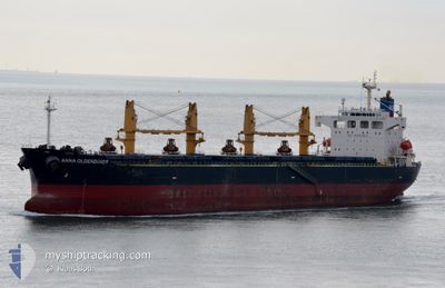
ANNA OLDENDORFF
Bulk Carrier
Current Trip
| Time Travelled | 4 days |
|---|---|
| Remaining Time | --- |
| Distance Travelled | 225.39 nm |
| Remaining Distance | --- |
| AVG Speed | 8.6 Knots |
| MAX Speed | 10.3 Knots |
| AVG Wind | 9.7 knots |
| MAX Wind | 14 knots |
| MIN Temp | 32°C / 89.6°F |
| MAX Temp | 38.1°C / 100.58°F |
| Dybgang | 7.5 m |
| Position Modtaget | 7 h, 42 m siden |
Current Position
| Longitude | 49.94157° |
|---|---|
| Latitude | 27.26733° |
| Status | At anchor |
| Fart | |
| Kurs | 306° |
| Område | Persian Gulf |
| Station | T-AIS |
| Position Modtaget | 7 h, 42 m siden |
Info
Information
The current position of ANNA OLDENDORFF is in Persian Gulf with coordinates 27.26733° / 49.94157° as reported on 2024-07-12 11:07 by AIS to our vessel tracker app. The vessel's current speed is 0 Knots
The vessel ANNA OLDENDORFF (IMO: 9342889, MMSI: 636092685) is a Bulk Carrier that was built in 2006 ( 18 år gamle ). It's sailing under the flag of [LR] Liberia.
In this page you can find informations about the vessels current position, last detected port calls, and current voyage information. If the vessels is not in coverage by AIS you will find the latest position.
The current position of ANNA OLDENDORFF is detected by our AIS receivers and we are not responsible for the reliability of the data. The last position was recorded while the vessel was in Coverage by the Ais receivers of our vessel tracking app.
The current draught of ANNA OLDENDORFF as reported by AIS is 7.5 meters
Weather
| Temperature | 36.2°C / 97.16°F |
|---|---|
| Wind Speed | 6 knots |
| Direction | 277° W |
| Pressure | 993.9 hPa |
| Humidity | 44.3 % |
| Cloud Coverage | 90 % |
Featured Company
Last Port Calls
| Port | Arrival | Departure | Time In Port |
|---|---|---|---|
| 2024-07-06 20:06 | 2024-07-08 14:44 | 1 d | |
| 2024-06-24 20:18 | 2024-06-28 00:09 | 3 d | |
| 2024-06-20 07:34 | 2024-06-22 16:41 | 2 d | |
| 2024-06-11 13:49 | 2024-06-13 18:13 | 2 d | |
| 2024-06-05 05:25 | 2024-06-07 17:15 | 2 d | |
| 2024-05-25 16:29 | 2024-05-27 23:01 | 2 d | |
| 2024-05-18 07:53 | 2024-05-20 10:40 | 2 d | |
| 2024-05-14 11:44 | 2024-05-17 14:03 | 3 d | |
| 2024-05-01 20:48 | 2024-05-03 13:50 | 1 d |
Most Visited Ports (Last year)
| Port | Arrivals | |
|---|---|---|
| 27 | ||
| 7 | ||
| 4 | ||
| 1 |
Last Trips
| Origin | Departure | Destination | Arrival | Distance | |
|---|---|---|---|---|---|
| 2024-06-28 03:09 | 2024-07-06 23:06 | 239.87 nm | |||
| 2024-06-22 19:41 | 2024-06-24 23:18 | 160.85 nm | |||
| 2024-06-13 21:13 | 2024-06-20 10:34 | 164.50 nm | |||
| 2024-06-07 20:15 | 2024-06-11 16:49 | 162.55 nm | |||
| 2024-05-28 02:01 | 2024-06-05 08:25 | 160.82 nm | |||
| 2024-05-20 13:40 | 2024-05-25 19:29 | 121.71 nm | |||
| 2024-05-17 17:03 | 2024-05-18 10:53 | 138.93 nm | |||
| 2024-05-03 16:50 | 2024-05-14 14:44 | 175.85 nm | |||
| 2024-04-27 12:03 | 2024-05-01 23:48 | 121.09 nm |
Events
| Tid | Hændelsen | Detaljer | Position / Dest | Info |
|---|---|---|---|---|
| 2024-07-12 11:10 | Status er ændret | Default At anchor |
27.26733 / 49.94157
JUBAIL OPL
|
Fart: Kurs: 306° |
| 2024-07-12 11:07 | Status er ændret | At anchor Default |
27.26733 / 49.94157
JUBAIL OPL
|
Fart: Kurs: 308° |
| 2024-07-12 11:07 | Udenfor Dækning |
27.26733 / 49.94157
Persian Gulf
|
Fart: Kurs: 274° |
|
| 2024-07-12 10:49 | Indenfor Dækning |
27.26733 / 49.94157
Persian Gulf
|
Fart: Kurs: 274° |
|
| 2024-07-10 20:35 | Status er ændret | Default At anchor |
27.26910 / 49.93687
JUBAIL OPL
|
Fart: Kurs: 70° |
| 2024-07-10 20:28 | Status er ændret | At anchor Default |
27.26900 / 49.93683
JUBAIL OPL
|
Fart: 0.1 kn Kurs: 63° |
| 2024-07-10 20:28 | Indenfor Dækning |
27.26900 / 49.93683
Persian Gulf
|
Fart: Kurs: 322° |
|
| 2024-07-10 20:28 | Udenfor Dækning |
27.26900 / 49.93683
Persian Gulf
|
Fart: Kurs: 322° |
|
| 2024-07-10 17:05 | STOP Sejllads | 16.28 nm, North East of AL JUBAIL |
27.26780 / 49.94068
JUBAIL OPL
|
Fart: 0.3 kn Kurs: 303° |
| 2024-07-10 16:49 | Udenfor Dækning |
27.27302 / 49.94607
Persian Gulf
|
Fart: 4.8 kn Kurs: 231° |