
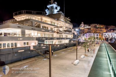
ANDROMEDA
Pleasure Craft
Current Trip
| Time Travelled | 2 days |
|---|---|
| Remaining Time | --- |
| Distance Travelled | 450.91 nm |
| Remaining Distance | --- |
| AVG Speed | 9.9 Knots |
| MAX Speed | 12.6 Knots |
| AVG Wind | 8.5 knots |
| MAX Wind | 19 knots |
| MIN Temp | 20.3°C / 68.54°F |
| MAX Temp | 27°C / 80.6°F |
| Dybgang | 5.1 m |
| Position Modtaget | 8 h, 30 m siden |
Current Position
| Longitude | -77.50097° |
|---|---|
| Latitude | 25.82392° |
| Status | Under way using engine |
| Fart | 12.6 Knots |
| Kurs | 108.9° |
| Område | North Atlantic Ocean |
| Station | T-AIS |
| Position Modtaget | 8 h, 30 m siden |
Info
Information
The current position of ANDROMEDA is in North Atlantic Ocean with coordinates 25.82392° / -77.50097° as reported on 2024-05-15 15:01 by AIS to our vessel tracker app. The vessel's current speed is 12.6 Knots
The vessel ANDROMEDA (IMO: 9692545, MMSI: 319879000) is a Pleasure Craft It's sailing under the flag of [KY] Cayman Is.
In this page you can find informations about the vessels current position, last detected port calls, and current voyage information. If the vessels is not in coverage by AIS you will find the latest position.
The current position of ANDROMEDA is detected by our AIS receivers and we are not responsible for the reliability of the data. The last position was recorded while the vessel was in Coverage by the Ais receivers of our vessel tracking app.
The current draught of ANDROMEDA as reported by AIS is 5.1 meters
Weather
| Temperature | 26.6°C / 79.88°F |
|---|---|
| Wind Speed | 11 knots |
| Direction | 200° SSW |
| Pressure | 1015.4 hPa |
| Humidity | 87.2 % |
| Cloud Coverage | --- |
Featured Company
Most Visited Ports (Last year)
| Port | Arrivals | |
|---|---|---|
| 3 | ||
| 1 |
Last Trips
| Origin | Departure | Destination | Arrival | Distance |
|---|
Events
| Tid | Hændelsen | Detaljer | Position / Dest | Info |
|---|---|---|---|---|
| 2024-05-15 15:01 | Udenfor Dækning |
25.82392 / -77.50097
North Atlantic Ocean
US SAV > PA CTB
|
Fart: 12.6 kn Kurs: 108.9° |
|
| 2024-05-15 14:13 | Indenfor Dækning |
25.87377 / -77.67271
North Atlantic Ocean
US SAV > PA CTB
|
Fart: 12 kn Kurs: 106.9° |
|
| 2024-05-15 07:36 | Udenfor Dækning |
26.27893 / -78.48596
North Atlantic Ocean
US SAV > PA CTB
|
Fart: 11 kn Kurs: 115° |
|
| 2024-05-15 06:09 | Indenfor Dækning |
26.40617 / -78.77356
North Atlantic Ocean
US SAV > PA CTB
|
Fart: 12 kn Kurs: 127° |
|
| 2024-05-15 04:42 | Udenfor Dækning |
26.54339 / -79.08404
North Atlantic Ocean
US SAV > PA CTB
|
Fart: 12 kn Kurs: 118° |
|
| 2024-05-15 04:42 | Fundet i havområde | Bahamas part of the North Atlantic Ocean |
26.54339 / -79.08404
North Atlantic Ocean
US SAV > PA CTB
|
Fart: 12 kn Kurs: 118° |
| 2024-05-15 04:42 | Indenfor Dækning |
26.54339 / -79.08404
North Atlantic Ocean
US SAV > PA CTB
|
Fart: 12 kn Kurs: 118° |
|
| 2024-05-13 20:02 | Udenfor Dækning |
31.98727 / -80.76938
North Atlantic Ocean
US SAV > PA CTB
|
Fart: 12.5 kn Kurs: 119.3° |
|
| 2024-05-13 18:20 | Afsejlet fra sidste havn |
|
32.08039 / -81.05122
US SAV > PA CTB
|
Fart: 10.1 kn Kurs: 89° |
| 2024-05-13 17:58 | Status er ændret | Under way using engine Moored |
32.09517 / -81.10693
[US] SAVANNAH
|
Fart: 3.2 kn Kurs: 127° |