
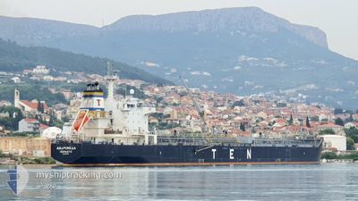
ANDROMEDA
Oil/Chemical Tanker
Current Trip
| Time Travelled | 4 days |
|---|---|
| Remaining Time | --- |
| Distance Travelled | 906.13 nm |
| Remaining Distance | --- |
| AVG Speed | 11.3 Knots |
| MAX Speed | 14.5 Knots |
| AVG Wind | 10 knots |
| MAX Wind | 27 knots |
| MIN Temp | 11.9°C / 53.42°F |
| MAX Temp | 18.9°C / 66.02°F |
| Dybgang | 7.8 m |
| Position Modtaget | 11 m siden |
Current Position
| Longitude | --- |
|---|---|
| Latitude | --- |
| Status | At anchor |
| Fart | |
| Kurs | 253° |
| Område | Aegean Sea |
| Station | T-AIS |
| Position Modtaget | 11 m siden |
Info
Information
The current position of ANDROMEDA is in Aegean Sea with coordinates 38.81017° / 26.87515° as reported on 2024-12-19 12:57 by AIS to our vessel tracker app. The vessel's current speed is 0 Knots
The vessel ANDROMEDA (IMO: 9315795, MMSI: 240597000) is a Oil/Chemical Tanker that was built in 2007 ( 17 år gamle ). It's sailing under the flag of [GR] Greece.
In this page you can find informations about the vessels current position, last detected port calls, and current voyage information. If the vessels is not in coverage by AIS you will find the latest position.
The current position of ANDROMEDA is detected by our AIS receivers and we are not responsible for the reliability of the data. The last position was recorded while the vessel was in Coverage by the Ais receivers of our vessel tracking app.
The current draught of ANDROMEDA as reported by AIS is 7.8 meters
Weather
| Temperature | 15.1°C / 59.18°F |
|---|---|
| Wind Speed | 1 knots |
| Direction | 291° WNW |
| Pressure | 1016.2 hPa |
| Humidity | 49.7 % |
| Cloud Coverage | 98 % |
Featured Company
Last Port Calls
| Port | Arrival | Departure | Time In Port |
|---|---|---|---|
| 2024-11-30 09:33 | 2024-12-14 15:58 | 14 d | |
| 2024-11-17 14:45 | 2024-11-18 23:45 | 1 d | |
| 2024-11-05 14:03 | 2024-11-07 09:42 | 1 d | |
| 2024-10-31 15:36 | 2024-11-02 14:26 | 1 d | |
| 2024-10-22 04:38 | 2024-10-25 22:51 | 3 d | |
| 2024-10-16 06:36 | 2024-10-18 12:09 | 2 d | |
| 2024-10-03 10:28 |
Last Trips
| Origin | Departure | Destination | Arrival | Distance | |
|---|---|---|---|---|---|
| 2024-11-19 00:45 | 2024-11-30 11:33 | 941.87 nm | |||
| 2024-11-07 10:42 | 2024-11-17 15:45 | 490.31 nm | |||
| 2024-11-02 15:26 | 2024-11-05 15:03 | 391.35 nm | |||
| 2024-10-26 00:51 | 2024-10-31 16:36 | 380.77 nm | |||
| 2024-10-18 15:09 | 2024-10-22 06:38 | 944.79 nm | |||
| 2024-10-03 12:28 | 2024-10-16 09:36 | 1388.03 nm |
Events
| Tid | Hændelsen | Detaljer | Position / Dest | Info |
|---|---|---|---|---|
| 2024-12-19 13:03 | Status er ændret | Default At anchor |
38.81007 / 26.87525
TR ALI
|
Fart: Kurs: 253° |
| 2024-12-19 12:45 | Status er ændret | At anchor Default |
38.81043 / 26.87498
TR ALI
|
Fart: Kurs: 237° |
| 2024-12-19 12:39 | Status er ændret | Default At anchor |
38.81057 / 26.87492
TR ALI
|
Fart: Kurs: 230° |
| 2024-12-19 12:27 | Status er ændret | At anchor Default |
38.81078 / 26.87470
TR ALI
|
Fart: Kurs: 221° |
| 2024-12-19 12:12 | Status er ændret | Default At anchor |
38.81092 / 26.87422
TR ALI
|
Fart: 0.1 kn Kurs: 199° |
| 2024-12-19 12:03 | Status er ændret | At anchor Default |
38.81100 / 26.87390
TR ALI
|
Fart: Kurs: 193° |
| 2024-12-19 11:54 | Status er ændret | Default At anchor |
38.81110 / 26.87363
TR ALI
|
Fart: Kurs: 187° |
| 2024-12-19 11:51 | Status er ændret | At anchor Default |
38.81113 / 26.87357
TR ALI
|
Fart: Kurs: 180° |
| 2024-12-19 11:44 | Status er ændret | Default At anchor |
38.81115 / 26.87332
TR ALI
|
Fart: Kurs: 174° |
| 2024-12-19 11:30 | Status er ændret | At anchor Default |
38.81108 / 26.87312
TR ALI
|
Fart: Kurs: 168° |