
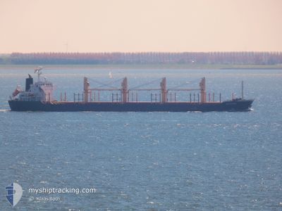
AMYNTOR
Bulk Carrier
Current Trip
| Time Travelled | 7 days |
|---|---|
| Remaining Time | 4 days |
| Distance Travelled | 1965.89 nm |
| Remaining Distance | 1274.56 nm |
| AVG Speed | 11.3 Knots |
| MAX Speed | 15 Knots |
| AVG Wind | 12.6 knots |
| MAX Wind | 27.8 knots |
| MIN Temp | 13.4°C / 56.12°F |
| MAX Temp | 21.9°C / 71.42°F |
| Dybgang | 8.4 m |
| Position Modtaget | 4 d siden |
Current Position
| Longitude | 17.27002° |
|---|---|
| Latitude | -32.86950° |
| Status | Under way using engine |
| Fart | 11.7 Knots |
| Kurs | 345° |
| Område | South Atlantic Ocean |
| Station | T-AIS |
| Position Modtaget | 4 d siden |
Info
Information
The current position of AMYNTOR is in South Atlantic Ocean with coordinates -32.86950° / 17.27002° as reported on 2024-05-28 08:22 by AIS to our vessel tracker app. The vessel's current speed is 11.7 Knots and is heading at the port of DOUALA. The estimated time of arrival as calculated by MyShipTracking vessel tracking app is 2024-06-06 08:43 LT
The vessel AMYNTOR (IMO: 9515656, MMSI: 538003620) is a Bulk Carrier that was built in 2009 ( 15 år gamle ). It's sailing under the flag of [MH] Marshall Is.
In this page you can find informations about the vessels current position, last detected port calls, and current voyage information. If the vessels is not in coverage by AIS you will find the latest position.
The current position of AMYNTOR is detected by our AIS receivers and we are not responsible for the reliability of the data. The last position was recorded while the vessel was in Coverage by the Ais receivers of our vessel tracking app.
The current draught of AMYNTOR as reported by AIS is 8.4 meters
Weather
| Temperature | 19.7°C / 67.46°F |
|---|---|
| Wind Speed | 19 knots |
| Direction | 177° S |
| Pressure | 1017.7 hPa |
| Humidity | 75.2 % |
| Cloud Coverage | 99 % |
Featured Company
Last Port Calls
| Port | Arrival | Departure | Time In Port |
|---|---|---|---|
| 2024-05-16 22:59 | 2024-05-25 04:23 | 8 d | |
| 2024-05-03 07:20 | 2024-05-10 08:47 | 7 d |
Most Visited Ports (Last year)
| Port | Arrivals | |
|---|---|---|
| 3 | ||
| 2 | ||
| 1 | ||
| 1 | ||
| 1 | ||
| 1 |
Last Trips
| Origin | Departure | Destination | Arrival | Distance | |
|---|---|---|---|---|---|
| 2024-05-10 08:47 | 2024-05-16 22:59 | 1601.08 nm | |||
| 2024-03-30 09:00 | 2024-05-03 07:20 | 1283.99 nm |
Events
| Tid | Hændelsen | Detaljer | Position / Dest | Info |
|---|---|---|---|---|
| 2024-05-28 08:28 | Status er ændret | Default Under way using engine |
-32.84767 / 17.26335
CM DLA
|
Fart: 11.7 kn Kurs: 345° |
| 2024-05-28 08:22 | Udenfor Dækning |
-32.86950 / 17.27002
South Atlantic Ocean
CM DLA
|
Fart: 11.7 kn Kurs: 345° |
|
| 2024-05-28 08:10 | Status er ændret | Under way using engine Default |
-32.90792 / 17.28122
CM DLA
|
Fart: 11.8 kn Kurs: 349° |
| 2024-05-28 07:57 | Status er ændret | Default Under way using engine |
-32.95028 / 17.29250
CM DLA
|
Fart: 11.9 kn Kurs: 346° |
| 2024-05-28 07:48 | Status er ændret | Under way using engine Default |
-32.97873 / 17.30012
CM DLA
|
Fart: 11.9 kn Kurs: 346° |
| 2024-05-28 07:36 | Status er ændret | Default Under way using engine |
-33.01534 / 17.30942
CM DLA
|
Fart: 11.9 kn Kurs: 350° |
| 2024-05-28 06:39 | ETA er ændret | 2024/06/06 02:00 2024/06/06 07:00 |
-33.19658 / 17.35912
CM DLA
|
Fart: 11.5 kn Kurs: 348° |
| 2024-05-28 04:57 | Status er ændret | Under way using engine Default |
-33.50167 / 17.47567
CM DLA
|
Fart: 11.3 kn Kurs: 339° |
| 2024-05-28 04:44 | Status er ændret | Default Under way using engine |
-33.54015 / 17.49282
CM DLA
|
Fart: 11.1 kn Kurs: 339° |
| 2024-05-28 00:03 | Status er ændret | Under way using engine Default |
-34.31903 / 18.04740
CM DLA
|
Fart: 12.2 kn Kurs: 298° |