
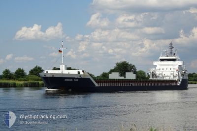
AMBER SKY
General Cargo
Current Trip
RUVYG
| Time Travelled | 1 day |
|---|---|
| Remaining Time | --- |
| Distance Travelled | 684.63 nm |
| Remaining Distance | --- |
| AVG Speed | 15.5 Knots |
| MAX Speed | 15.5 Knots |
| AVG Wind | 12.1 knots |
| MAX Wind | 22 knots |
| MIN Temp | 0.4°C / 32.72°F |
| MAX Temp | 4.3°C / 39.74°F |
| Dybgang | 4.5 m |
| Position Modtaget | 3 h, 41 m siden |
Current Position
| Longitude | --- |
|---|---|
| Latitude | --- |
| Status | Under way using engine |
| Fart | 11.9 Knots |
| Kurs | 74.3° |
| Område | Gulf of Finland |
| Station | T-AIS |
| Position Modtaget | 3 h, 41 m siden |
Info
Information
The current position of AMBER SKY is in Gulf of Finland with coordinates 59.97721° / 26.55085° as reported on 2026-03-23 13:29 by AIS to our vessel tracker app. The vessel's current speed is 11.9 Knots
The vessel AMBER SKY (IMO: 9312688, MMSI: 255806387) is a General Cargo that was built in 2005 ( 21 år gamle ). It's sailing under the flag of [PT] Portugal.
In this page you can find informations about the vessels current position, last detected port calls, and current voyage information. If the vessels is not in coverage by AIS you will find the latest position.
The current position of AMBER SKY is detected by our AIS receivers and we are not responsible for the reliability of the data. The last position was recorded while the vessel was in Coverage by the Ais receivers of our vessel tracking app.
The current draught of AMBER SKY as reported by AIS is 4.5 meters
Weather
| Temperature | 1.6°C / 34.88°F |
|---|---|
| Wind Speed | 10 knots |
| Direction | 221° SW |
| Pressure | 1009.8 hPa |
| Humidity | 78.5 % |
| Cloud Coverage | 78 % |
Featured Company
Last Port Calls
| Port | Arrival | Departure | Time In Port |
|---|---|---|---|
| 2026-03-21 07:11 | 2026-03-21 23:30 | 16 h | |
| 2026-03-18 16:01 | 2026-03-19 00:14 | 8 h | |
| 2026-03-14 15:25 | 2026-03-15 13:57 | 22 h | |
| 2026-03-10 16:46 | 2026-03-12 00:46 | 1 d | |
| 2026-03-08 12:21 | |||
| 2026-02-27 15:47 | 2026-03-02 23:45 | 3 d | |
| 2026-02-24 14:49 | |||
| 2026-02-24 13:38 | |||
| 2026-02-24 13:08 | |||
| 2026-02-22 13:17 |
Last Trips
| Origin | Departure | Destination | Arrival | Distance | |
|---|---|---|---|---|---|
| 2026-03-19 00:14 | 2026-03-21 07:11 | 600.02 nm | |||
| 2026-03-15 13:57 | 2026-03-18 16:01 | 58.91 nm | |||
| 2026-03-12 00:46 | 2026-03-14 15:25 | 552.33 nm | |||
| 2026-03-08 12:21 | 2026-03-10 16:46 | 504.54 nm | |||
| 2026-02-24 13:08 | 2026-02-27 15:47 | 549.61 nm | |||
| 2026-02-24 13:38 | 2026-02-24 14:49 | 7.50 nm | |||
| 2026-02-22 12:18 | 2026-02-22 13:17 | 6.09 nm | |||
| 2026-02-19 21:04 | 2026-02-22 12:07 | 547.42 nm | |||
| 2026-02-14 15:54 | 2026-02-17 04:26 | 543.97 nm | |||
| 2026-02-14 14:53 | 2026-02-14 15:45 | 6.98 nm |
Events
| Tid | Hændelsen | Detaljer | Position / Dest | Info |
|---|---|---|---|---|
| 2026-03-23 13:37 | Status er ændret | Default Under way using engine |
59.98493 / 26.60482
RUVYG
|
Fart: 11.9 kn Kurs: 74.3° |
| 2026-03-23 13:29 | Status er ændret | Under way using engine Default |
59.97721 / 26.55085
RUVYG
|
Fart: 11.8 kn Kurs: 73° |
| 2026-03-23 13:29 | Udenfor Dækning |
59.97721 / 26.55085
Gulf of Finland
|
Fart: 11.9 kn Kurs: 74.3° |
|
| 2026-03-23 13:22 | Status er ændret | Default Under way using engine |
59.97042 / 26.50421
RUVYG
|
Fart: 12 kn Kurs: 74° |
| 2026-03-23 13:07 | Fundet i havområde | Russian part of the Gulf of Finland |
59.95687 / 26.41018
Gulf of Finland
|
Fart: 12 kn Kurs: 74.4° |
| 2026-03-23 12:07 | Fundet i havområde | Estonian part of the Gulf of Finland |
59.90154 / 26.02969
Gulf of Finland
|
Fart: 12.2 kn Kurs: 73.4° |
| 2026-03-23 11:34 | Ændre havområde | Finnish part of the Gulf of Finland Estonian part of the Gulf of Finland |
59.86904 / 25.81943
Gulf of Finland
|
Fart: 12 kn Kurs: 73.2° |
| 2026-03-23 07:56 | Status er ændret | Under way using engine Default |
59.70778 / 24.39307
RUVYG
|
Fart: 12.2 kn Kurs: 77° |
| 2026-03-23 07:53 | Status er ændret | Default Under way using engine |
59.70583 / 24.37549
RUVYG
|
Fart: 12.1 kn Kurs: 77.6° |
| 2026-03-23 07:44 | Status er ændret | Under way using engine Default |
59.69840 / 24.31177
RUVYG
|
Fart: 12 kn Kurs: 74° |