
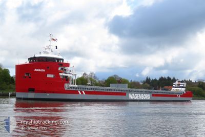
AMALIA
Cargo
Current Trip
| Time Travelled | 11 days |
|---|---|
| Remaining Time | --- |
| Distance Travelled | 1373.15 nm |
| Remaining Distance | 3.65 nm |
| AVG Speed | 9 Knots |
| MAX Speed | 15 Knots |
| AVG Wind | 14.1 knots |
| MAX Wind | 24 knots |
| MIN Temp | -0.8°C / 30.56°F |
| MAX Temp | 8°C / 46.4°F |
| Dybgang | 6.7 m |
| Position Modtaget | 3 m siden |
Current Position
| Longitude | --- |
|---|---|
| Latitude | --- |
| Status | At anchor |
| Fart | 0.1 Knots |
| Kurs | 341° |
| Område | Kattegat |
| Station | T-AIS |
| Position Modtaget | 3 m siden |
Info
Information
The current position of AMALIA is in Kattegat with coordinates 55.75387° / 12.71492° as reported on 2025-03-26 07:24 by AIS to our vessel tracker app. The vessel's current speed is 0.1 Knots and is heading at the port of COPENHAGEN. The estimated time of arrival as calculated by MyShipTracking vessel tracking app is 2025-03-22 10:00 LT
The vessel AMALIA (IMO: 9973327, MMSI: 245230000) is a Cargo It's sailing under the flag of [NL] Netherlands.
In this page you can find informations about the vessels current position, last detected port calls, and current voyage information. If the vessels is not in coverage by AIS you will find the latest position.
The current position of AMALIA is detected by our AIS receivers and we are not responsible for the reliability of the data. The last position was recorded while the vessel was in Coverage by the Ais receivers of our vessel tracking app.
The current draught of AMALIA as reported by AIS is 6.7 meters
Weather
| Temperature | 5.6°C / 42.08°F |
|---|---|
| Wind Speed | 12 knots |
| Direction | 300° WNW |
| Pressure | 1014.1 hPa |
| Humidity | 86.8 % |
| Cloud Coverage | 13 % |
Featured Company
Last Port Calls
| Port | Arrival | Departure | Time In Port |
|---|---|---|---|
| 2025-03-12 20:57 | 2025-03-14 19:00 | 1 d | |
| 2025-03-11 09:55 | 2025-03-12 20:18 | 1 d | |
| 2025-02-24 14:10 | |||
| 2025-02-15 00:41 | 2025-02-16 12:23 | 1 d | |
| 2025-01-18 06:14 | 2025-01-19 08:58 | 1 d | |
| 2025-01-04 16:54 | 2025-01-08 04:33 | 3 d |
Most Visited Ports (Last year)
| Port | Arrivals | |
|---|---|---|
| 5 | ||
| 4 | ||
| 3 | ||
| 3 | ||
| 2 | ||
| 1 |
Last Trips
| Origin | Departure | Destination | Arrival | Distance | |
|---|---|---|---|---|---|
| 2025-03-12 21:18 | 2025-03-12 21:57 | 2.00 nm | |||
| 2025-02-24 15:10 | 2025-03-11 10:55 | 2516.74 nm | |||
| 2025-01-19 09:58 | 2025-02-15 01:41 | 1991.13 nm | |||
| 2025-01-08 05:33 | 2025-01-18 07:14 | 2003.04 nm | |||
| 2024-12-24 22:21 | 2025-01-04 17:54 | 988.03 nm |
Events
| Tid | Hændelsen | Detaljer | Position / Dest | Info |
|---|---|---|---|---|
| 2025-03-22 08:42 | STOP Sejllads | 4.97 nm, North East of COPENHAGEN |
55.75434 / 12.71428
DKCPH
|
Fart: 0.2 kn Kurs: 89° |
| 2025-03-22 08:36 | Status er ændret | At anchor Under way using engine |
55.75404 / 12.71534
DKCPH
|
Fart: 0.7 kn Kurs: 78° |
| 2025-03-22 06:46 | Ændre havområde | Danish part of the Kattegat Swedish part of the Kattegat |
55.49369 / 12.71528
Kattegat
DKCPH
|
Fart: 9.9 kn Kurs: 6.7° |
| 2025-03-22 05:38 | Ændre havområde | Swedish part of the Kattegat Swedish part of the Baltic Sea |
55.33910 / 12.67669
Kattegat
DKCPH
|
Fart: 7.4 kn Kurs: 8.5° |
| 2025-03-21 20:56 | Fundet i havområde | Swedish part of the Baltic Sea |
55.48008 / 14.71658
Baltic Sea
DKCPH
|
Fart: 9.1 kn Kurs: 241.8° |
| 2025-03-21 18:47 | Ændre havområde | Danish part of the Kattegat Swedish part of the Baltic Sea |
55.64653 / 15.22866
Kattegat
DKCPH
|
Fart: 10.1 kn Kurs: 239.3° |
| 2025-03-21 12:05 | Status er ændret | Under way using engine Default |
56.23642 / 16.97607
DKCPH
|
Fart: 9.9 kn Kurs: 232° |
| 2025-03-21 11:34 | Status er ændret | Default Under way using engine |
56.28941 / 17.09944
DKCPH
|
Fart: 10 kn Kurs: 233.2° |
| 2025-03-21 11:25 | Status er ændret | Under way using engine Default |
56.30337 / 17.13227
DKCPH
|
Fart: 10 kn Kurs: 234° |
| 2025-03-21 11:02 | Status er ændret | Default Under way using engine |
56.34259 / 17.22568
DKCPH
|
Fart: 9.9 kn Kurs: 232.2° |