
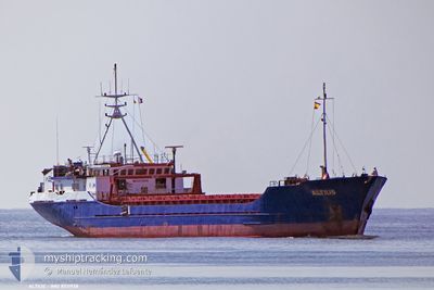
ALTIUS
General Cargo
Current Trip
ORDER
| Time Travelled | 1 day |
|---|---|
| Remaining Time | --- |
| Distance Travelled | 10.17 nm |
| Remaining Distance | --- |
| AVG Speed | 9.3 Knots |
| MAX Speed | 9.4 Knots |
| AVG Wind | 10.4 knots |
| MAX Wind | 20 knots |
| MIN Temp | 13.1°C / 55.58°F |
| MAX Temp | 19.2°C / 66.56°F |
| Dybgang | 2.5 m |
| Position Modtaget | 11 h, 24 m siden |
Current Position
| Longitude | --- |
|---|---|
| Latitude | --- |
| Status | At anchor |
| Fart | 0.3 Knots |
| Kurs | 199° |
| Område | Aegean Sea |
| Station | T-AIS |
| Position Modtaget | 11 h, 24 m siden |
Information
The current position of ALTIUS is in Aegean Sea with coordinates 39.23514° / 26.66447° as reported on 2025-03-13 00:53 by AIS to our vessel tracker app. The vessel's current speed is 0.3 Knots
The vessel ALTIUS (IMO: 8511938, MMSI: 577249000) is a General Cargo that was built in 1985 ( 40 år gamle ). It's sailing under the flag of [VU] Vanuatu.
In this page you can find informations about the vessels current position, last detected port calls, and current voyage information. If the vessels is not in coverage by AIS you will find the latest position.
The current position of ALTIUS is detected by our AIS receivers and we are not responsible for the reliability of the data. The last position was recorded while the vessel was in Coverage by the Ais receivers of our vessel tracking app.
The current draught of ALTIUS as reported by AIS is 2.5 meters
Weather
| Temperature | 19.8°C / 67.64°F |
|---|---|
| Wind Speed | 24 knots |
| Direction | 176° S |
| Pressure | 1011.9 hPa |
| Humidity | 46.6 % |
| Cloud Coverage | 83 % |
Featured Company
Last Port Calls
| Port | Arrival | Departure | Time In Port |
|---|---|---|---|
| 2025-03-11 05:10 | 2025-03-11 18:06 | 12 h | |
| 2025-03-09 05:15 | 2025-03-09 16:51 | 11 h | |
| 2025-03-06 11:41 | 2025-03-07 09:05 | 21 h | |
| 2025-03-04 05:19 | 2025-03-05 13:56 | 1 d | |
| 2025-03-02 10:29 | 2025-03-03 07:57 | 21 h | |
| 2025-02-27 15:56 | 2025-02-28 22:01 | 1 d | |
| 2025-02-17 04:39 | 2025-02-21 04:39 | 3 d | |
| 2025-01-25 10:36 | |||
| 2025-01-23 05:49 | 2025-01-24 03:25 | 21 h | |
| 2025-01-13 07:01 | 2025-01-16 14:57 | 3 d |
Most Visited Ports (Last year)
| Port | Arrivals | |
|---|---|---|
| 4 | ||
| 3 | ||
| 2 | ||
| 2 | ||
| 2 | ||
| 1 |
Last Trips
| Origin | Departure | Destination | Arrival | Distance | |
|---|---|---|---|---|---|
| 2025-03-09 18:51 | 2025-03-11 07:10 | 159.44 nm | |||
| 2025-03-07 12:05 | 2025-03-09 07:15 | 323.67 nm | |||
| 2025-03-05 15:56 | 2025-03-06 14:41 | 166.62 nm | |||
| 2025-03-03 10:57 | 2025-03-04 07:19 | 166.85 nm | |||
| 2025-03-01 00:01 | 2025-03-02 13:29 | 327.55 nm | |||
| 2025-02-21 07:39 | 2025-02-27 17:56 | 845.28 nm | |||
| 2025-01-24 06:25 | 2025-02-17 07:39 | 1041.45 nm | |||
| 2025-01-24 06:25 | 2025-01-25 12:36 | 145.89 nm | |||
| 2025-01-16 16:57 | 2025-01-23 08:49 | 160.12 nm | |||
| 2025-01-10 04:29 | 2025-01-13 09:01 | 145.80 nm |
Events
| Tid | Hændelsen | Detaljer | Position / Dest | Info |
|---|---|---|---|---|
| 2025-03-13 00:59 | Status er ændret | Default At anchor |
39.23517 / 26.66405
ORDER
|
Fart: 0.3 kn Kurs: 199° |
| 2025-03-13 00:53 | Status er ændret | At anchor Default |
39.23514 / 26.66447
ORDER
|
Fart: 0.3 kn Kurs: 169° |
| 2025-03-13 00:53 | Indenfor Dækning |
39.23514 / 26.66447
Aegean Sea
|
Fart: 0.3 kn Kurs: 313° |
|
| 2025-03-13 00:53 | Udenfor Dækning |
39.23514 / 26.66447
Aegean Sea
|
Fart: 0.3 kn Kurs: 313° |
|
| 2025-03-12 15:47 | Status er ændret | Default At anchor |
39.23510 / 26.66413
ORDER
|
Fart: 0.2 kn Kurs: 196° |
| 2025-03-12 15:44 | Status er ændret | At anchor Default |
39.23513 / 26.66456
ORDER
|
Fart: 0.1 kn Kurs: 179° |
| 2025-03-12 15:44 | Udenfor Dækning |
39.23513 / 26.66456
Aegean Sea
|
Fart: 0.2 kn Kurs: 240.3° |
|
| 2025-03-12 15:21 | Status er ændret | Default At anchor |
39.23517 / 26.66442
ORDER
|
Fart: 0.1 kn Kurs: 188° |
| 2025-03-12 15:21 | Status er ændret | At anchor Default |
39.23521 / 26.66443
ORDER
|
Fart: 0.2 kn Kurs: 162° |
| 2025-03-12 15:21 | Ændre havområde | Turkish part of the Aegean Sea Greek part of the Aegean Sea |
39.23521 / 26.66443
Aegean Sea
|
Fart: 0.1 kn Kurs: 59.1° |