
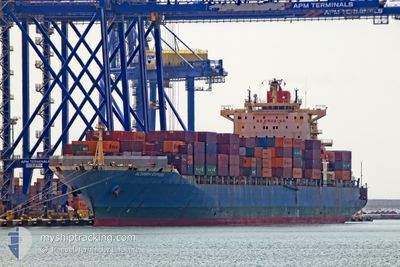
ALTAMIRA EXPRESS
Container Ship
Current Trip
| Trip Time | 20 days |
|---|---|
| Trip Distance | 5990.16 nm |
| AVG Speed | 13.2 Knots |
| MAX Speed | 17.4 Knots |
| Dybgang | 10.6 m |
| AVG Wind | 14.2 knots |
| MAX Wind | 50.7 knots |
| MIN Temp | 8.5°C / 47.3°F |
| MAX Temp | 29.4°C / 84.92°F |
| Position Modtaget | 1 m siden |
Current Position
| Longitude | --- |
|---|---|
| Latitude | --- |
| Status | Moored |
| Fart | |
| Kurs | 172° |
| Område | Ligurian Sea |
| Station | T-AIS |
| Position Modtaget | 1 m siden |
Info
Information
The current position of ALTAMIRA EXPRESS is in Ligurian Sea with coordinates 44.40469° / 8.89639° as reported on 2024-11-21 16:07 by AIS to our vessel tracker app. The vessel's current speed is 0 Knots and is currently inside the port of GENOVA.
The vessel ALTAMIRA EXPRESS (IMO: 9407146, MMSI: 477547100) is a Container Ship that was built in 2009 ( 15 år gamle ). It's sailing under the flag of [HK] Hong Kong.
In this page you can find informations about the vessels current position, last detected port calls, and current voyage information. If the vessels is not in coverage by AIS you will find the latest position.
The current position of ALTAMIRA EXPRESS is detected by our AIS receivers and we are not responsible for the reliability of the data. The last position was recorded while the vessel was in Coverage by the Ais receivers of our vessel tracking app.
The current draught of ALTAMIRA EXPRESS as reported by AIS is 10.6 meters
Weather
| Temperature | 5.4°C / 41.72°F |
|---|---|
| Wind Speed | 1 knots |
| Direction | 157° SSE |
| Pressure | 998.5 hPa |
| Humidity | 95.4 % |
| Cloud Coverage | 100 % |
Featured Company
Last Port Calls
| Port | Arrival | Departure | Time In Port |
|---|---|---|---|
| 2024-11-21 12:44 | |||
| 2024-10-29 23:13 | 2024-10-31 12:14 | 1 d | |
| 2024-10-27 22:22 | 2024-10-28 14:41 | 16 h | |
| 2024-10-09 17:00 | 2024-10-10 11:41 | 18 h | |
| 2024-10-05 23:38 | 2024-10-06 21:08 | 21 h | |
| 2024-10-02 18:00 | 2024-10-04 00:44 | 1 d | |
| 2024-10-01 09:43 | 2024-10-02 08:14 | 22 h | |
| 2024-09-26 23:14 | 2024-09-28 07:42 | 1 d | |
| 2024-09-26 09:37 |
Last Trips
| Origin | Departure | Destination | Arrival | Distance | |
|---|---|---|---|---|---|
| 2024-10-31 12:14 | 2024-11-21 12:44 | 5990.16 nm | |||
| 2024-10-28 14:41 | 2024-10-29 23:13 | 514.65 nm | |||
| 2024-10-10 11:41 | 2024-10-27 22:22 | 5733.24 nm | |||
| 2024-10-06 21:08 | 2024-10-09 17:00 | 178.84 nm | |||
| 2024-10-04 00:44 | 2024-10-05 23:38 | 397.38 nm | |||
| 2024-10-02 08:14 | 2024-10-02 18:00 | 84.20 nm | |||
| 2024-09-28 07:42 | 2024-10-01 09:43 | 1246.57 nm | |||
| 2024-09-26 09:37 | 2024-09-26 23:14 | 61.99 nm |
Events
| Tid | Hændelsen | Detaljer | Position / Dest | Info |
|---|---|---|---|---|
| 2024-11-21 12:40 | STOP Sejllads |
44.40472 / 8.89637
[IT] GENOVA
|
Fart: 0.1 kn Kurs: 173° |
|
| 2024-11-21 12:37 | Status er ændret | Moored Under way using engine |
44.40447 / 8.89625
[IT] GENOVA
|
Fart: 0.4 kn Kurs: 174° |
| 2024-11-21 11:44 | Skibe i havn |
|
44.38668 / 8.94656
[IT] GENOVA
|
Fart: 8.1 kn Kurs: 306.1° |
| 2024-11-21 10:47 | START Sejllads | 6.68 nm, South West of RECCO |
44.30030 / 9.00943
ITGOA
|
Fart: 3.1 kn Kurs: 38° |
| 2024-11-21 10:18 | STOP Sejllads | 6.73 nm, South West of RECCO |
44.29589 / 9.01203
ITGOA
|
Fart: 0.3 kn Kurs: 350° |
| 2024-11-21 06:15 | START Sejllads | 17.92 nm, South West of LAVAGNA |
44.06038 / 9.10307
ITGOA
|
Fart: 3.2 kn Kurs: 323° |
| 2024-11-21 03:46 | Status er ændret | Under way using engine Default |
44.03910 / 9.09952
ITGOA
|
Fart: 0.3 kn Kurs: 322° |
| 2024-11-21 03:44 | Status er ændret | Default Under way using engine |
44.03893 / 9.09947
ITGOA
|
Fart: 0.3 kn Kurs: 316° |
| 2024-11-21 03:08 | Status er ændret | Under way using engine Default |
44.03511 / 9.09947
ITGOA
|
Fart: 0.4 kn Kurs: 321° |
| 2024-11-21 03:04 | Status er ændret | Default Under way using engine |
44.03471 / 9.09955
ITGOA
|
Fart: 0.4 kn Kurs: 320° |