

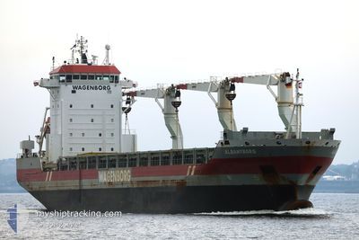
ALBANYBORG
General Cargo

Current Trip
| Time Travelled | 7 days |
|---|---|
| Remaining Time | 10 days |
| Distance Travelled | 1801.30 nm |
| Remaining Distance | 3364.68 nm |
| AVG Speed | 11.7 Knots |
| MAX Speed | 15.4 Knots |
| AVG Wind | 13.7 knots |
| MAX Wind | 27.8 knots |
| MIN Temp | -0.5°C / 31.1°F |
| MAX Temp | 8.9°C / 48.02°F |
| Dybgang | 9.5 m |
| Position Modtaget | Nu |
Current Position
| Longitude | --- |
|---|---|
| Latitude | --- |
| Status | Under way using engine |
| Fart | 15.4 Knots |
| Kurs | 254.2° |
| Område | English Channel |
| Station | T-AIS |
| Position Modtaget | Nu |
Information
The current position of ALBANYBORG is in English Channel with coordinates 50.20632° / -1.78302° as reported on 2025-03-05 03:44 by AIS to our vessel tracker app. The vessel's current speed is 15.4 Knots and is heading at the port of BALTIMORE. The estimated time of arrival as calculated by MyShipTracking vessel tracking app is 2025-03-15 08:40 LT
The vessel ALBANYBORG (IMO: 9466300, MMSI: 246519000) is a General Cargo that was built in 2010 ( 15 år gamle ). It's sailing under the flag of [NL] Netherlands.
In this page you can find informations about the vessels current position, last detected port calls, and current voyage information. If the vessels is not in coverage by AIS you will find the latest position.
The current position of ALBANYBORG is detected by our AIS receivers and we are not responsible for the reliability of the data. The last position was recorded while the vessel was in Coverage by the Ais receivers of our vessel tracking app.
The current draught of ALBANYBORG as reported by AIS is 9.5 meters
Weather
| Temperature | 8.8°C / 47.84°F |
|---|---|
| Wind Speed | 6 knots |
| Direction | 137° SE |
| Pressure | 1023.4 hPa |
| Humidity | 74.9 % |
| Cloud Coverage | --- |


Featured Company
Most Visited Ports (Last year)
| Port | Arrivals | |
|---|---|---|
| 3 | ||
| 2 | ||
| 2 | ||
| 1 | ||
| 1 | ||
| 1 |
Events
| Tid | Hændelsen | Detaljer | Position / Dest | Info |
|---|---|---|---|---|
| 2025-03-05 03:14 | Status er ændret | Under way using engine Default |
50.23975 / -1.59872
USBAL
|
Fart: 14.4 kn Kurs: 254° |
| 2025-03-05 03:12 | Status er ændret | Default Under way using engine |
50.24265 / -1.58296
USBAL
|
Fart: 14.3 kn Kurs: 253.6° |
| 2025-03-04 20:11 | Status er ændret | Under way using engine Default |
50.61134 / .45377
USBAL
|
Fart: 14.1 kn Kurs: 254° |
| 2025-03-04 20:10 | Status er ændret | Default Under way using engine |
50.61319 / .46372
USBAL
|
Fart: 14.1 kn Kurs: 253.5° |
| 2025-03-04 16:23 | Ændre havområde | United Kingdom part of the English Channel United Kingdom part of the North Sea |
51.07705 / 1.46463
English Channel
USBAL
|
Fart: 10.2 kn Kurs: 227.6° |
| 2025-03-04 11:13 | Ændre havområde | United Kingdom part of the North Sea Dutch part of the North Sea |
51.87969 / 2.54285
North Sea
USBAL
|
Fart: 14.7 kn Kurs: 221.2° |
| 2025-03-04 07:49 | Ændre havområde | Dutch part of the North Sea United Kingdom part of the North Sea |
52.50194 / 3.11218
North Sea
USBAL
|
Fart: 11.5 kn Kurs: 192.4° |
| 2025-03-04 07:30 | Fundet i havområde | United Kingdom part of the North Sea |
52.56162 / 3.12986
North Sea
USBAL
|
Fart: 11 kn Kurs: 189° |
| 2025-03-04 07:30 | Status er ændret | Under way using engine Default |
52.56162 / 3.12986
USBAL
|
Fart: 11 kn Kurs: 189° |
| 2025-03-04 07:18 | Indenfor Dækning |
52.56162 / 3.12986
North Sea
USBAL
|
Fart: 11 kn Kurs: 189° |