
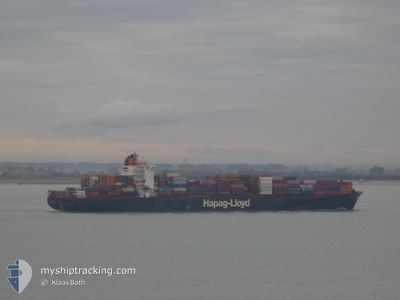
AL SAFAT
Container Ship
Current Trip
| Time Travelled | 10 days |
|---|---|
| Remaining Time | --- |
| Distance Travelled | 2951.51 nm |
| Remaining Distance | 691.49 nm |
| AVG Speed | 12.3 Knots |
| MAX Speed | 16.7 Knots |
| AVG Wind | 15.1 knots |
| MAX Wind | 34 knots |
| MIN Temp | 8.2°C / 46.76°F |
| MAX Temp | 18.7°C / 65.66°F |
| Dybgang | 12.1 m |
| Position Modtaget | 10 d siden |
Current Position
| Longitude | --- |
|---|---|
| Latitude | --- |
| Status | Under way using engine |
| Fart | 9 Knots |
| Kurs | 124.5° |
| Område | North Atlantic Ocean |
| Station | T-AIS |
| Position Modtaget | 10 d siden |
Info
Information
The current position of AL SAFAT is in North Atlantic Ocean with coordinates 36.91710° / -75.93524° as reported on 2025-12-27 08:14 by AIS to our vessel tracker app. The vessel's current speed is 9 Knots and is heading at the port of ANTWERP. The estimated time of arrival as calculated by MyShipTracking vessel tracking app is 2026-01-12 08:00 LT
The vessel AL SAFAT (IMO: 9349497, MMSI: 636093160) is a Container Ship that was built in 2008 ( 18 år gamle ). It's sailing under the flag of [LR] Liberia.
In this page you can find informations about the vessels current position, last detected port calls, and current voyage information. If the vessels is not in coverage by AIS you will find the latest position.
The current position of AL SAFAT is detected by our AIS receivers and we are not responsible for the reliability of the data. The last position was recorded while the vessel was in Coverage by the Ais receivers of our vessel tracking app.
The current draught of AL SAFAT as reported by AIS is 12.1 meters
Weather
| Temperature | 11.2°C / 52.16°F |
|---|---|
| Wind Speed | 28 knots |
| Direction | 348° NNW |
| Pressure | 1015.3 hPa |
| Humidity | 78.4 % |
| Cloud Coverage | 68 % |
Featured Company
Last Port Calls
| Port | Arrival | Departure | Time In Port |
|---|---|---|---|
| 2025-12-26 03:26 | 2025-12-27 01:51 | 22 h | |
| 2025-12-20 19:51 | 2025-12-22 08:35 | 1 d | |
| 2025-12-19 00:41 | 2025-12-20 08:56 | 1 d | |
| 2025-12-04 08:53 | 2025-12-05 14:56 | 1 d | |
| 2025-12-02 05:05 | 2025-12-03 10:34 | 1 d | |
| 2025-11-30 05:51 | 2025-11-30 22:12 | 16 h | |
| 2025-11-15 08:12 | 2025-11-16 20:11 | 1 d | |
| 2025-11-12 11:03 | 2025-11-13 17:54 | 1 d | |
| 2025-11-01 11:25 |
Most Visited Ports (Last year)
| Port | Arrivals | |
|---|---|---|
| 9 | ||
| 8 | ||
| 7 | ||
| 7 | ||
| 7 | ||
| 7 |
Last Trips
| Origin | Departure | Destination | Arrival | Distance | |
|---|---|---|---|---|---|
| 2025-12-22 08:35 | 2025-12-26 03:26 | 601.14 nm | |||
| 2025-12-20 08:56 | 2025-12-20 19:51 | 117.76 nm | |||
| 2025-12-05 14:56 | 2025-12-19 00:41 | 4893.53 nm | |||
| 2025-12-03 10:34 | 2025-12-04 08:53 | 316.54 nm | |||
| 2025-11-30 22:12 | 2025-12-02 05:05 | 221.19 nm | |||
| 2025-11-16 20:11 | 2025-11-30 05:51 | 4335.62 nm | |||
| 2025-11-13 17:54 | 2025-11-15 08:12 | 287.65 nm | |||
| 2025-11-01 11:25 | 2025-11-12 11:03 | 4639.83 nm |
Events
| Tid | Hændelsen | Detaljer | Position / Dest | Info |
|---|---|---|---|---|
| 2025-12-31 16:39 | START Sejllads |
42.34021 / -49.63943
BEANR
|
Fart: 5.7 kn Kurs: 145° |
|
| 2025-12-31 11:51 | STOP Sejllads |
42.28487 / -49.59213
BEANR
|
Fart: 0.3 kn Kurs: 157° |