
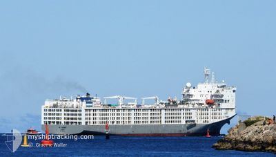
AL KUWAIT
Cargo
Current Trip
| Time Travelled | 16 days |
|---|---|
| Remaining Time | 10 h, 15 mins |
| Distance Travelled | 5222.36 nm |
| Remaining Distance | 169.59 nm |
| AVG Speed | 14.2 Knots |
| MAX Speed | 14.2 Knots |
| AVG Wind | 10.4 knots |
| MAX Wind | 30 knots |
| MIN Temp | 22.1°C / 71.78°F |
| MAX Temp | 36°C / 96.8°F |
| Dybgang | 7.8 m |
| Position Modtaget | 34 m siden |
Current Position
| Longitude | 2.51194° |
|---|---|
| Latitude | 37.57878° |
| Status | Under way using engine |
| Fart | 16 Knots |
| Kurs | 265.7° |
| Område | Mediterranean Sea - Western Basin |
| Station | T-AIS |
| Position Modtaget | 34 m siden |
Info
Information
The current position of AL KUWAIT is in Mediterranean Sea - Western Basin with coordinates 37.57878° / 2.51194° as reported on 2024-07-06 21:54 by AIS to our vessel tracker app. The vessel's current speed is 16 Knots and is heading at the port of CARTAGENA. The estimated time of arrival as calculated by MyShipTracking vessel tracking app is 2024-07-07 08:43 LT
The vessel AL KUWAIT (IMO: 9590931, MMSI: 447302000) is a Cargo It's sailing under the flag of [KW] Kuwait.
In this page you can find informations about the vessels current position, last detected port calls, and current voyage information. If the vessels is not in coverage by AIS you will find the latest position.
The current position of AL KUWAIT is detected by our AIS receivers and we are not responsible for the reliability of the data. The last position was recorded while the vessel was in Coverage by the Ais receivers of our vessel tracking app.
The current draught of AL KUWAIT as reported by AIS is 7.8 meters
Weather
| Temperature | 23.1°C / 73.58°F |
|---|---|
| Wind Speed | 3 knots |
| Direction | 217° SW |
| Pressure | 1010.9 hPa |
| Humidity | 77.3 % |
| Cloud Coverage | --- |
Featured Company
Last Port Calls
| Port | Arrival | Departure | Time In Port |
|---|---|---|---|
| 2024-07-02 03:07 | 2024-07-02 11:15 | 8 h | |
| 2024-06-20 04:49 | 2024-06-20 20:52 | 16 h | |
| 2024-06-13 15:29 | 2024-06-18 18:38 | 5 d | |
| 2024-05-13 08:55 | 2024-05-19 16:32 | 6 d |
Most Visited Ports (Last year)
| Port | Arrivals | |
|---|---|---|
| 3 | ||
| 3 | ||
| 2 | ||
| 2 | ||
| 1 | ||
| 1 |
Last Trips
| Origin | Departure | Destination | Arrival | Distance | |
|---|---|---|---|---|---|
| 2024-06-21 00:52 | 2024-07-02 05:07 | 3234.13 nm | |||
| 2024-06-18 21:38 | 2024-06-20 08:49 | 495.48 nm | |||
| 2024-05-19 13:32 | 2024-06-13 18:29 | 9016.70 nm | |||
| 2024-03-10 17:58 | 2024-05-13 05:55 | 5114.43 nm |
Events
| Tid | Hændelsen | Detaljer | Position / Dest | Info |
|---|---|---|---|---|
| 2024-07-06 21:58 | Status er ændret | Default Under way using engine |
37.57776 / 2.49307
ES CAR
|
Fart: 16 kn Kurs: 265.7° |
| 2024-07-06 20:41 | ETA er ændret | 2024/07/07 07:00 2024/07/07 08:00 |
37.59475 / 2.91622
ES CAR
|
Fart: 15.6 kn Kurs: 269.8° |
| 2024-07-06 20:35 | Status er ændret | Under way using engine Default |
37.59489 / 2.94910
ES CAR
|
Fart: 15.7 kn Kurs: 269° |
| 2024-07-06 20:22 | Status er ændret | Default Under way using engine |
37.59602 / 3.02404
ES CAR
|
Fart: 15.7 kn Kurs: 267.7° |
| 2024-07-06 20:03 | Status er ændret | Under way using engine Default |
37.60005 / 3.12545
ES CAR
|
Fart: 15.7 kn Kurs: 267° |
| 2024-07-06 19:26 | Status er ændret | Default Under way using engine |
37.60974 / 3.32893
ES CAR
|
Fart: 15.4 kn Kurs: 267.4° |
| 2024-07-06 19:09 | Status er ændret | Under way using engine Default |
37.61275 / 3.42047
ES CAR
|
Fart: 15.4 kn Kurs: 267° |
| 2024-07-06 19:09 | Indenfor Dækning |
37.61275 / 3.42047
Mediterranean Sea - Western Basin
ES CAR
|
Fart: 15.4 kn Kurs: 268.8° |
|
| 2024-07-06 12:01 | Status er ændret | Default Under way using engine |
37.70008 / 5.74128
ES CAR
|
Fart: 16 kn Kurs: 263° |
| 2024-07-06 11:57 | Udenfor Dækning |
37.70226 / 5.76368
Mediterranean Sea - Western Basin
ES CAR
|
Fart: 16 kn Kurs: 263° |