
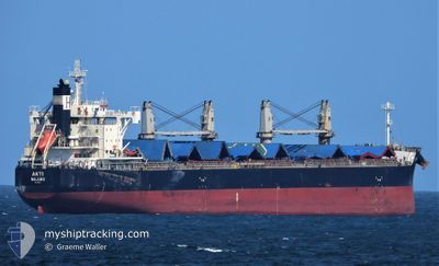
AKTI
Cargo
Current Trip
| Time Travelled | 6 days |
|---|---|
| Remaining Time | --- |
| Distance Travelled | 1250.81 nm |
| Remaining Distance | --- |
| AVG Speed | 12 Knots |
| MAX Speed | 14.3 Knots |
| AVG Wind | 7.6 knots |
| MAX Wind | 17.8 knots |
| MIN Temp | 27.7°C / 81.86°F |
| MAX Temp | 31.3°C / 88.34°F |
| Dybgang | 6.5 m |
| Position Modtaget | 22 h, 41 m siden |
Current Position
| Longitude | 100.84107° |
|---|---|
| Latitude | 13.19962° |
| Status | At anchor |
| Fart | 0.3 Knots |
| Kurs | 49° |
| Område | Gulf of Thailand |
| Station | T-AIS |
| Position Modtaget | 22 h, 41 m siden |
Info
Information
The current position of AKTI is in Gulf of Thailand with coordinates 13.19962° / 100.84107° as reported on 2024-05-21 04:22 by AIS to our vessel tracker app. The vessel's current speed is 0.3 Knots
The vessel AKTI (IMO: 9660619, MMSI: 538009278) is a Cargo It's sailing under the flag of [MH] Marshall Is.
In this page you can find informations about the vessels current position, last detected port calls, and current voyage information. If the vessels is not in coverage by AIS you will find the latest position.
The current position of AKTI is detected by our AIS receivers and we are not responsible for the reliability of the data. The last position was recorded while the vessel was in Coverage by the Ais receivers of our vessel tracking app.
The current draught of AKTI as reported by AIS is 6.5 meters
Weather
| Temperature | 28°C / 82.4°F |
|---|---|
| Wind Speed | 12 knots |
| Direction | 164° SSE |
| Pressure | 1009 hPa |
| Humidity | 84.7 % |
| Cloud Coverage | 100 % |
Featured Company
Most Visited Ports (Last year)
| Port | Arrivals | |
|---|---|---|
| 3 | ||
| 1 | ||
| 1 | ||
| 1 | ||
| 1 | ||
| 1 |
Events
| Tid | Hændelsen | Detaljer | Position / Dest | Info |
|---|---|---|---|---|
| 2024-05-21 04:40 | Status er ændret | Default At anchor |
13.20156 / 100.84038
TH KSI
|
Fart: 0.3 kn Kurs: 49° |
| 2024-05-21 04:22 | Udenfor Dækning |
13.19962 / 100.84107
Gulf of Thailand
|
Fart: 0.3 kn Kurs: 302.4° |
|
| 2024-05-21 03:34 | Status er ændret | At anchor Default |
13.19891 / 100.84157
TH KSI
|
Fart: Kurs: -1° |
| 2024-05-21 03:34 | Indenfor Dækning |
13.19891 / 100.84157
Gulf of Thailand
|
Fart: Kurs: 115.6° |
|
| 2024-05-20 05:17 | STOP Sejllads | 3.04 nm, North East of KO SICHANG |
13.20360 / 100.84297
TH KSI
|
Fart: 0.3 kn Kurs: 200° |
| 2024-05-20 03:59 | Status er ændret | Default Under way using engine |
13.04571 / 100.79939
TH KSI
|
Fart: 12.1 kn Kurs: 35.7° |
| 2024-05-20 03:53 | Status er ændret | Under way using engine Default |
13.02736 / 100.78613
TH KSI
|
Fart: 10.7 kn Kurs: 40° |
| 2024-05-20 03:53 | Indenfor Dækning |
13.02736 / 100.78613
Gulf of Thailand
TH KSI
|
Fart: 12.1 kn Kurs: 35.7° |
|
| 2024-05-20 03:53 | Udenfor Dækning |
13.02736 / 100.78613
Gulf of Thailand
TH KSI
|
Fart: 12.1 kn Kurs: 35.7° |
|
| 2024-05-20 02:22 | Udenfor Dækning |
12.75275 / 100.73934
Gulf of Thailand
TH KSI
|
Fart: 12.8 kn Kurs: 7.7° |