
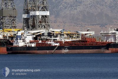
AGIOS NIKOLAOS
Not available
Current Trip
FOR ORDERS
| Time Travelled | 23 days |
|---|---|
| Remaining Time | --- |
| Distance Travelled | 3360.98 nm |
| Remaining Distance | --- |
| AVG Speed | 11.3 Knots |
| MAX Speed | 14.6 Knots |
| AVG Wind | 11.2 knots |
| MAX Wind | 25.9 knots |
| MIN Temp | 4.3°C / 39.74°F |
| MAX Temp | 22.6°C / 72.68°F |
| Dybgang | 10.5 m |
| Position Modtaget | 7 m siden |
Current Position
| Longitude | -6.42349° |
|---|---|
| Latitude | 35.90325° |
| Status | Under way using engine |
| Fart | 11.2 Knots |
| Kurs | 131.1° |
| Område | North Atlantic Ocean |
| Station | T-AIS |
| Position Modtaget | 7 m siden |
Info
Information
The current position of AGIOS NIKOLAOS is in North Atlantic Ocean with coordinates 35.90325° / -6.42349° as reported on 2024-06-03 21:22 by AIS to our vessel tracker app. The vessel's current speed is 11.2 Knots
The vessel AGIOS NIKOLAOS (IMO: 9820283, MMSI: 538009048) is a Not available It's sailing under the flag of [MH] Marshall Is.
In this page you can find informations about the vessels current position, last detected port calls, and current voyage information. If the vessels is not in coverage by AIS you will find the latest position.
The current position of AGIOS NIKOLAOS is detected by our AIS receivers and we are not responsible for the reliability of the data. The last position was recorded while the vessel was in Coverage by the Ais receivers of our vessel tracking app.
The current draught of AGIOS NIKOLAOS as reported by AIS is 10.5 meters
Weather
| Temperature | 19.3°C / 66.74°F |
|---|---|
| Wind Speed | 25 knots |
| Direction | 101° E |
| Pressure | 1013.8 hPa |
| Humidity | 81.7 % |
| Cloud Coverage | 3 % |
Featured Company
Last Trips
| Origin | Departure | Destination | Arrival | Distance |
|---|
Events
| Tid | Hændelsen | Detaljer | Position / Dest | Info |
|---|---|---|---|---|
| 2024-06-03 21:22 | Ændre havområde | Moroccan part of the North Atlantic Ocean Spanish part of the North Atlantic Ocean |
35.90325 / -6.42349
North Atlantic Ocean
FOR ORDERS
|
Fart: 11.2 kn Kurs: 131.1° |
| 2024-06-03 21:22 | Status er ændret | Under way using engine Default |
35.90325 / -6.42349
FOR ORDERS
|
Fart: 11.1 kn Kurs: 130° |
| 2024-06-03 21:17 | Status er ændret | Default Under way using engine |
35.91308 / -6.43786
FOR ORDERS
|
Fart: 11 kn Kurs: 130.3° |
| 2024-06-03 21:12 | Status er ændret | Under way using engine Default |
35.92508 / -6.45541
FOR ORDERS
|
Fart: 11 kn Kurs: 131° |
| 2024-06-03 21:05 | Status er ændret | Default Under way using engine |
35.93795 / -6.47359
FOR ORDERS
|
Fart: 11 kn Kurs: 131.9° |
| 2024-06-03 21:01 | Status er ændret | Under way using engine Default |
35.94691 / -6.48588
FOR ORDERS
|
Fart: 11 kn Kurs: 131° |
| 2024-06-03 20:53 | Status er ændret | Default Under way using engine |
35.96199 / -6.50654
FOR ORDERS
|
Fart: 11 kn Kurs: 132.8° |
| 2024-06-03 20:48 | Status er ændret | Under way using engine Default |
35.97275 / -6.52112
FOR ORDERS
|
Fart: 11 kn Kurs: 133° |
| 2024-06-03 20:45 | Status er ændret | Default Under way using engine |
35.97865 / -6.52900
FOR ORDERS
|
Fart: 10.9 kn Kurs: 130.5° |
| 2024-06-03 20:37 | Status er ændret | Under way using engine Default |
35.99509 / -6.55141
FOR ORDERS
|
Fart: 11 kn Kurs: 131° |