
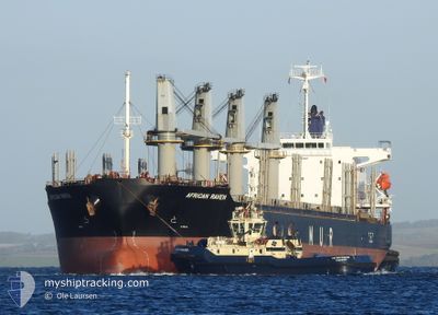
AFRICAN RAVEN
Cargo
Current Trip
| Trip Time | 8 days |
|---|---|
| Trip Distance | 1028.66 nm |
| AVG Speed | 6.4 Knots |
| MAX Speed | 6.4 Knots |
| Dybgang | 6.6 m |
| AVG Wind | 17.7 knots |
| MAX Wind | 32 knots |
| MIN Temp | 4.5°C / 40.1°F |
| MAX Temp | 21.3°C / 70.34°F |
| Position Modtaget | 10 d siden |
Current Position
| Longitude | --- |
|---|---|
| Latitude | --- |
| Status | Under way using engine |
| Fart | 13 Knots |
| Kurs | 70.6° |
| Område | Black Sea |
| Station | T-AIS |
| Position Modtaget | 10 d siden |
Info
Information
The current position of AFRICAN RAVEN is in Black Sea with coordinates 41.41209° / 29.78487° as reported on 2024-11-21 23:01 by AIS to our vessel tracker app. The vessel's current speed is 13 Knots and is currently inside the port of GIRESUN.
The vessel AFRICAN RAVEN (IMO: 9700287, MMSI: 311000243) is a Cargo It's sailing under the flag of [BS] Bahamas.
In this page you can find informations about the vessels current position, last detected port calls, and current voyage information. If the vessels is not in coverage by AIS you will find the latest position.
The current position of AFRICAN RAVEN is detected by our AIS receivers and we are not responsible for the reliability of the data. The last position was recorded while the vessel was in Coverage by the Ais receivers of our vessel tracking app.
The current draught of AFRICAN RAVEN as reported by AIS is 6.6 meters
Weather
| Temperature | --- |
|---|---|
| Wind Speed | --- |
| Direction | --- |
| Pressure | --- |
| Humidity | --- |
| Cloud Coverage | --- |
Featured Company
Events
| Tid | Hændelsen | Detaljer | Position / Dest | Info |
|---|---|---|---|---|
| 2024-11-30 17:07 | STOP Sejllads |
40.91917 / 38.38206
[TR] GIRESUN
|
Fart: 0.1 kn Kurs: 231° |
|
| 2024-11-27 10:11 | Skibe i havn |
|
40.91694 / 38.37602
[TR] GIRESUN
|
Fart: 5.3 kn Kurs: 161° |
| 2024-11-25 01:33 | START Sejllads | 11.12 nm, North of GIRESUN |
41.10612 / 38.37238
TR GIR
|
Fart: 4.3 kn Kurs: 102° |
| 2024-11-24 21:37 | STOP Sejllads | 8.46 nm, North of GIRESUN |
41.06126 / 38.39970
TR GIR
|
Fart: 0.3 kn Kurs: 324° |
| 2024-11-23 09:29 | STOP Sejllads | 0.71 nm, North of GIRESUN |
40.93269 / 38.38106
TR GIR
|
Fart: 0.2 kn Kurs: 153° |