
AETERNO
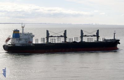
Bulk Carrier
Current Trip
| Trip Time | 28 days |
|---|---|
| Trip Distance | 6047.17 nm |
| AVG Speed | 10.6 Knots |
| MAX Speed | 13.2 Knots |
| Dybgang | 10 m |
| AVG Wind | 11.3 knots |
| MAX Wind | 22 knots |
| MIN Temp | 12.5°C / 54.5°F |
| MAX Temp | 33.7°C / 92.66°F |
| Position Modtaget | 7 d siden |
Current Position
| Longitude | --- |
|---|---|
| Latitude | --- |
| Status | Under way using engine |
| Fart | 13.1 Knots |
| Kurs | 89.4° |
| Område | Alboran Sea |
| Station | T-AIS |
| Position Modtaget | 7 d siden |
Info
Information
The current position of AETERNO is in Alboran Sea with coordinates 36.09843° / -3.78021° as reported on 2025-02-21 23:43 by AIS to our vessel tracker app. The vessel's current speed is 13.1 Knots and is currently inside the port of BEJAIA.
The vessel AETERNO (IMO: 9474228, MMSI: 538007976) is a Bulk Carrier that was built in 2011 ( 14 år gamle ). It's sailing under the flag of [MH] Marshall Is.
In this page you can find informations about the vessels current position, last detected port calls, and current voyage information. If the vessels is not in coverage by AIS you will find the latest position.
The current position of AETERNO is detected by our AIS receivers and we are not responsible for the reliability of the data. The last position was recorded while the vessel was in Coverage by the Ais receivers of our vessel tracking app.
The current draught of AETERNO as reported by AIS is 10 meters
Weather
| Temperature | 11.4°C / 52.52°F |
|---|---|
| Wind Speed | 2 knots |
| Direction | 325° NW |
| Pressure | 1013.4 hPa |
| Humidity | 87.1 % |
| Cloud Coverage | 83 % |
Featured Company
Last Port Calls
| Port | Arrival | Departure | Time In Port |
|---|---|---|---|
| 2025-02-25 22:24 | |||
| 2025-01-24 12:03 | 2025-01-28 19:46 | 4 d | |
| 2025-01-02 13:45 | 2025-01-06 03:34 | 3 d |
Last Trips
| Origin | Departure | Destination | Arrival | Distance | |
|---|---|---|---|---|---|
| 2025-01-28 16:46 | 2025-02-25 23:24 | 6047.17 nm | |||
| 2025-01-06 03:34 | 2025-01-24 09:03 | 4092.79 nm | |||
| 2024-12-30 23:46 | 2025-01-02 13:45 | 28.39 nm |
Events
| Tid | Hændelsen | Detaljer | Position / Dest | Info |
|---|---|---|---|---|
| 2025-02-25 22:39 | STOP Sejllads |
36.74354 / 5.07995
[DZ] BEJAIA
|
Fart: 0.3 kn Kurs: 337° |
|
| 2025-02-25 22:24 | Skibe i havn |
|
36.74637 / 5.08509
[DZ] BEJAIA
|
Fart: 4 kn Kurs: 286° |
| 2025-02-25 21:02 | START Sejllads | 2.87 nm, South East of BEJAIA |
36.73258 / 5.14968
DZ BJA
|
Fart: 5.2 kn Kurs: 322° |
| 2025-02-23 14:02 | STOP Sejllads | 3.93 nm, South East of BEJAIA |
36.72033 / 5.16675
DZ BJA
|
Fart: 0.2 kn Kurs: 254° |
| 2025-02-21 23:54 | Status er ændret | Default Under way using engine |
36.10080 / -3.73182
DZ BJA
|
Fart: 13.1 kn Kurs: 89.4° |
| 2025-02-21 23:43 | Udenfor Dækning |
36.09843 / -3.78021
Alboran Sea
DZ BJA
|
Fart: 13.1 kn Kurs: 89.4° |
|
| 2025-02-21 23:03 | Status er ændret | Under way using engine Default |
36.10504 / -3.96168
DZ BJA
|
Fart: 12.9 kn Kurs: 95° |
| 2025-02-21 23:03 | Indenfor Dækning |
36.10504 / -3.96168
Alboran Sea
DZ BJA
|
Fart: 12.9 kn Kurs: 92.2° |
|
| 2025-02-21 20:34 | Status er ændret | Default Under way using engine |
36.05087 / -4.58464
DZ BJA
|
Fart: 11.4 kn Kurs: 83.7° |
| 2025-02-21 20:33 | Udenfor Dækning |
36.05063 / -4.58723
Alboran Sea
DZ BJA
|
Fart: 11.4 kn Kurs: 83.7° |