
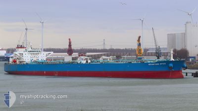
ADVANTAGE SPICE
Crude Oil Tanker
Current Trip
SG PUB
| Time Travelled | 30 days |
|---|---|
| Remaining Time | --- |
| Distance Travelled | 6590.26 nm |
| Remaining Distance | --- |
| AVG Speed | 11.7 Knots |
| MAX Speed | 11.7 Knots |
| AVG Wind | 6.9 knots |
| MAX Wind | 29 knots |
| MIN Temp | 24.5°C / 76.1°F |
| MAX Temp | 32°C / 89.6°F |
| Dybgang | 15.9 m |
| Position Modtaget | 1 d siden |
Current Position
| Longitude | 76.65642° |
|---|---|
| Latitude | 7.86474° |
| Status | Under way using engine |
| Fart | 9.1 Knots |
| Kurs | 138.9° |
| Område | Laccadive Sea |
| Station | T-AIS |
| Position Modtaget | 1 d siden |
Info
Information
The current position of ADVANTAGE SPICE is in Laccadive Sea with coordinates 7.86474° / 76.65642° as reported on 2024-05-07 03:31 by AIS to our vessel tracker app. The vessel's current speed is 9.1 Knots
The vessel ADVANTAGE SPICE (IMO: 9419888, MMSI: 538006197) is a Crude Oil Tanker that was built in 2010 ( 14 år gamle ). It's sailing under the flag of [MH] Marshall Is.
In this page you can find informations about the vessels current position, last detected port calls, and current voyage information. If the vessels is not in coverage by AIS you will find the latest position.
The current position of ADVANTAGE SPICE is detected by our AIS receivers and we are not responsible for the reliability of the data. The last position was recorded while the vessel was in Coverage by the Ais receivers of our vessel tracking app.
The current draught of ADVANTAGE SPICE as reported by AIS is 15.9 meters
Weather
| Temperature | 28.9°C / 84.02°F |
|---|---|
| Wind Speed | 5 knots |
| Direction | 169° S |
| Pressure | 1008.5 hPa |
| Humidity | 76.4 % |
| Cloud Coverage | 100 % |
Featured Company
Last Port Calls
| Port | Arrival | Departure | Time In Port |
|---|---|---|---|
| 2024-04-06 04:29 | 2024-04-08 03:27 | 1 d | |
| 2024-04-01 06:27 | 2024-04-02 20:13 | 1 d |
Most Visited Ports (Last year)
| Port | Arrivals | |
|---|---|---|
| 2 | ||
| 1 | ||
| 1 | ||
| 1 |
Last Trips
| Origin | Departure | Destination | Arrival | Distance | |
|---|---|---|---|---|---|
| 2024-04-03 04:13 | 2024-04-06 12:29 | 80.90 nm | |||
| 2024-01-15 12:54 | 2024-04-01 14:27 | 8195.04 nm |
Events
| Tid | Hændelsen | Detaljer | Position / Dest | Info |
|---|---|---|---|---|
| 2024-05-07 03:34 | Status er ændret | Default Under way using engine |
7.85667 / 76.66167
SG PUB
|
Fart: 9.1 kn Kurs: 138.9° |
| 2024-05-07 03:31 | Udenfor Dækning |
7.86474 / 76.65642
Laccadive Sea
SG PUB
|
Fart: 9.1 kn Kurs: 138.9° |
|
| 2024-05-07 03:27 | Status er ændret | Under way using engine Default |
7.87237 / 76.64972
SG PUB
|
Fart: 9 kn Kurs: 138° |
| 2024-05-07 03:19 | Status er ændret | Default Under way using engine |
7.88667 / 76.63666
SG PUB
|
Fart: 9.2 kn Kurs: 139.1° |
| 2024-05-07 02:53 | Status er ændret | Under way using engine Default |
7.93658 / 76.59332
SG PUB
|
Fart: 9 kn Kurs: 139° |
| 2024-05-07 02:49 | Status er ændret | Default Under way using engine |
7.94500 / 76.58500
SG PUB
|
Fart: 9.3 kn Kurs: 139.8° |
| 2024-05-07 02:43 | Status er ændret | Under way using engine Default |
7.95765 / 76.57503
SG PUB
|
Fart: 9 kn Kurs: 139° |
| 2024-05-07 02:40 | Status er ændret | Default Under way using engine |
7.96167 / 76.57000
SG PUB
|
Fart: 9.6 kn Kurs: 139° |
| 2024-05-07 02:23 | Ændre havområde | Indian part of the Laccadive Sea Omani part of the Gulf of Oman |
7.99687 / 76.54035
Laccadive Sea
SG PUB
|
Fart: 10.2 kn Kurs: 138.3° |
| 2024-05-07 02:23 | Status er ændret | Under way using engine Default |
7.99687 / 76.54035
SG PUB
|
Fart: 11 kn Kurs: 138° |