
ADAMS
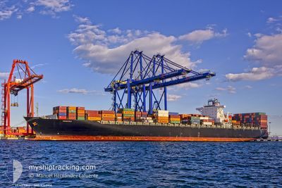
Container Ship
Current Trip
| Time Travelled | 1 day |
|---|---|
| Remaining Time | --- |
| Distance Travelled | 379.99 nm |
| Remaining Distance | --- |
| AVG Speed | 9.4 Knots |
| MAX Speed | 10.9 Knots |
| AVG Wind | 8.9 knots |
| MAX Wind | 17 knots |
| MIN Temp | 26.2°C / 79.16°F |
| MAX Temp | 30.3°C / 86.54°F |
| Dybgang | 12 m |
| Position Modtaget | 1 h, 39 m siden |
Current Position
| Longitude | --- |
|---|---|
| Latitude | --- |
| Status | Under way using engine |
| Fart | 0.8 Knots |
| Kurs | 124° |
| Område | Java Sea |
| Station | T-AIS |
| Position Modtaget | 1 h, 39 m siden |
Info
Information
The current position of ADAMS is in Java Sea with coordinates -6.69802° / 112.72485° as reported on 2024-11-30 02:39 by AIS to our vessel tracker app. The vessel's current speed is 0.8 Knots
The vessel ADAMS (IMO: 9260914, MMSI: 636015952) is a Container Ship that was built in 2003 ( 21 år gamle ). It's sailing under the flag of [LR] Liberia.
In this page you can find informations about the vessels current position, last detected port calls, and current voyage information. If the vessels is not in coverage by AIS you will find the latest position.
The current position of ADAMS is detected by our AIS receivers and we are not responsible for the reliability of the data. The last position was recorded while the vessel was in Coverage by the Ais receivers of our vessel tracking app.
The current draught of ADAMS as reported by AIS is 12 meters
Weather
| Temperature | 29.3°C / 84.74°F |
|---|---|
| Wind Speed | 6 knots |
| Direction | 266° W |
| Pressure | 1006.8 hPa |
| Humidity | 70.9 % |
| Cloud Coverage | 100 % |
Featured Company
Last Port Calls
| Port | Arrival | Departure | Time In Port |
|---|---|---|---|
| 2024-11-27 07:55 | 2024-11-28 07:23 | 23 h | |
| 2024-11-25 00:31 | 2024-11-25 15:12 | 14 h | |
| 2024-11-23 22:46 | 2024-11-24 16:15 | 17 h | |
| 2024-11-22 18:40 | 2024-11-23 17:06 | 22 h | |
| 2024-11-14 11:48 | 2024-11-14 22:51 | 11 h | |
| 2024-11-13 11:24 | 2024-11-14 01:36 | 14 h | |
| 2024-11-10 00:31 | 2024-11-10 20:28 | 19 h | |
| 2024-11-01 16:44 | 2024-11-02 09:40 | 16 h | |
| 2024-10-31 22:48 | 2024-11-01 09:47 | 10 h | |
| 2024-10-31 04:10 | 2024-10-31 14:14 | 10 h |
Last Trips
| Origin | Departure | Destination | Arrival | Distance | |
|---|---|---|---|---|---|
| 2024-11-25 23:12 | 2024-11-27 14:55 | 587.48 nm | |||
| 2024-11-25 00:15 | 2024-11-25 08:31 | 14.11 nm | |||
| 2024-11-24 01:06 | 2024-11-24 06:46 | 47.89 nm | |||
| 2024-11-15 06:51 | 2024-11-23 02:40 | 2687.92 nm | |||
| 2024-11-14 09:36 | 2024-11-14 19:48 | 142.57 nm | |||
| 2024-11-11 04:28 | 2024-11-13 19:24 | 450.60 nm | |||
| 2024-11-02 17:40 | 2024-11-10 08:31 | 1765.82 nm | |||
| 2024-11-01 17:47 | 2024-11-02 00:44 | 71.49 nm | |||
| 2024-10-31 22:14 | 2024-11-01 06:48 | 87.91 nm | |||
| 2024-10-27 12:07 | 2024-10-31 12:10 | 1481.02 nm |
Events
| Tid | Hændelsen | Detaljer | Position / Dest | Info |
|---|---|---|---|---|
| 2024-11-30 02:48 | Status er ændret | Default Under way using engine |
-6.69697 / 112.72659
IDSUB
|
Fart: 0.8 kn Kurs: 124° |
| 2024-11-30 02:39 | Udenfor Dækning |
-6.69802 / 112.72485
Java Sea
IDSUB
|
Fart: 0.8 kn Kurs: 63° |
|
| 2024-11-30 02:35 | Status er ændret | Under way using engine Default |
-6.69850 / 112.72408
IDSUB
|
Fart: 0.8 kn Kurs: 120° |
| 2024-11-30 02:27 | Indenfor Dækning |
-6.69850 / 112.72408
Java Sea
IDSUB
|
Fart: 0.8 kn Kurs: 62° |
|
| 2024-11-30 00:04 | STOP Sejllads | 19.48 nm, North East of LAMONGAN |
-6.70893 / 112.70309
IDSUB
|
Fart: 0.3 kn Kurs: 219° |
| 2024-11-29 23:00 | Status er ændret | Default Under way using engine |
-6.68538 / 112.70116
IDSUB
|
Fart: 9.1 kn Kurs: 115° |
| 2024-11-29 22:51 | Udenfor Dækning |
-6.67210 / 112.69100
Java Sea
IDSUB
|
Fart: 9.1 kn Kurs: 115° |
|
| 2024-11-29 22:29 | Status er ændret | Under way using engine Default |
-6.64847 / 112.63942
IDSUB
|
Fart: 9.1 kn Kurs: 117° |
| 2024-11-29 22:19 | Status er ændret | Default Under way using engine |
-6.63717 / 112.61717
IDSUB
|
Fart: 9.1 kn Kurs: 116° |
| 2024-11-28 23:23 | Dybgangen er ændret | 12 13.9 |
-5.88995 / 109.12943
IDSUB
|
Fart: 9.7 kn Kurs: 105° |