
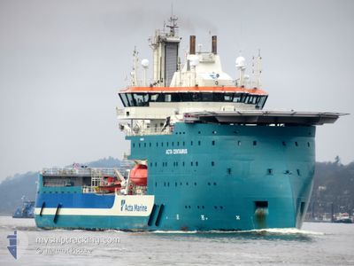
ACTA CENTAURUS
Other Type
Current Trip
| Time Travelled | 12 days |
|---|---|
| Remaining Time | 3 h, 39 mins |
| Distance Travelled | 256.88 nm |
| Remaining Distance | 34.24 nm |
| AVG Speed | 5.6 Knots |
| MAX Speed | 10.3 Knots |
| AVG Wind | 12.7 knots |
| MAX Wind | 21.3 knots |
| MIN Temp | 2.8°C / 37.04°F |
| MAX Temp | 7.8°C / 46.04°F |
| Dybgang | 5.7 m |
| Position Modtaget | 1 m siden |
Current Position
| Longitude | --- |
|---|---|
| Latitude | --- |
| Status | Under way using engine |
| Fart | 10.4 Knots |
| Kurs | 89.9° |
| Område | North Sea |
| Station | T-AIS |
| Position Modtaget | 1 m siden |
Info
Information
The current position of ACTA CENTAURUS is in North Sea with coordinates 53.61374° / 6.49681° as reported on 2025-03-18 00:37 by AIS to our vessel tracker app. The vessel's current speed is 10.4 Knots and is heading at the port of EMDEN. The estimated time of arrival as calculated by MyShipTracking vessel tracking app is 2025-03-18 05:17 LT
The vessel ACTA CENTAURUS (IMO: 9850355, MMSI: 244341000) is a Other Type It's sailing under the flag of [NL] Netherlands.
In this page you can find informations about the vessels current position, last detected port calls, and current voyage information. If the vessels is not in coverage by AIS you will find the latest position.
The current position of ACTA CENTAURUS is detected by our AIS receivers and we are not responsible for the reliability of the data. The last position was recorded while the vessel was in Coverage by the Ais receivers of our vessel tracking app.
The current draught of ACTA CENTAURUS as reported by AIS is 5.7 meters
Weather
| Temperature | 3.4°C / 38.12°F |
|---|---|
| Wind Speed | 10 knots |
| Direction | 104° ESE |
| Pressure | 1032.2 hPa |
| Humidity | 66.6 % |
| Cloud Coverage | 1 % |
Featured Company
Last Port Calls
| Port | Arrival | Departure | Time In Port |
|---|---|---|---|
| 2025-03-05 06:01 | 2025-03-05 20:26 | 14 h | |
| 2025-02-19 02:43 | 2025-02-19 21:23 | 18 h | |
| 2025-02-05 00:00 | 2025-02-05 20:04 | 20 h | |
| 2025-01-24 03:54 | 2025-01-25 20:14 | 1 d | |
| 2025-01-21 23:49 | 2025-01-22 19:27 | 19 h | |
| 2025-01-06 00:32 | 2025-01-08 22:22 | 2 d | |
| 2025-01-03 23:25 |
Last Trips
| Origin | Departure | Destination | Arrival | Distance | |
|---|---|---|---|---|---|
| 2025-02-19 21:23 | 2025-03-05 06:01 | 209.29 nm | |||
| 2025-02-05 20:04 | 2025-02-19 02:43 | 181.67 nm | |||
| 2025-01-25 20:14 | 2025-02-05 00:00 | 148.24 nm | |||
| 2025-01-22 19:27 | 2025-01-24 03:54 | 85.25 nm | |||
| 2025-01-08 22:22 | 2025-01-21 23:49 | 198.68 nm | |||
| 2025-01-03 23:25 | 2025-01-06 00:32 | 104.74 nm |
Events
| Tid | Hændelsen | Detaljer | Position / Dest | Info |
|---|---|---|---|---|
| 2025-03-18 00:11 | Destination er ændret | EMDEN SANDBANK OWF |
53.63066 / 6.38812
EMDEN
|
Fart: 9.1 kn Kurs: 118.8° |
| 2025-03-18 00:11 | ETA er ændret | 2025/03/18 04:30 2025/03/06 03:00 |
53.63066 / 6.38812
EMDEN
|
Fart: 9.1 kn Kurs: 118.8° |
| 2025-03-17 23:08 | Fundet i havområde | Dutch part of the North Sea |
53.71151 / 6.35201
North Sea
|
Fart: 6.2 kn Kurs: 219.8° |
| 2025-03-17 23:08 | Indenfor Dækning |
53.71151 / 6.35201
North Sea
|
Fart: 6.2 kn Kurs: 219.8° |
|
| 2025-03-17 11:01 | Udenfor Dækning |
55.11244 / 7.23330
North Sea
|
Fart: 7.9 kn Kurs: 118.2° |
|
| 2025-03-17 10:54 | START Sejllads |
55.12446 / 7.22114
SANDBANK OWF
|
Fart: 4.8 kn Kurs: 324° |
|
| 2025-03-17 10:10 | STOP Sejllads |
55.12563 / 7.21845
SANDBANK OWF
|
Fart: 0.1 kn Kurs: 135° |
|
| 2025-03-17 10:07 | START Sejllads |
55.12695 / 7.21622
SANDBANK OWF
|
Fart: 4.5 kn Kurs: 136° |
|
| 2025-03-17 07:20 | Indenfor Dækning |
55.12805 / 7.21356
North Sea
|
Fart: 0.2 kn Kurs: 42.8° |
|
| 2025-03-17 05:23 | Udenfor Dækning |
55.12683 / 7.22015
North Sea
|
Fart: 2.4 kn Kurs: 243.1° |