

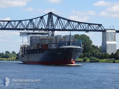
ACACIA
Bulk Carrier

Current Trip
EGZ SUEZ
| Time Travelled | 6 days |
|---|---|
| Remaining Time | --- |
| Distance Travelled | 2096.28 nm |
| Remaining Distance | --- |
| AVG Speed | 12.7 Knots |
| MAX Speed | 14.5 Knots |
| AVG Wind | 13 knots |
| MAX Wind | 22 knots |
| MIN Temp | 23°C / 73.4°F |
| MAX Temp | 29.2°C / 84.56°F |
| Dybgang | 10.3 m |
| Position Modtaget | 1 m siden |
Current Position
| Longitude | --- |
|---|---|
| Latitude | --- |
| Status | Under way using engine |
| Fart | 5.5 Knots |
| Kurs | 297.3° |
| Område | Laccadive Sea |
| Station | T-AIS |
| Position Modtaget | 1 m siden |
Information
The current position of ACACIA is in Laccadive Sea with coordinates 5.88301° / 80.26479° as reported on 2025-03-24 08:21 by AIS to our vessel tracker app. The vessel's current speed is 5.5 Knots
The vessel ACACIA (IMO: 9597642, MMSI: 538009124) is a Bulk Carrier that was built in 2011 ( 14 år gamle ). It's sailing under the flag of [MH] Marshall Is.
In this page you can find informations about the vessels current position, last detected port calls, and current voyage information. If the vessels is not in coverage by AIS you will find the latest position.
The current position of ACACIA is detected by our AIS receivers and we are not responsible for the reliability of the data. The last position was recorded while the vessel was in Coverage by the Ais receivers of our vessel tracking app.
The current draught of ACACIA as reported by AIS is 10.3 meters
Weather
| Temperature | 28.5°C / 83.3°F |
|---|---|
| Wind Speed | 8 knots |
| Direction | 230° SW |
| Pressure | 1009.5 hPa |
| Humidity | 71.9 % |
| Cloud Coverage | 6 % |


Featured Company
Last Port Calls
| Port | Arrival | Departure | Time In Port |
|---|---|---|---|
| 2025-03-02 13:20 | 2025-03-17 20:47 | 15 d | |
| 2025-01-05 06:48 | 2025-01-05 16:51 | 10 h |
Most Visited Ports (Last year)
| Port | Arrivals | |
|---|---|---|
| 2 | ||
| 2 | ||
| 2 | ||
| 1 | ||
| 1 | ||
| 1 |
Last Trips
| Origin | Departure | Destination | Arrival | Distance | |
|---|---|---|---|---|---|
| 2024-11-30 23:33 | 2025-01-05 06:48 | 1988.34 nm |
Events
| Tid | Hændelsen | Detaljer | Position / Dest | Info |
|---|---|---|---|---|
| 2025-03-24 07:39 | Destination er ændret | EGZ SUEZ EGZ_SUEZ |
5.84877 / 80.33493
EGZ SUEZ
|
Fart: 10.4 kn Kurs: 285.4° |
| 2025-03-24 07:39 | ETA er ændret | 2025/04/05 14:00 2025/04/05 18:00 |
5.84877 / 80.33493
EGZ SUEZ
|
Fart: 10.4 kn Kurs: 285.4° |
| 2025-03-24 07:28 | Status er ændret | Under way using engine Default |
5.83972 / 80.36748
EGZ_SUEZ
|
Fart: 11.8 kn Kurs: 285° |
| 2025-03-24 07:21 | Status er ændret | Default Under way using engine |
5.83446 / 80.38760
EGZ_SUEZ
|
Fart: 12 kn Kurs: 284.3° |
| 2025-03-24 07:16 | Ændre havområde | Sri Lankan part of the Laccadive Sea Malaysian part of the Malacca Strait |
5.83010 / 80.40484
Laccadive Sea
EGZ_SUEZ
|
Fart: 12 kn Kurs: 284.3° |
| 2025-03-24 07:16 | Status er ændret | Under way using engine Default |
5.83010 / 80.40484
EGZ_SUEZ
|
Fart: 12.4 kn Kurs: 277° |
| 2025-03-24 07:16 | Indenfor Dækning |
5.83010 / 80.40484
Laccadive Sea
EGZ_SUEZ
|
Fart: 12 kn Kurs: 284.3° |
|
| 2025-03-19 13:14 | Status er ændret | Default Under way using engine |
1.27749 / 103.37840
EGZ_SUEZ
|
Fart: 14.4 kn Kurs: 306.3° |
| 2025-03-19 13:07 | Udenfor Dækning |
1.25981 / 103.39786
Malacca Strait
EGZ_SUEZ
|
Fart: 14.4 kn Kurs: 306.3° |
|
| 2025-03-19 13:03 | Status er ændret | Under way using engine Default |
1.25104 / 103.40977
EGZ_SUEZ
|
Fart: 14.3 kn Kurs: 306° |