
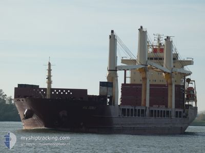
AAL GENOA
General Cargo
Current Trip
| Time Travelled | 12 days |
|---|---|
| Remaining Time | 3 days |
| Distance Travelled | 3313.10 nm |
| Remaining Distance | 1064.94 nm |
| AVG Speed | 11.1 Knots |
| MAX Speed | 14.8 Knots |
| AVG Wind | 11.6 knots |
| MAX Wind | 24 knots |
| MIN Temp | 10.5°C / 50.9°F |
| MAX Temp | 24.7°C / 76.46°F |
| Dybgang | 9.9 m |
| Position Modtaget | 9 m siden |
Current Position
| Longitude | 12.37162° |
|---|---|
| Latitude | 36.99355° |
| Status | Under way using engine |
| Fart | 11.2 Knots |
| Kurs | 110.3° |
| Område | Mediterranean Sea - Eastern Basin |
| Station | T-AIS |
| Position Modtaget | 9 m siden |
Info
Information
The current position of AAL GENOA is in Mediterranean Sea - Eastern Basin with coordinates 36.99355° / 12.37162° as reported on 2024-05-28 17:55 by AIS to our vessel tracker app. The vessel's current speed is 11.2 Knots and is heading at the port of SUEZ CANAL. The estimated time of arrival as calculated by MyShipTracking vessel tracking app is 2024-06-01 18:39 LT
The vessel AAL GENOA (IMO: 9393553, MMSI: 210843000) is a General Cargo that was built in 2009 ( 15 år gamle ). It's sailing under the flag of [CY] Cyprus.
In this page you can find informations about the vessels current position, last detected port calls, and current voyage information. If the vessels is not in coverage by AIS you will find the latest position.
The current position of AAL GENOA is detected by our AIS receivers and we are not responsible for the reliability of the data. The last position was recorded while the vessel was in Coverage by the Ais receivers of our vessel tracking app.
The current draught of AAL GENOA as reported by AIS is 9.9 meters
Weather
| Temperature | 21.4°C / 70.52°F |
|---|---|
| Wind Speed | 7 knots |
| Direction | 189° S |
| Pressure | 1014.1 hPa |
| Humidity | 68.7 % |
| Cloud Coverage | 65 % |
Featured Company
Most Visited Ports (Last year)
| Port | Arrivals | |
|---|---|---|
| 3 | ||
| 2 | ||
| 2 | ||
| 2 | ||
| 1 | ||
| 1 |
Events
| Tid | Hændelsen | Detaljer | Position / Dest | Info |
|---|---|---|---|---|
| 2024-05-28 17:58 | Status er ændret | Default Under way using engine |
36.99026 / 12.38264
SUEZ CANAL
|
Fart: 11.2 kn Kurs: 110.3° |
| 2024-05-28 17:55 | Status er ændret | Under way using engine Default |
36.99355 / 12.37162
SUEZ CANAL
|
Fart: 11.3 kn Kurs: 110° |
| 2024-05-28 17:44 | Status er ændret | Default Under way using engine |
37.00444 / 12.33379
SUEZ CANAL
|
Fart: 11.2 kn Kurs: 110° |
| 2024-05-28 17:40 | Status er ændret | Under way using engine Default |
37.00873 / 12.31900
SUEZ CANAL
|
Fart: 11.2 kn Kurs: 110° |
| 2024-05-28 17:37 | Status er ændret | Default Under way using engine |
37.01247 / 12.30621
SUEZ CANAL
|
Fart: 11.1 kn Kurs: 110.3° |
| 2024-05-28 16:51 | Status er ændret | Under way using engine Default |
37.05893 / 12.13546
SUEZ CANAL
|
Fart: 11 kn Kurs: 107° |
| 2024-05-28 16:44 | Status er ændret | Default Under way using engine |
37.06500 / 12.10833
SUEZ CANAL
|
Fart: 10.9 kn Kurs: 106.7° |
| 2024-05-28 16:17 | Fundet i havområde | Italian part of the Mediterranean Sea - Eastern Basin |
37.09043 / 12.01382
Mediterranean Sea - Eastern Basin
SUEZ CANAL
|
Fart: 10.6 kn Kurs: 109.9° |
| 2024-05-28 16:17 | Status er ændret | Under way using engine Default |
37.09043 / 12.01382
SUEZ CANAL
|
Fart: 10.7 kn Kurs: 110° |
| 2024-05-28 16:03 | Status er ændret | Default Under way using engine |
37.10506 / 11.96218
SUEZ CANAL
|
Fart: 10.9 kn Kurs: 106.6° |