
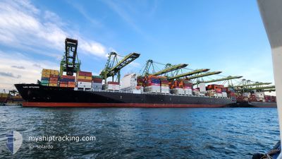
CAPE ARTEMISIO
Cargo
Current Trip
| Time Travelled | 1 day |
|---|---|
| Remaining Time | 18 days |
| Distance Travelled | 501.62 nm |
| Remaining Distance | 8503.48 nm |
| AVG Speed | 14.9 Knots |
| MAX Speed | 20.8 Knots |
| AVG Wind | 8.3 knots |
| MAX Wind | 15.8 knots |
| MIN Temp | 25.4°C / 77.72°F |
| MAX Temp | 29.9°C / 85.82°F |
| Dybgang | 14.4 m |
| Position Modtaget | 1 d siden |
Current Position
| Longitude | 103.39036° |
|---|---|
| Latitude | 1.24952° |
| Status | Under way using engine |
| Fart | 18.7 Knots |
| Kurs | 306.6° |
| Område | Malacca Strait |
| Station | T-AIS |
| Position Modtaget | 1 d siden |
Info
Information
The current position of CAPE ARTEMISIO is in Malacca Strait with coordinates 1.24952° / 103.39036° as reported on 2024-09-15 19:55 by AIS to our vessel tracker app. The vessel's current speed is 18.7 Knots and is heading at the port of SANTOS. The estimated time of arrival as calculated by MyShipTracking vessel tracking app is 2024-10-05 06:45 LT
The vessel CAPE ARTEMISIO (IMO: 9777175, MMSI: 248140000) is a Cargo It's sailing under the flag of [MT] Malta.
In this page you can find informations about the vessels current position, last detected port calls, and current voyage information. If the vessels is not in coverage by AIS you will find the latest position.
The current position of CAPE ARTEMISIO is detected by our AIS receivers and we are not responsible for the reliability of the data. The last position was recorded while the vessel was in Coverage by the Ais receivers of our vessel tracking app.
The current draught of CAPE ARTEMISIO as reported by AIS is 14.4 meters
Weather
| Temperature | 27.2°C / 80.96°F |
|---|---|
| Wind Speed | 25 knots |
| Direction | 254° WSW |
| Pressure | 1010.5 hPa |
| Humidity | 81.1 % |
| Cloud Coverage | 100 % |
Featured Company
Last Port Calls
| Port | Arrival | Departure | Time In Port |
|---|---|---|---|
| 2024-09-13 23:57 | 2024-09-15 17:15 | 1 d | |
| 2024-09-09 20:04 | 2024-09-10 13:32 | 17 h | |
| 2024-08-25 14:12 | 2024-08-26 18:42 | 1 d | |
| 2024-07-30 00:10 | 2024-07-30 01:04 | 53 m | |
| 2024-07-27 02:40 | 2024-07-27 22:37 | 19 h | |
| 2024-07-22 15:50 | 2024-07-23 14:53 | 23 h | |
| 2024-07-18 12:58 | 2024-07-19 07:47 | 18 h | |
| 2024-07-12 04:28 | 2024-07-13 19:53 | 1 d | |
| 2024-07-10 21:57 | 2024-07-11 08:14 | 10 h | |
| 2024-07-07 01:12 | 2024-07-07 16:54 | 15 h |
Most Visited Ports (Last year)
| Port | Arrivals | |
|---|---|---|
| 8 | ||
| 7 | ||
| 7 | ||
| 6 | ||
| 4 | ||
| 3 |
Last Trips
| Origin | Departure | Destination | Arrival | Distance | |
|---|---|---|---|---|---|
| 2024-09-10 21:32 | 2024-09-14 07:57 | 1465.09 nm | |||
| 2024-08-27 02:42 | 2024-09-10 04:04 | 1828.50 nm | |||
| 2024-07-29 22:04 | 2024-08-25 22:12 | 10533.05 nm | |||
| 2024-07-27 19:37 | 2024-07-29 21:10 | 178.32 nm | |||
| 2024-07-23 11:53 | 2024-07-26 23:40 | 108.01 nm | |||
| 2024-07-19 04:47 | 2024-07-22 12:50 | 753.62 nm | |||
| 2024-07-13 16:53 | 2024-07-18 09:58 | 148.95 nm | |||
| 2024-07-11 05:14 | 2024-07-12 01:28 | 148.24 nm | |||
| 2024-07-07 13:54 | 2024-07-10 18:57 | 792.25 nm | |||
| 2024-07-02 16:41 | 2024-07-06 22:12 | 188.14 nm |
Events
| Tid | Hændelsen | Detaljer | Position / Dest | Info |
|---|---|---|---|---|
| 2024-09-15 20:01 | Status er ændret | Default Under way using engine |
1.26805 / 103.36472
BRSSZ
|
Fart: 18.7 kn Kurs: 306.6° |
| 2024-09-15 19:55 | Udenfor Dækning |
1.24952 / 103.39036
Malacca Strait
BRSSZ
|
Fart: 18.7 kn Kurs: 306.6° |
|
| 2024-09-15 19:53 | Ændre havområde | Malaysian part of the Malacca Strait Malaysian part of the Singapore Strait |
1.24311 / 103.39916
Malacca Strait
BRSSZ
|
Fart: 18.6 kn Kurs: 303.7° |
| 2024-09-15 19:49 | Status er ændret | Under way using engine Default |
1.23403 / 103.41361
BRSSZ
|
Fart: 18.4 kn Kurs: 288° |
| 2024-09-15 19:45 | Status er ændret | Default Under way using engine |
1.22517 / 103.43494
BRSSZ
|
Fart: 18.1 kn Kurs: 283.9° |
| 2024-09-15 19:16 | Ændre havområde | Malaysian part of the Singapore Strait Indonesian part of the Singapore Strait |
1.18839 / 103.57068
Singapore Strait
BRSSZ
|
Fart: 15.6 kn Kurs: 282.7° |
| 2024-09-15 18:35 | Ændre havområde | Indonesian part of the Singapore Strait Singaporean part of the Singapore Strait |
1.14472 / 103.71640
Singapore Strait
BRSSZ
|
Fart: 13 kn Kurs: 295.2° |
| 2024-09-15 17:15 | Afsejlet fra sidste havn |
|
1.25985 / 103.77294
BRSSZ
|
Fart: 6.3 kn Kurs: 204° |
| 2024-09-15 17:09 | START Sejllads |
1.26839 / 103.77584
[SG] SINGAPORE
|
Fart: 3.1 kn Kurs: 215° |
|
| 2024-09-15 16:30 | Status er ændret | Under way using engine Moored |
1.27718 / 103.77617
[SG] SINGAPORE
|
Fart: Kurs: 31° |