
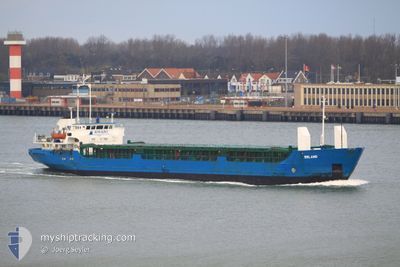
RANIA QUEEN
General Cargo
Current Trip
| Time Travelled | 1 day |
|---|---|
| Remaining Time | --- |
| Distance Travelled | 449.29 nm |
| Remaining Distance | --- |
| AVG Speed | 40.2 Knots |
| MAX Speed | 40.2 Knots |
| AVG Wind | 7.6 knots |
| MAX Wind | 12 knots |
| MIN Temp | 18.7°C / 65.66°F |
| MAX Temp | 26°C / 78.8°F |
| Draught | 4.6 m |
| Position Received | 3 h, 54 m ago |
Current Position
| Longitude | 34.25428° |
|---|---|
| Latitude | 33.02728° |
| Status | Moored |
| Speed | 58.5 Knots |
| Course | 276° |
| Area | Mediterranean Sea - Eastern Basin |
| Station | T-AIS |
| Position Received | 3 h, 54 m ago |
Info
Information
The current position of RANIA QUEEN is in Mediterranean Sea - Eastern Basin with coordinates 33.02728° / 34.25428° as reported on 2024-06-02 10:20 by AIS to our vessel tracker app. The vessel's current speed is 58.5 Knots
The vessel RANIA QUEEN (IMO: 8406779, MMSI: 667001589) is a General Cargo that was built in 1985 ( 39 years old ). It's sailing under the flag of [SL] Sierra Leone.
In this page you can find informations about the vessels current position, last detected port calls, and current voyage information. If the vessels is not in coverage by AIS you will find the latest position.
The current position of RANIA QUEEN is detected by our AIS receivers and we are not responsible for the reliability of the data. The last position was recorded while the vessel was in Coverage by the Ais receivers of our vessel tracking app.
The current draught of RANIA QUEEN as reported by AIS is 4.6 meters
Weather
| Temperature | 23.8°C / 74.84°F |
|---|---|
| Wind Speed | 11 knots |
| Direction | 17° NNE |
| Pressure | 1013.4 hPa |
| Humidity | 81.4 % |
| Cloud Coverage | --- |
Featured Company
Last Port Calls
| Port | Arrival | Departure | Time In Port |
|---|---|---|---|
| 2024-05-23 05:58 | 2024-05-31 23:26 | 8 d | |
| 2024-05-19 22:50 | 2024-05-20 11:33 | 12 h | |
| 2024-05-19 02:36 | 2024-05-19 22:42 | 20 h | |
| 2024-05-18 22:53 | 2024-05-19 02:31 | 3 h | |
| 2024-05-16 12:28 | 2024-05-18 22:46 | 2 d | |
| 2024-05-06 07:39 | |||
| 2024-05-03 20:07 | 2024-05-06 07:34 | 2 d | |
| 2024-05-02 18:12 | 2024-05-03 19:59 | 1 d | |
| 2024-04-22 21:36 | 2024-04-25 06:20 | 2 d | |
| 2024-04-15 14:20 | 2024-04-16 22:59 | 1 d |
Most Visited Ports (Last year)
| Port | Arrivals | |
|---|---|---|
| 4 | ||
| 3 | ||
| 2 | ||
| 2 | ||
| 1 | ||
| 1 |
Last Trips
| Origin | Departure | Destination | Arrival | Distance | |
|---|---|---|---|---|---|
| 2024-05-20 13:33 | 2024-05-23 08:58 | 556.82 nm | |||
| 2024-05-20 00:42 | 2024-05-20 00:50 | 0.91 nm | |||
| 2024-05-19 04:31 | 2024-05-19 04:36 | 4.60 nm | |||
| 2024-05-19 00:46 | 2024-05-19 00:53 | 1.10 nm | |||
| 2024-05-06 10:34 | 2024-05-06 10:39 | 0.54 nm | |||
| 2024-05-03 22:59 | 2024-05-03 23:07 | 3.17 nm | |||
| 2024-04-25 09:20 | 2024-05-02 21:12 | 1170.85 nm | |||
| 2024-04-17 01:59 | 2024-04-23 00:36 | 390.61 nm | |||
| 2024-04-10 15:35 | 2024-04-15 17:20 | 1095.05 nm | |||
| 2024-04-02 12:58 | 2024-04-02 18:38 | 49.47 nm |
Events
| Time | Event | Details | Position / Dest | Info |
|---|---|---|---|---|
| 2024-06-02 10:20 | OUT of Coverage |
33.02728 / 34.25428
Mediterranean Sea - Eastern Basin
EGDAM
|
Speed: 58.5 kn Course: 276° |
|
| 2024-06-02 09:58 | Change Sea Area | Israeli part of the Mediterranean Sea - Eastern Basin Lebanese part of the Mediterranean Sea - Eastern Basin |
33.25518 / 34.48808
Mediterranean Sea - Eastern Basin
EGDAM
|
Speed: 58 kn Course: 162° |
| 2024-06-02 09:47 | Change Sea Area | Lebanese part of the Mediterranean Sea - Eastern Basin Israeli part of the Mediterranean Sea - Eastern Basin |
33.37662 / 34.34637
Mediterranean Sea - Eastern Basin
EGDAM
|
Speed: 58.3 kn Course: 107° |
| 2024-06-02 08:47 | Change Sea Area | Israeli part of the Mediterranean Sea - Eastern Basin Lebanese part of the Mediterranean Sea - Eastern Basin |
33.26862 / 34.48477
Mediterranean Sea - Eastern Basin
EGDAM
|
Speed: 58.2 kn Course: 157° |
| 2024-06-02 08:31 | Change Sea Area | Lebanese part of the Mediterranean Sea - Eastern Basin Israeli part of the Mediterranean Sea - Eastern Basin |
33.38028 / 34.23344
Mediterranean Sea - Eastern Basin
EGDAM
|
Speed: 58.4 kn Course: 75° |
| 2024-06-02 08:28 | Change Sea Area | Israeli part of the Mediterranean Sea - Eastern Basin Cypriote part of the Mediterranean Sea - Eastern Basin |
33.36443 / 34.18271
Mediterranean Sea - Eastern Basin
EGDAM
|
Speed: 58.3 kn Course: 60° |
| 2024-06-02 08:26 | IN Coverage |
33.36443 / 34.18271
Mediterranean Sea - Eastern Basin
EGDAM
|
Speed: 58.3 kn Course: 60° |
|
| 2024-06-02 07:23 | OUT of Coverage |
33.81833 / 35.49080
Mediterranean Sea - Eastern Basin
EGDAM
|
Speed: Course: 191° |
|
| 2024-06-02 04:49 | STOP Moving | 6.14 nm, South of BEIRUT |
33.81826 / 35.49080
EGDAM
|
Speed: Course: 205° |
| 2024-06-02 04:44 | START Moving | 6.35 nm, South of BEIRUT |
33.81508 / 35.48907
EGDAM
|
Speed: 6.4 kn Course: 205° |