
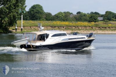
GUUSJE
Pleasure Craft
Current Trip
Current Position
| Longitude | 5.11165° |
|---|---|
| Latitude | 51.78662° |
| Status | Default |
| Speed | |
| Course | --- |
| Area | North Sea |
| Station | T-AIS |
| Position Received | 12 m ago |
Info
Information
The current position of GUUSJE is in North Sea with coordinates 51.78662° / 5.11165° as reported on 2024-06-12 01:50 by AIS to our vessel tracker app. The vessel's current speed is 0 Knots and is currently inside the port of AALST.
The vessel GUUSJE (MMSI: 244130463) is a Pleasure Craft It's sailing under the flag of [NL] Netherlands.
In this page you can find informations about the vessels current position, last detected port calls, and current voyage information. If the vessels is not in coverage by AIS you will find the latest position.
The current position of GUUSJE is detected by our AIS receivers and we are not responsible for the reliability of the data. The last position was recorded while the vessel was in Coverage by the Ais receivers of our vessel tracking app.
Weather
| Temperature | 8.6°C / 47.48°F |
|---|---|
| Wind Speed | 5 knots |
| Direction | 287° WNW |
| Pressure | 1018.3 hPa |
| Humidity | 95.9 % |
| Cloud Coverage | 100 % |
Featured Company
Last Port Calls
| Port | Arrival | Departure | Time In Port |
|---|---|---|---|
| 2024-06-07 01:57 | |||
| 2024-06-06 01:00 | 2024-06-07 00:48 | 23 h | |
| 2024-06-03 10:54 | 2024-06-06 00:52 | 2 d | |
| 2024-06-01 09:41 | 2024-06-03 10:51 | 2 d | |
| 2024-05-29 11:12 | 2024-06-01 09:33 | 2 d | |
| 2024-05-27 23:27 | 2024-05-29 10:21 | 1 d | |
| 2024-05-24 20:03 | 2024-05-27 23:25 | 3 d | |
| 2024-05-23 09:17 | 2024-05-24 19:33 | 1 d | |
| 2024-05-20 22:30 | 2024-05-23 09:14 | 2 d | |
| 2024-05-20 17:20 | 2024-05-20 22:21 | 5 h |
Most Visited Ports (Last year)
| Port | Arrivals | |
|---|---|---|
| 33 | ||
| 2 | ||
| 2 | ||
| 2 | ||
| 1 | ||
| 1 |
Last Trips
| Origin | Departure | Destination | Arrival | Distance | |
|---|---|---|---|---|---|
| 2024-06-07 00:48 | 2024-06-07 01:57 | 0.24 nm | |||
| 2024-06-06 00:52 | 2024-06-06 01:00 | --- | |||
| 2024-06-03 10:51 | 2024-06-03 10:54 | 3.28 nm | |||
| 2024-06-01 09:33 | 2024-06-01 09:41 | 0.49 nm | |||
| 2024-05-29 10:21 | 2024-05-29 11:12 | 7.65 nm | |||
| 2024-05-27 23:25 | 2024-05-27 23:27 | 0.50 nm | |||
| 2024-05-24 19:33 | 2024-05-24 20:03 | 10.75 nm | |||
| 2024-05-23 09:14 | 2024-05-23 09:17 | 0.11 nm | |||
| 2024-05-20 22:21 | 2024-05-20 22:30 | 1.21 nm | |||
| 2024-05-20 12:12 | 2024-05-20 17:20 | 17.15 nm |
Events
| Time | Event | Details | Position / Dest | Info |
|---|---|---|---|---|
| 2024-06-11 17:47 | IN Coverage |
51.78661 / 5.11166
North Sea
[NL] AALST
|
Speed: Course: 2.2° |
|
| 2024-06-11 16:09 | OUT of Coverage |
51.78664 / 5.11157
North Sea
[NL] AALST
|
Speed: Course: 134.7° |
|
| 2024-06-11 13:17 | IN Coverage |
51.78669 / 5.11163
North Sea
[NL] AALST
|
Speed: Course: 313.4° |
|
| 2024-06-11 12:08 | OUT of Coverage |
51.78663 / 5.11174
North Sea
[NL] AALST
|
Speed: Course: 313.4° |
|
| 2024-06-10 08:19 | IN Coverage |
51.78642 / 5.11195
North Sea
[NL] AALST
|
Speed: Course: 122.6° |
|
| 2024-06-10 06:58 | OUT of Coverage |
51.78668 / 5.11164
North Sea
[NL] AALST
|
Speed: Course: 351.8° |
|
| 2024-06-10 03:49 | IN Coverage |
51.78662 / 5.11164
North Sea
[NL] AALST
|
Speed: Course: 351.8° |
|
| 2024-06-10 02:42 | OUT of Coverage |
51.78661 / 5.11162
North Sea
[NL] AALST
|
Speed: Course: 94° |
|
| 2024-06-09 03:41 | IN Coverage |
51.78684 / 5.11159
North Sea
[NL] AALST
|
Speed: Course: 11.8° |
|
| 2024-06-09 02:30 | OUT of Coverage |
51.78665 / 5.11155
North Sea
[NL] AALST
|
Speed: Course: 286.5° |