
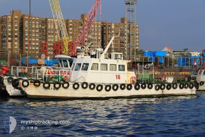
YUNG TONG NO 16
Pilot Vessel
Current Trip
| Trip Time | 15 mins |
|---|---|
| Trip Distance | 2.20 nm |
| AVG Speed | 10.7 Knots |
| MAX Speed | 11.3 Knots |
| Draught | 0 m |
| AVG Wind | 7 knots |
| MAX Wind | 7 knots |
| MIN Temp | 22.5°C / 72.5°F |
| MAX Temp | 22.5°C / 72.5°F |
| Position Received | 4 h, 31 m ago |
Current Position
| Longitude | --- |
|---|---|
| Latitude | --- |
| Status | Default |
| Speed | 10.3 Knots |
| Course | 145.6° |
| Area | South China Sea |
| Station | T-AIS |
| Position Received | 4 h, 31 m ago |
Info
Information
The current position of YUNG TONG NO 16 is in South China Sea with coordinates 22.58647° / 120.29550° as reported on 2025-12-07 11:17 by AIS to our vessel tracker app. The vessel's current speed is 10.3 Knots and is currently inside the port of KAOHSIUNG.
The vessel YUNG TONG NO 16 (MMSI: 416002703) is a Pilot Vessel It's sailing under the flag of [TW] Taiwan.
In this page you can find informations about the vessels current position, last detected port calls, and current voyage information. If the vessels is not in coverage by AIS you will find the latest position.
The current position of YUNG TONG NO 16 is detected by our AIS receivers and we are not responsible for the reliability of the data. The last position was recorded while the vessel was in Coverage by the Ais receivers of our vessel tracking app.
Weather
| Temperature | 23.3°C / 73.94°F |
|---|---|
| Wind Speed | 4 knots |
| Direction | 346° NNW |
| Pressure | 1018.3 hPa |
| Humidity | 72 % |
| Cloud Coverage | 45 % |
Featured Company
Last Port Calls
| Port | Arrival | Departure | Time In Port |
|---|---|---|---|
| 2025-12-06 15:02 | |||
| 2025-12-06 12:27 | 2025-12-06 14:47 | 2 h | |
| 2025-12-06 06:51 | 2025-12-06 11:35 | 4 h | |
| 2025-12-05 18:39 | 2025-12-06 06:26 | 11 h | |
| 2025-12-05 16:15 | 2025-12-05 18:16 | 2 h | |
| 2025-12-04 17:06 | 2025-12-05 15:24 | 22 h | |
| 2025-12-04 10:18 | 2025-12-04 16:06 | 5 h | |
| 2025-12-03 15:12 | 2025-12-04 09:05 | 17 h | |
| 2025-12-03 12:08 | 2025-12-03 14:36 | 2 h | |
| 2025-12-03 11:20 | 2025-12-03 11:49 | 28 m |
Most Visited Ports (Last year)
| Port | Arrivals | |
|---|---|---|
| 76 |
Last Trips
| Origin | Departure | Destination | Arrival | Distance | |
|---|---|---|---|---|---|
| 2025-12-06 14:47 | 2025-12-06 15:02 | 2.20 nm | |||
| 2025-12-06 11:35 | 2025-12-06 12:27 | 7.35 nm | |||
| 2025-12-06 06:26 | 2025-12-06 06:51 | 3.73 nm | |||
| 2025-12-05 18:16 | 2025-12-05 18:39 | 3.39 nm | |||
| 2025-12-05 15:24 | 2025-12-05 16:15 | 7.51 nm | |||
| 2025-12-04 16:06 | 2025-12-04 17:06 | 8.51 nm | |||
| 2025-12-04 09:05 | 2025-12-04 10:18 | 9.16 nm | |||
| 2025-12-03 14:36 | 2025-12-03 15:12 | 5.57 nm | |||
| 2025-12-03 11:49 | 2025-12-03 12:08 | 3.01 nm | |||
| 2025-12-03 04:43 | 2025-12-03 11:20 | 7.16 nm |
Events
| Time | Event | Details | Position / Dest | Info |
|---|---|---|---|---|
| 2025-12-07 11:17 | OUT of Coverage |
22.58647 / 120.29550
South China Sea
[TW] KAOHSIUNG
|
Speed: 10.3 kn Course: 145.6° |
|
| 2025-12-07 11:03 | START Moving |
22.61373 / 120.27330
[TW] KAOHSIUNG
|
Speed: 10 kn Course: 119.6° |
|
| 2025-12-07 10:40 | STOP Moving |
22.61699 / 120.26767
[TW] KAOHSIUNG
|
Speed: 0.2 kn Course: 511° |
|
| 2025-12-07 10:13 | IN Coverage |
22.58556 / 120.30144
South China Sea
[TW] KAOHSIUNG
|
Speed: 1.9 kn Course: 315.8° |
|
| 2025-12-07 07:25 | OUT of Coverage |
22.58563 / 120.30161
South China Sea
[TW] KAOHSIUNG
|
Speed: 4.9 kn Course: 40.7° |
|
| 2025-12-07 06:35 | START Moving |
22.60855 / 120.28158
[TW] KAOHSIUNG
|
Speed: 9.4 kn Course: 318.5° |
|
| 2025-12-07 05:27 | STOP Moving |
22.60649 / 120.28402
[TW] KAOHSIUNG
|
Speed: 0.1 kn Course: 511° |
|
| 2025-12-07 03:58 | IN Coverage |
22.58693 / 120.29531
South China Sea
[TW] KAOHSIUNG
|
Speed: 10 kn Course: 324.3° |
|
| 2025-12-07 02:22 | OUT of Coverage |
22.58791 / 120.29454
South China Sea
[TW] KAOHSIUNG
|
Speed: 10.1 kn Course: 153.5° |
|
| 2025-12-07 01:19 | START Moving |
22.60859 / 120.28055
[TW] KAOHSIUNG
|
Speed: 9.2 kn Course: 297° |