
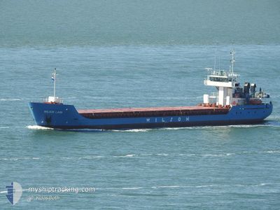
WILSON LAHN
General Cargo
Current Trip
| Time Travelled | 9 h, 25 mins |
|---|---|
| Remaining Time | 2 h, 21 mins |
| Distance Travelled | 88.18 nm |
| Remaining Distance | 21.93 nm |
| AVG Speed | 9.2 Knots |
| MAX Speed | 12.7 Knots |
| AVG Wind | 21.5 knots |
| MAX Wind | 23.9 knots |
| MIN Temp | 5.2°C / 41.36°F |
| MAX Temp | 7.4°C / 45.32°F |
| Draught | 3.1 m |
| Position Received | Now |
Current Position
| Longitude | -0.60178° |
|---|---|
| Latitude | 54.56127° |
| Status | Under way using engine |
| Speed | 8.6 Knots |
| Course | 318.9° |
| Area | North Sea |
| Station | T-AIS |
| Position Received | Now |
Info
Information
The current position of WILSON LAHN is in North Sea with coordinates 54.56127° / -0.60178° as reported on 2024-04-24 03:12 by AIS to our vessel tracker app. The vessel's current speed is 8.6 Knots and is heading at the port of TEES. The estimated time of arrival as calculated by MyShipTracking vessel tracking app is 2024-04-24 05:34 LT
The vessel WILSON LAHN (IMO: 9198458, MMSI: 314259000) is a General Cargo that was built in 2001 ( 23 years old ). It's sailing under the flag of [BB] Barbados.
In this page you can find informations about the vessels current position, last detected port calls, and current voyage information. If the vessels is not in coverage by AIS you will find the latest position.
The current position of WILSON LAHN is detected by our AIS receivers and we are not responsible for the reliability of the data. The last position was recorded while the vessel was in Coverage by the Ais receivers of our vessel tracking app.
The current draught of WILSON LAHN as reported by AIS is 3.1 meters
Weather
| Temperature | 5.2°C / 41.36°F |
|---|---|
| Wind Speed | 20 knots |
| Direction | 349° N |
| Pressure | 1019.1 hPa |
| Humidity | 74.8 % |
| Cloud Coverage | 100 % |
Featured Company
Last Port Calls
| Port | Arrival | Departure | Time In Port |
|---|---|---|---|
| 2024-04-22 10:16 | 2024-04-23 17:48 | 1 d | |
| 2024-04-19 19:36 | 2024-04-21 05:42 | 1 d | |
| 2024-04-17 22:47 | 2024-04-19 17:28 | 1 d | |
| 2024-04-06 03:03 | 2024-04-06 11:42 | 8 h | |
| 2024-03-30 18:09 | 2024-04-03 19:44 | 4 d | |
| 2024-03-26 06:06 | 2024-03-26 15:04 | 8 h | |
| 2024-03-20 19:36 | 2024-03-22 11:40 | 1 d | |
| 2024-03-20 18:32 | 2024-03-20 18:59 | 26 m | |
| 2024-03-19 04:52 | 2024-03-19 16:48 | 11 h | |
| 2024-03-12 07:27 |
Last Trips
| Origin | Departure | Destination | Arrival | Distance | |
|---|---|---|---|---|---|
| 2024-04-21 07:42 | 2024-04-22 11:16 | 235.21 nm | |||
| 2024-04-19 19:28 | 2024-04-19 21:36 | 22.37 nm | |||
| 2024-04-06 13:42 | 2024-04-18 00:47 | 2101.03 nm | |||
| 2024-04-03 21:44 | 2024-04-06 05:03 | 609.63 nm | |||
| 2024-03-26 16:04 | 2024-03-30 19:09 | 493.91 nm | |||
| 2024-03-22 12:40 | 2024-03-26 07:06 | 113.15 nm | |||
| 2024-03-20 19:59 | 2024-03-20 20:36 | 5.54 nm | |||
| 2024-03-19 17:48 | 2024-03-20 19:32 | 283.00 nm | |||
| 2024-03-12 07:27 | 2024-03-19 05:52 | 1003.55 nm | |||
| 2024-02-27 21:09 | 2024-03-01 17:47 | 672.23 nm |
Events
| Time | Event | Details | Position / Dest | Info |
|---|---|---|---|---|
| 2024-04-24 02:32 | Status Changed | Under way using engine Default |
54.49302 / -.49004
GBTEE
|
Speed: 8 kn Course: 330° |
| 2024-04-24 02:32 | IN Coverage |
54.49502 / -.49301
North Sea
GBTEE
|
Speed: 8.2 kn Course: 318.7° |
|
| 2024-04-23 23:49 | Status Changed | Default Under way using engine |
54.19780 / -.11307
GBTEE
|
Speed: 9.7 kn Course: 321.8° |
| 2024-04-23 23:44 | Status Changed | Under way using engine Default |
54.18843 / -.10016
GBTEE
|
Speed: 10 kn Course: 316° |
| 2024-04-23 23:44 | OUT of Coverage |
54.18843 / -.10016
North Sea
GBTEE
|
Speed: 9.7 kn Course: 321.8° |
|
| 2024-04-23 23:39 | Status Changed | Default Under way using engine |
54.17688 / -.08347
GBTEE
|
Speed: 9.8 kn Course: 317.6° |
| 2024-04-23 20:42 | Status Changed | Under way using engine Default |
53.77551 / .33665
GBTEE
|
Speed: 10.2 kn Course: 347° |
| 2024-04-23 20:25 | IN Coverage |
53.77551 / .33665
North Sea
GBTEE
|
Speed: 10.1 kn Course: 346.7° |
|
| 2024-04-23 19:08 | Status Changed | Default Under way using engine |
53.54273 / .24554
GBTEE
|
Speed: 11 kn Course: 89.3° |
| 2024-04-23 19:00 | OUT of Coverage |
53.54171 / .20433
North Sea
GBTEE
|
Speed: 11 kn Course: 89.3° |