
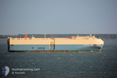
TRANQUIL ACE
Vehicles Carrier
Current Trip
| Time Travelled | 2 days |
|---|---|
| Remaining Time | --- |
| Distance Travelled | 1087.51 nm |
| Remaining Distance | --- |
| AVG Speed | 16.4 Knots |
| MAX Speed | 21.3 Knots |
| AVG Wind | 17.1 knots |
| MAX Wind | 24.8 knots |
| MIN Temp | 15.4°C / 59.72°F |
| MAX Temp | 26.2°C / 79.16°F |
| Draught | 8.7 m |
| Position Received | 1 m ago |
Current Position
| Longitude | 137.00755° |
|---|---|
| Latitude | 34.56025° |
| Status | Under way using engine |
| Speed | 12.9 Knots |
| Course | 312° |
| Area | Philippine Sea |
| Station | T-AIS |
| Position Received | 1 m ago |
Info
Information
The current position of TRANQUIL ACE is in Philippine Sea with coordinates 34.56025° / 137.00755° as reported on 2024-04-19 19:56 by AIS to our vessel tracker app. The vessel's current speed is 12.9 Knots and is heading at the port of MIKAWA. The estimated time of arrival as calculated by MyShipTracking vessel tracking app is 2024-04-19 19:40 LT
The vessel TRANQUIL ACE (IMO: 9561253, MMSI: 353943000) is a Vehicles Carrier that was built in 2009 ( 15 years old ). It's sailing under the flag of [PA] Panama.
In this page you can find informations about the vessels current position, last detected port calls, and current voyage information. If the vessels is not in coverage by AIS you will find the latest position.
The current position of TRANQUIL ACE is detected by our AIS receivers and we are not responsible for the reliability of the data. The last position was recorded while the vessel was in Coverage by the Ais receivers of our vessel tracking app.
The current draught of TRANQUIL ACE as reported by AIS is 8.7 meters
Weather
| Temperature | 15.6°C / 60.08°F |
|---|---|
| Wind Speed | 11 knots |
| Direction | 327° NNW |
| Pressure | 1012.5 hPa |
| Humidity | 63.1 % |
| Cloud Coverage | 5 % |
Featured Company
Last Port Calls
| Port | Arrival | Departure | Time In Port |
|---|---|---|---|
| 2024-04-16 23:11 | 2024-04-17 07:24 | 8 h | |
| 2024-04-12 06:27 | 2024-04-12 19:53 | 13 h | |
| 2024-03-29 10:37 | 2024-03-30 07:44 | 21 h | |
| 2024-03-27 05:45 | 2024-03-27 21:50 | 16 h | |
| 2024-03-15 10:45 | 2024-03-16 03:41 | 16 h | |
| 2024-03-01 09:11 | 2024-03-03 01:46 | 1 d | |
| 2024-02-29 00:07 | 2024-02-29 20:13 | 20 h | |
| 2024-02-26 09:05 | 2024-02-26 22:11 | 13 h | |
| 2024-02-20 18:05 | 2024-02-21 00:25 | 6 h | |
| 2024-02-15 11:40 | 2024-02-15 13:46 | 2 h |
Last Trips
| Origin | Departure | Destination | Arrival | Distance | |
|---|---|---|---|---|---|
| 2024-04-13 03:53 | 2024-04-17 07:11 | 1723.94 nm | |||
| 2024-03-30 09:44 | 2024-04-12 14:27 | 4920.99 nm | |||
| 2024-03-27 23:50 | 2024-03-29 12:37 | 310.31 nm | |||
| 2024-03-16 00:41 | 2024-03-27 07:45 | 4188.01 nm | |||
| 2024-03-02 20:46 | 2024-03-15 07:45 | 4923.52 nm | |||
| 2024-02-29 15:13 | 2024-03-01 04:11 | 162.83 nm | |||
| 2024-02-26 17:11 | 2024-02-28 19:07 | 569.13 nm | |||
| 2024-02-20 19:25 | 2024-02-26 04:05 | 1640.29 nm | |||
| 2024-02-15 09:46 | 2024-02-20 13:05 | 1151.82 nm | |||
| 2024-02-14 14:56 | 2024-02-15 07:40 | 79.37 nm |
Events
| Time | Event | Details | Position / Dest | Info |
|---|---|---|---|---|
| 2024-04-19 19:36 | Destination Changed | JP MKW JP THS |
34.49777 / 137.05468
JP MKW
|
Speed: 11.6 kn Course: 345° |
| 2024-04-19 18:14 | ETA Changed | 2024/04/19 19:40 2024/04/19 18:30 |
34.26258 / 137.05222
JP THS
|
Speed: 12.6 kn Course: 3° |
| 2024-04-19 18:09 | Status Changed | Under way using engine Default |
34.24623 / 137.05140
JP THS
|
Speed: 12.5 kn Course: 1° |
| 2024-04-19 18:08 | Status Changed | Default Under way using engine |
34.24332 / 137.05135
JP THS
|
Speed: 12.4 kn Course: 1° |
| 2024-04-19 17:58 | Change Sea Area | Japanese part of the Philippine Sea Taiwanese part of the Eastern China Sea |
34.20715 / 137.04955
Philippine Sea
JP THS
|
Speed: 12.4 kn Course: 14° |
| 2024-04-19 17:56 | Status Changed | Under way using engine Default |
34.20213 / 137.04767
JP THS
|
Speed: 12.4 kn Course: 31° |
| 2024-04-19 17:56 | IN Coverage |
34.20715 / 137.04955
Philippine Sea
JP THS
|
Speed: 12.4 kn Course: 14° |
|
| 2024-04-17 15:26 | Status Changed | Default Under way using engine |
26.27173 / 122.22726
JP THS
|
Speed: 19.5 kn Course: 61° |
| 2024-04-17 15:17 | OUT of Coverage |
26.24498 / 122.17988
Eastern China Sea
JP THS
|
Speed: 19.5 kn Course: 61° |
|
| 2024-04-17 14:46 | Status Changed | Under way using engine Default |
26.15632 / 122.02800
JP THS
|
Speed: 19 kn Course: 60° |