
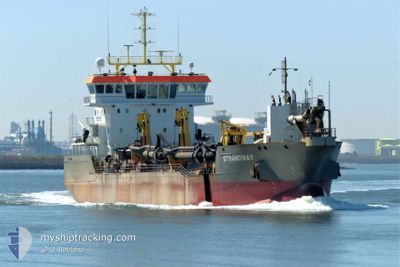
STRANDWAY
Trailing Suction Hopper Dredger
Current Trip
| Time Travelled | 1 day |
|---|---|
| Remaining Time | -2 mins |
| Distance Travelled | 202.83 nm |
| Remaining Distance | 2.09 nm |
| AVG Speed | 8.2 Knots |
| MAX Speed | 14.9 Knots |
| AVG Wind | 20.1 knots |
| MAX Wind | 29.3 knots |
| MIN Temp | 10.5°C / 50.9°F |
| MAX Temp | 12.3°C / 54.14°F |
| Draught | 4 m |
| Position Received | 2 m ago |
Current Position
| Longitude | --- |
|---|---|
| Latitude | --- |
| Status | Restricted manoeuverability |
| Speed | 9.7 Knots |
| Course | 115.3° |
| Area | North Sea |
| Station | T-AIS |
| Position Received | 2 m ago |
Info
Information
The current position of STRANDWAY is in North Sea with coordinates 51.97348° / 4.12176° as reported on 2025-12-09 04:23 by AIS to our vessel tracker app. The vessel's current speed is 9.7 Knots and is heading at the port of ROTTERDAM. The estimated time of arrival as calculated by MyShipTracking vessel tracking app is 2025-12-09 05:23 LT
The vessel STRANDWAY (IMO: 9664457, MMSI: 212396000) is a Trailing Suction Hopper Dredger that was built in 2014 ( 11 years old ). It's sailing under the flag of [CY] Cyprus.
In this page you can find informations about the vessels current position, last detected port calls, and current voyage information. If the vessels is not in coverage by AIS you will find the latest position.
The current position of STRANDWAY is detected by our AIS receivers and we are not responsible for the reliability of the data. The last position was recorded while the vessel was in Coverage by the Ais receivers of our vessel tracking app.
The current draught of STRANDWAY as reported by AIS is 4 meters
Weather
| Temperature | 10.9°C / 51.62°F |
|---|---|
| Wind Speed | 14 knots |
| Direction | 186° S |
| Pressure | 1011.1 hPa |
| Humidity | 94.5 % |
| Cloud Coverage | 100 % |
Featured Company
Last Port Calls
| Port | Arrival | Departure | Time In Port |
|---|---|---|---|
| 2025-12-07 22:23 | 2025-12-07 22:31 | 8 m | |
| 2025-12-07 22:12 | 2025-12-07 22:18 | 6 m | |
| 2025-12-07 01:24 | 2025-12-07 01:30 | 5 m | |
| 2025-12-06 18:20 | 2025-12-06 18:29 | 8 m | |
| 2025-12-06 00:05 | 2025-12-06 00:08 | 3 m | |
| 2025-12-05 15:02 | 2025-12-05 15:13 | 10 m | |
| 2025-12-05 03:20 | 2025-12-05 04:07 | 46 m | |
| 2025-12-05 02:18 | 2025-12-05 03:03 | 45 m | |
| 2025-12-05 01:13 | 2025-12-05 01:55 | 42 m | |
| 2025-12-05 00:02 | 2025-12-05 00:55 | 52 m |
Most Visited Ports (Last year)
| Port | Arrivals | |
|---|---|---|
| 302 | ||
| 158 | ||
| 112 | ||
| 38 | ||
| 32 | ||
| 23 |
Last Trips
| Origin | Departure | Destination | Arrival | Distance | |
|---|---|---|---|---|---|
| 2025-12-07 22:18 | 2025-12-07 22:23 | 0.32 nm | |||
| 2025-12-07 01:30 | 2025-12-07 22:12 | 142.39 nm | |||
| 2025-12-06 18:29 | 2025-12-07 01:24 | 51.35 nm | |||
| 2025-12-06 00:08 | 2025-12-06 18:20 | 131.67 nm | |||
| 2025-12-05 15:13 | 2025-12-06 00:05 | 66.41 nm | |||
| 2025-12-05 04:07 | 2025-12-05 15:02 | 96.29 nm | |||
| 2025-12-05 03:03 | 2025-12-05 03:20 | 1.65 nm | |||
| 2025-12-05 01:55 | 2025-12-05 02:18 | 1.25 nm | |||
| 2025-12-05 00:55 | 2025-12-05 01:13 | 2.11 nm | |||
| 2025-12-04 23:51 | 2025-12-05 00:02 | 1.73 nm |
Events
| Time | Event | Details | Position / Dest | Info |
|---|---|---|---|---|
| 2025-12-09 00:55 | START Moving | 1.18 nm, East of ROZENBURG |
51.90230 / 4.27740
ROTTERDAM
|
Speed: 9.3 kn Course: 292.2° |
| 2025-12-09 00:33 | STOP Moving | 1.3 nm, East of ROZENBURG |
51.90254 / 4.28048
ROTTERDAM
|
Speed: 0.3 kn Course: 102° |
| 2025-12-08 08:17 | START Moving | 0.95 nm, North East of MAASVLAKTE - ROTTERDAM |
51.96993 / 4.09109
ROTTERDAM
|
Speed: 3.2 kn Course: 39° |
| 2025-12-08 08:12 | STOP Moving | 1.02 nm, North East of MAASVLAKTE - ROTTERDAM |
51.97236 / 4.09080
ROTTERDAM
|
Speed: 0.2 kn Course: 166° |
| 2025-12-08 07:31 | START Moving | 1.19 nm, East of ROZENBURG |
51.90239 / 4.27769
ROTTERDAM
|
Speed: 5.8 kn Course: 285.9° |
| 2025-12-08 07:07 | STOP Moving | 1.3 nm, North of BOTLEK - ROTTERDAM |
51.90248 / 4.28088
ROTTERDAM
|
Speed: 0.3 kn Course: 108° |
| 2025-12-08 00:46 | START Moving | 7.06 nm, North West of MAASVLAKTE - ROTTERDAM |
52.06748 / 3.98592
ROTTERDAM
|
Speed: 7.7 kn Course: 230.5° |
| 2025-12-08 00:41 | STOP Moving | 7 nm, North West of MAASVLAKTE - ROTTERDAM |
52.06744 / 3.98905
ROTTERDAM
|
Speed: 0.3 kn Course: 250° |
| 2025-12-07 21:31 | PORT DEPARTURE |
|
51.95879 / 4.08159
ROTTERDAM
|
Speed: 2.5 kn Course: 64° |
| 2025-12-07 21:23 | PORT ARRIVAL |
|
51.96094 / 4.07955
[NL] MAASVLAKTE - ROTTERDAM
|
Speed: 3.5 kn Course: 248° |