
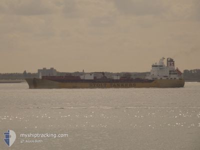
STOLT EFFORT
Oil/Chemical Tanker
Current Trip
| Time Travelled | 2 days |
|---|---|
| Remaining Time | --- |
| Distance Travelled | 392.36 nm |
| Remaining Distance | --- |
| AVG Speed | 11.5 Knots |
| MAX Speed | 16.4 Knots |
| AVG Wind | 9.1 knots |
| MAX Wind | 13.7 knots |
| MIN Temp | 11.4°C / 52.52°F |
| MAX Temp | 22.3°C / 72.14°F |
| Draught | 7.8 m |
| Position Received | 2 m ago |
Current Position
| Longitude | --- |
|---|---|
| Latitude | --- |
| Status | At anchor |
| Speed | 0.5 Knots |
| Course | 113° |
| Area | Gulf of Mexico |
| Station | T-AIS |
| Position Received | 2 m ago |
Info
Information
The current position of STOLT EFFORT is in Gulf of Mexico with coordinates 29.58514° / -93.22626° as reported on 2025-12-07 18:19 by AIS to our vessel tracker app. The vessel's current speed is 0.5 Knots
The vessel STOLT EFFORT (IMO: 9178202, MMSI: 319445000) is a Oil/Chemical Tanker that was built in 1999 ( 26 years old ). It's sailing under the flag of [KY] Cayman Is.
In this page you can find informations about the vessels current position, last detected port calls, and current voyage information. If the vessels is not in coverage by AIS you will find the latest position.
The current position of STOLT EFFORT is detected by our AIS receivers and we are not responsible for the reliability of the data. The last position was recorded while the vessel was in Coverage by the Ais receivers of our vessel tracking app.
The current draught of STOLT EFFORT as reported by AIS is 7.8 meters
Weather
| Temperature | 18.7°C / 65.66°F |
|---|---|
| Wind Speed | 9 knots |
| Direction | 104° ESE |
| Pressure | 1013.4 hPa |
| Humidity | 92 % |
| Cloud Coverage | 100 % |
Featured Company
Last Port Calls
| Port | Arrival | Departure | Time In Port |
|---|---|---|---|
| 2025-12-03 14:33 | 2025-12-05 10:03 | 1 d | |
| 2025-11-27 12:41 | 2025-11-29 11:44 | 1 d | |
| 2025-11-19 07:30 | 2025-11-20 04:34 | 21 h | |
| 2025-11-15 15:30 | 2025-11-17 15:18 | 1 d | |
| 2025-10-01 10:12 | 2025-10-03 08:16 | 1 d |
Most Visited Ports (Last year)
| Port | Arrivals | |
|---|---|---|
| 7 | ||
| 6 | ||
| 6 | ||
| 5 | ||
| 3 | ||
| 2 |
Last Trips
| Origin | Departure | Destination | Arrival | Distance | |
|---|---|---|---|---|---|
| 2025-11-29 11:44 | 2025-12-03 14:33 | 1342.42 nm | |||
| 2025-11-20 04:34 | 2025-11-27 12:41 | 1597.24 nm | |||
| 2025-11-17 15:18 | 2025-11-19 07:30 | 44.38 nm | |||
| 2025-10-03 08:16 | 2025-11-15 15:30 | 12775.89 nm | |||
| 2025-09-28 10:36 | 2025-10-01 10:12 | 446.21 nm |
Events
| Time | Event | Details | Position / Dest | Info |
|---|---|---|---|---|
| 2025-12-07 18:19 | Status Changed | At anchor Default |
29.58514 / -93.22626
USLCH
|
Speed: Course: 122° |
| 2025-12-07 18:13 | Status Changed | Default At anchor |
29.58538 / -93.22632
USLCH
|
Speed: Course: 118° |
| 2025-12-07 18:10 | Status Changed | At anchor Default |
29.58536 / -93.22633
USLCH
|
Speed: Course: 116° |
| 2025-12-07 18:07 | Status Changed | Default At anchor |
29.58534 / -93.22636
USLCH
|
Speed: Course: 121° |
| 2025-12-07 18:01 | Status Changed | At anchor Under way using engine |
29.58535 / -93.22631
USLCH
|
Speed: Course: 121° |
| 2025-12-07 17:31 | Status Changed | Under way using engine At anchor |
29.58528 / -93.22641
USLCH
|
Speed: 0.1 kn Course: 121° |
| 2025-12-07 17:23 | Status Changed | At anchor Default |
29.58541 / -93.22634
USLCH
|
Speed: Course: 111° |
| 2025-12-07 17:17 | Status Changed | Default At anchor |
29.58527 / -93.22639
USLCH
|
Speed: Course: 116° |
| 2025-12-07 16:53 | Status Changed | At anchor Default |
29.58524 / -93.22639
USLCH
|
Speed: Course: 113° |
| 2025-12-07 16:41 | Status Changed | Default At anchor |
29.58516 / -93.22643
USLCH
|
Speed: Course: 113° |