
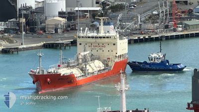
STELLA
Tanker
Current Trip
| Time Travelled | 14 h, 54 mins |
|---|---|
| Remaining Time | --- |
| Distance Travelled | 36.26 nm |
| Remaining Distance | --- |
| AVG Speed | 5.3 Knots |
| MAX Speed | 9.1 Knots |
| AVG Wind | 20 knots |
| MAX Wind | 24 knots |
| MIN Temp | 17.2°C / 62.96°F |
| MAX Temp | 22.9°C / 73.22°F |
| Draught | 6.4 m |
| Position Received | 5 h, 57 m ago |
Current Position
| Longitude | --- |
|---|---|
| Latitude | --- |
| Status | At anchor |
| Speed | 0.9 Knots |
| Course | 206° |
| Area | Tasman Sea |
| Station | T-AIS |
| Position Received | 5 h, 57 m ago |
Info
Information
The current position of STELLA is in Tasman Sea with coordinates -34.26590° / 151.04358° as reported on 2025-12-07 04:25 by AIS to our vessel tracker app. The vessel's current speed is 0.9 Knots
The vessel STELLA (IMO: 9959371, MMSI: 538011125) is a Tanker It's sailing under the flag of [MH] Marshall Is.
In this page you can find informations about the vessels current position, last detected port calls, and current voyage information. If the vessels is not in coverage by AIS you will find the latest position.
The current position of STELLA is detected by our AIS receivers and we are not responsible for the reliability of the data. The last position was recorded while the vessel was in Coverage by the Ais receivers of our vessel tracking app.
The current draught of STELLA as reported by AIS is 6.4 meters
Weather
| Temperature | 16.3°C / 61.34°F |
|---|---|
| Wind Speed | 6 knots |
| Direction | 86° E |
| Pressure | 1015.5 hPa |
| Humidity | 70.8 % |
| Cloud Coverage | 100 % |
Featured Company
Most Visited Ports (Last year)
| Port | Arrivals | |
|---|---|---|
| 12 | ||
| 11 | ||
| 6 | ||
| 2 | ||
| 1 |
Last Trips
Events
| Time | Event | Details | Position / Dest | Info |
|---|---|---|---|---|
| 2025-12-07 04:43 | STOP Moving | 11.47 nm, North East of WOLLONGONG |
-34.26527 / 151.04105
AU PKL
|
Speed: 0.1 kn Course: 130° |
| 2025-12-07 04:31 | Status Changed | Default At anchor |
-34.26333 / 151.04167
AU PKL
|
Speed: 0.9 kn Course: 206° |
| 2025-12-07 04:25 | Status Changed | At anchor Under way using engine |
-34.26590 / 151.04358
AU PKL
|
Speed: 1.9 kn Course: 197° |
| 2025-12-07 04:25 | OUT of Coverage |
-34.26590 / 151.04358
Tasman Sea
|
Speed: 0.9 kn Course: 327.9° |
|
| 2025-12-07 04:14 | Status Changed | Under way using engine Default |
-34.26407 / 151.05432
AU PKL
|
Speed: 5.2 kn Course: 274° |
| 2025-12-07 04:07 | Status Changed | Default Under way using engine |
-34.26229 / 151.06451
AU PKL
|
Speed: 6.2 kn Course: 253° |
| 2025-12-07 03:58 | Status Changed | Under way using engine Default |
-34.25892 / 151.08160
AU PKL
|
Speed: 6 kn Course: 253° |
| 2025-12-07 03:55 | Status Changed | Default Under way using engine |
-34.25667 / 151.08667
AU PKL
|
Speed: 6.8 kn Course: 302.4° |
| 2025-12-07 03:31 | Status Changed | Under way using engine Default |
-34.27508 / 151.13400
AU PKL
|
Speed: 6.7 kn Course: 322° |
| 2025-12-07 03:27 | Status Changed | Default Under way using engine |
-34.27949 / 151.14137
AU PKL
|
Speed: 7 kn Course: 305.6° |