
STAR
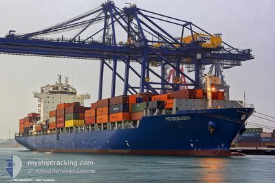
Container Ship
Current Trip
| Time Travelled | 10 days |
|---|---|
| Remaining Time | --- |
| Distance Travelled | 3705.42 nm |
| Remaining Distance | --- |
| AVG Speed | 16.5 Knots |
| MAX Speed | 19.2 Knots |
| AVG Wind | 12.6 knots |
| MAX Wind | 28 knots |
| MIN Temp | 11.7°C / 53.06°F |
| MAX Temp | 29.5°C / 85.1°F |
| Draught | 10 m |
| Position Received | 6 d ago |
Current Position
| Longitude | 39.53545° |
|---|---|
| Latitude | 18.29445° |
| Status | Under way using engine |
| Speed | 17.8 Knots |
| Course | 152.9° |
| Area | Red Sea |
| Station | T-AIS |
| Position Received | 6 d ago |
Info
Information
The current position of STAR is in Red Sea with coordinates 18.29445° / 39.53545° as reported on 2024-04-14 08:03 by AIS to our vessel tracker app. The vessel's current speed is 17.8 Knots
The vessel STAR (IMO: 9436484, MMSI: 636020787) is a Container Ship that was built in 2009 ( 15 years old ). It's sailing under the flag of [LR] Liberia.
In this page you can find informations about the vessels current position, last detected port calls, and current voyage information. If the vessels is not in coverage by AIS you will find the latest position.
The current position of STAR is detected by our AIS receivers and we are not responsible for the reliability of the data. The last position was recorded while the vessel was in Coverage by the Ais receivers of our vessel tracking app.
The current draught of STAR as reported by AIS is 10 meters
Weather
| Temperature | 29.2°C / 84.56°F |
|---|---|
| Wind Speed | 13 knots |
| Direction | 321° NW |
| Pressure | 1006.1 hPa |
| Humidity | 68.2 % |
| Cloud Coverage | --- |
Featured Company
Last Port Calls
| Port | Arrival | Departure | Time In Port |
|---|---|---|---|
| 2024-04-12 01:45 | 2024-04-12 11:08 | 9 h | |
| 2024-04-09 08:46 | 2024-04-10 04:44 | 19 h | |
| 2024-04-06 13:00 | 2024-04-07 12:37 | 23 h | |
| 2024-03-19 03:56 | 2024-03-20 10:00 | 1 d | |
| 2024-03-06 06:24 | 2024-03-08 21:49 | 2 d | |
| 2024-02-25 08:44 | 2024-02-27 10:27 | 2 d | |
| 2024-02-12 01:10 | 2024-02-12 19:12 | 18 h | |
| 2024-02-10 13:03 |
Most Visited Ports (Last year)
| Port | Arrivals | |
|---|---|---|
| 10 | ||
| 8 | ||
| 5 | ||
| 3 | ||
| 2 | ||
| 1 |
Last Trips
| Origin | Departure | Destination | Arrival | Distance | |
|---|---|---|---|---|---|
| 2024-04-10 07:44 | 2024-04-12 03:45 | 629.24 nm | |||
| 2024-04-07 14:37 | 2024-04-09 11:46 | 616.81 nm | |||
| 2024-03-20 13:00 | 2024-04-06 15:00 | 4767.99 nm | |||
| 2024-03-08 22:49 | 2024-03-19 06:56 | 3044.88 nm | |||
| 2024-02-27 13:27 | 2024-03-06 07:24 | 1895.33 nm | |||
| 2024-02-12 22:12 | 2024-02-25 11:44 | 4536.73 nm | |||
| 2024-02-10 16:03 | 2024-02-12 04:10 | 63.34 nm |
Events
| Time | Event | Details | Position / Dest | Info |
|---|---|---|---|---|
| 2024-04-20 07:30 | STOP Moving | 20.36 nm, South West of MUMBAI |
18.76040 / 72.60272
INNSA
|
Speed: 0.3 kn Course: 346° |
| 2024-04-14 08:28 | Status Changed | Default Under way using engine |
18.12487 / 39.62291
INNSA
|
Speed: 17.8 kn Course: 152.9° |
| 2024-04-14 08:03 | OUT of Coverage |
18.29445 / 39.53545
Red Sea
INNSA
|
Speed: 17.8 kn Course: 152.9° |
|
| 2024-04-14 03:40 | Draught Changed | 10 9.8 |
19.62297 / 38.86011
INNSA
|
Speed: 18.7 kn Course: 153.1° |
| 2024-04-14 02:59 | Detected in Sea | Sudanese part of the Red Sea |
19.67076 / 38.83478
Red Sea
INNSA
|
Speed: 18.8 kn Course: 153.7° |
| 2024-04-14 02:59 | Status Changed | Under way using engine Default |
19.67076 / 38.83478
INNSA
|
Speed: 18.8 kn Course: 154° |
| 2024-04-14 02:59 | IN Coverage |
19.67076 / 38.83478
Red Sea
INNSA
|
Speed: 18.8 kn Course: 153.7° |
|
| 2024-04-14 01:33 | Status Changed | Default Under way using engine |
20.02555 / 38.65441
INNSA
|
Speed: 18.4 kn Course: 155.1° |
| 2024-04-14 01:19 | Change Sea Area | Saudi Arabian part of the Red Sea Sudanese part of the Red Sea |
20.09197 / 38.62344
Red Sea
INNSA
|
Speed: 18.4 kn Course: 155.1° |
| 2024-04-14 01:19 | OUT of Coverage |
20.09197 / 38.62344
Red Sea
INNSA
|
Speed: 18.4 kn Course: 155.1° |